| Well Information Table |
|---|
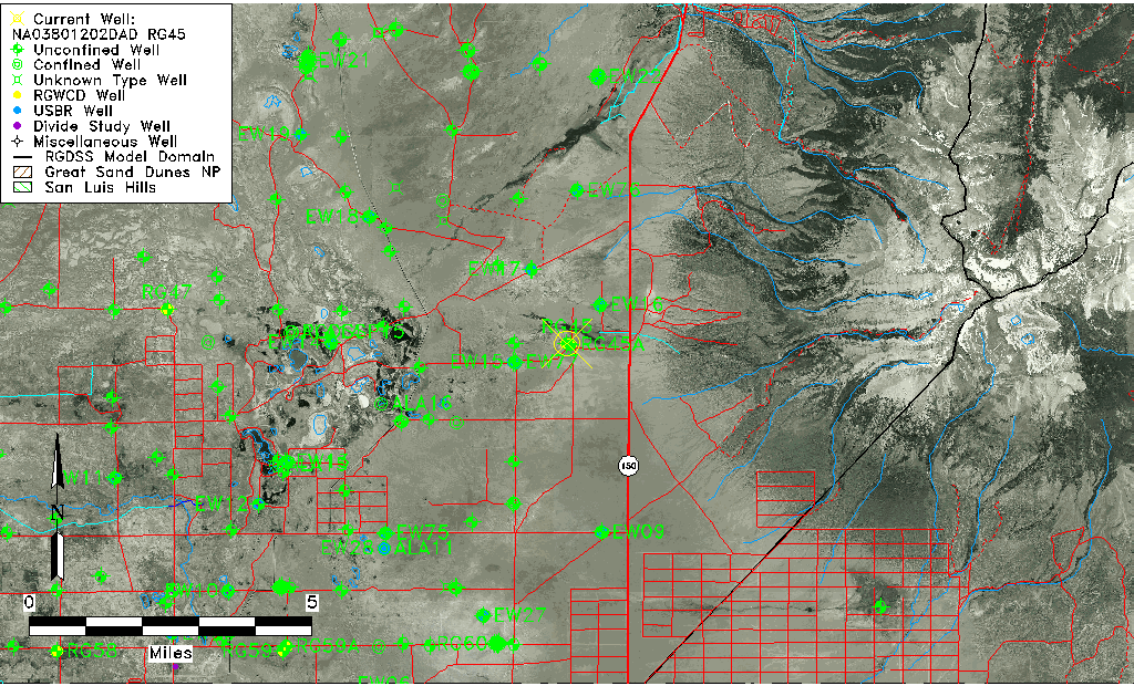
| Common Well ID | NA03801202DAD RG45 |
| RGWCD Well ID | RG45 |
| USGS Well ID | 373400105371501 |
| USGS Station Name | NA03801202DAD RG45 |
| USGS Construction Date | 01/01/1959 |
| USGS Site Type | Well |
| USGS Site Use Information | Observation |
| USGS Groundwater Use Information | Unused |
| Data Source(s) | USGS, RGWCD |
| Location Data |
|---|
| TRS | NA03801202DAD RG45 |
| RGWCD TRS | NA03801202DAD |
| USGS TRS 1 | NA03801202DAD RG45 |
| USGS TRS | SENESES002T0038NR0012EN |
| Longitude/Latitude (NAD83) | -105.62140399 , 37.56667079 |
| Longitude/Latitude Data Source | RGWCD/Davis Engineering |
| RGWCD Longitude/Latitude (NAD27) | -105:37:15 , 37:34:00 |
| USGS Longitude/Latitude (NAD83) | -105.6214040 , 37.56667079 |
| Easting, Northing RGDSS-NAD83 (US ft) | 215264.15 , 207782.91 |
| USGS Topography | Undulating |
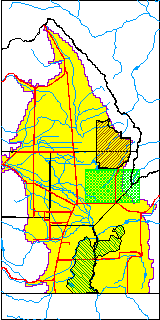
| USGS County | Alamosa County |
| Elevation and Depth Data |
|---|
| Ground Elevation (ft NAVD88) | 7609.22000000000 |
| Elevation Data Source | RGWCD well database |
| RGWCD Measuring Point Elevation (ft NGVD29) | 7605.600 |
| RGWCD Well Riser Height (ft) | 0.600 |
| RGWCD Ground Surface (ft NGVD29) | 7605.00 |
| USGS Ground Elevation (ft NGVD29) | 7605.00 |
| 1/3-Arc Second NED Ground Elevation (ft NAVD88) | 7602.31 |
| 1-Arc Second NED Ground Elevation (ft NAVD88) | 7601.95 |
| SRTM Ground Elevation (ft NAVD88) | 7598.38 |
| Total Depth (ft) | 440.00 |
| USGS Well Depth (ft) | 440.00 |
| Model Layer | 1 |
| Model Layer Source | RGWCD |
| Depth of Bottom of Layer 1 | 121 |
| Depth of Bottom of Layer 2 | 488 |
| Depth of Bottom of Layer 3 | 840 |
| Depth of Bottom of Layer 4 | 1983 |
| Additional Well Information | Geohydrology, Construction |
| Aquifer Information |
|---|
| Aquifer Type | Unconfined |
| Aquifer Type Source | RGWCD_AQ |
| USGS Primary Aquifer | Cenozoic Erathem |
| USGS Hydrologic Unit | San Luis |
| USGS Data Available | Water-level (GW.LEV) |
| Water-level Database Information |
|---|
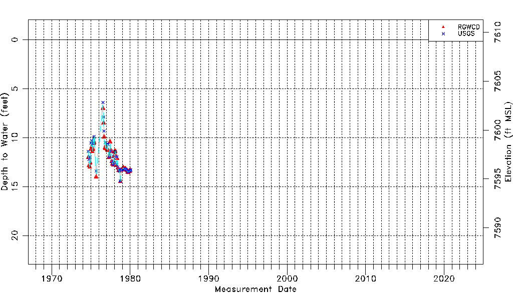
| Water-level Count | 80 |
| Water-level Date Range | 09/05/1974 thru 02/06/1980 |
| Monitored within the last 18 months | No, most recently on 02/06/1980 |
| Depth-to-Water Range (ft) | 6.40 to 14.46 |
| Water Table Elevation Range (ft NAVD88) | 7594.76 to 7602.82 |
| Water-Level-Source:Number-of-Measurements | RGWCD:54 USGS:50 |