| Well Information Table |
|---|
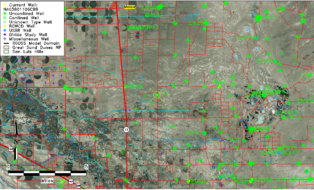
| Common Well ID | NA03801106CBB |
| USGS Well ID | 373403105491801 |
| USGS Station Name | NA03801106CBB |
| USGS Site Type | Well |
| USGS Site Use Information | Observation |
| USGS Groundwater Use Information | Unused |
| Data Source(s) | USGS |
| Location Data |
|---|
| TRS | NA03801106CBB |
| USGS TRS 1 | NA03801106CBB |
| USGS TRS | NWNWSWS006T0038NR0011EN |
| Longitude/Latitude (NAD83) | -105.82224250 , 37.56750308 |
| Longitude/Latitude Data Source | GWSI decimal LAT/LONG field |
| USGS Longitude/Latitude (NAD83) | -105.8222425 , 37.56750308 |
| Easting, Northing RGDSS-NAD83 (US ft) | 157071.77 , 208118.40 |
| USGS Topography | Valley flat |
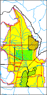
| USGS County | Alamosa County |
| Elevation and Depth Data |
|---|
| Ground Elevation (ft NAVD88) | 7541.82000000000 |
| Elevation Data Source | USGS GWSI database |
| USGS Ground Elevation (ft NGVD29) | 7538.00 |
| 1/3-Arc Second NED Ground Elevation (ft NAVD88) | 7543.07 |
| 1-Arc Second NED Ground Elevation (ft NAVD88) | 7543.40 |
| SRTM Ground Elevation (ft NAVD88) | 7552.43 |
| Total Depth (ft) | 44.00 |
| USGS Well Depth (ft) | 44.00 |
| Model Layer | 1 |
| Model Layer Source | Well Depth |
| Depth of Bottom of Layer 1 | 48 |
| Depth of Bottom of Layer 2 | 549 |
| Depth of Bottom of Layer 3 | 975 |
| Depth of Bottom of Layer 4 | 2549 |
| Additional Well Information | Geohydrology, Construction |
| Aquifer Information |
|---|
| Aquifer Type | Unconfined |
| Aquifer Type Source | TD Elevation/Model Layer |
| USGS Primary Aquifer | Cenozoic Erathem |
| USGS Hydrologic Unit | San Luis |
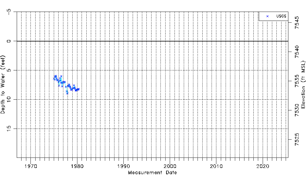
| USGS Data Available | Water-level (GW.LEV) |
| Water-level Database Information |
|---|
| Water-level Count | 55 |
| Water-level Date Range | 01/06/1975 thru 05/12/1980 |
| Monitored within the last 18 months | No, most recently on 05/12/1980 |
| Depth-to-Water Range (ft) | 5.93 to 8.97 |
| Water Table Elevation Range (ft NAVD88) | 7532.85 to 7535.89 |
| Water-Level-Source:Number-of-Measurements | USGSaguache Creek:55 |