| Well Information Table |
|---|
| Common Well ID | NA03801205ACA |
| USGS Well ID | 373406105411001 |
| USGS Station Name | NA03801205ACA |
| USGS Site Type | Well |
| USGS Site Use Information | Withdrawal of Water |
| USGS Groundwater Use Information | Unknown |
| Data Source(s) | USGS |
| Location Data |
|---|
| TRS | NA03801205ACA |
| USGS TRS 1 | NA03801205ACA |
| USGS TRS | NESWNES005T0038NR0012EN |
| Longitude/Latitude (NAD83) | -105.68046120 , 37.57100370 |
| Longitude/Latitude Data Source | GWSI decimal LAT/LONG field |
| USGS Longitude/Latitude (NAD83) | -105.6804612 , 37.57100370 |
| Easting, Northing RGDSS-NAD83 (US ft) | 198152.69 , 209356.76 |
| USGS Topography | Alluvial or Marine Terrace |
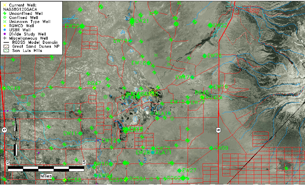
| USGS County | Alamosa County |
| USGS Map Name | DRY LAKES |
| USGS Map Scale | 24000 |
| Elevation and Depth Data |
|---|
| Ground Elevation (ft NAVD88) | 7527.12000000000 |
| Elevation Data Source | USGS GWSI database |
| USGS Ground Elevation (ft NGVD29) | 7523.00 |
| 1/3-Arc Second NED Ground Elevation (ft NAVD88) | 7529.05 |
| 1-Arc Second NED Ground Elevation (ft NAVD88) | 7531.23 |
| SRTM Ground Elevation (ft NAVD88) | 7523.55 |
| Total Depth (ft) | 20.00 |
| USGS Well Depth (ft) | 20.00 |
| Model Layer | 1 |
| Model Layer Source | Well Depth |
| Depth of Bottom of Layer 1 | 21 |
| Depth of Bottom of Layer 2 | 296 |
| Depth of Bottom of Layer 3 | 924 |
| Depth of Bottom of Layer 4 | 2617 |
| Additional Well Information | Geohydrology, Aquifer |
| Aquifer Information |
|---|
| Aquifer Type | Unconfined |
| Aquifer Type Source | TD Elevation/Model Layer |
| USGS Primary Aquifer | Quaternary System |
| USGS Hydrologic Unit | San Luis |
| USGS Data Available | Water-level (GW.LEV) |
| Water-level Database Information |
|---|
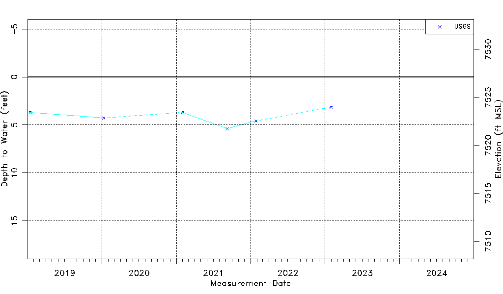
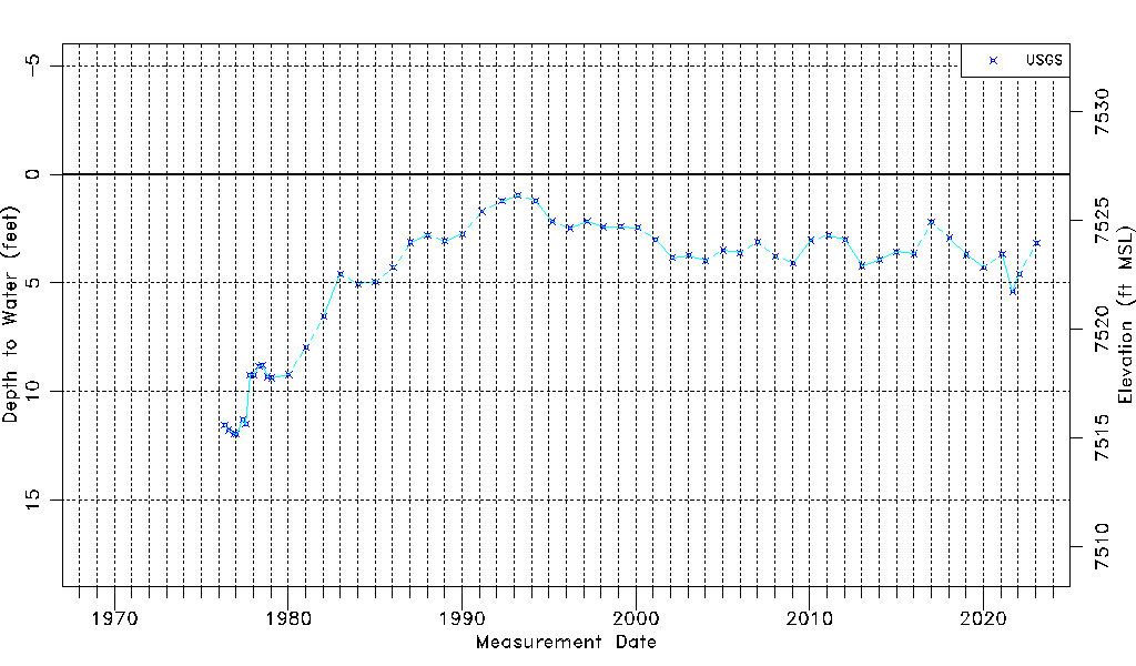
| Water-level Count | 57 |
| Water-level Date Range | 05/11/1976 thru 01/31/2023 |
| Monitored within the last 18 months | Yes, most recently on 01/31/2023 |
| Depth-to-Water Range (ft) | 0.98 to 11.96 |
| Water Table Elevation Range (ft NAVD88) | 7515.16 to 7526.14 |
| Water-Level-Source:Number-of-Measurements | USGS:57 |