| Well Information Table |
|---|
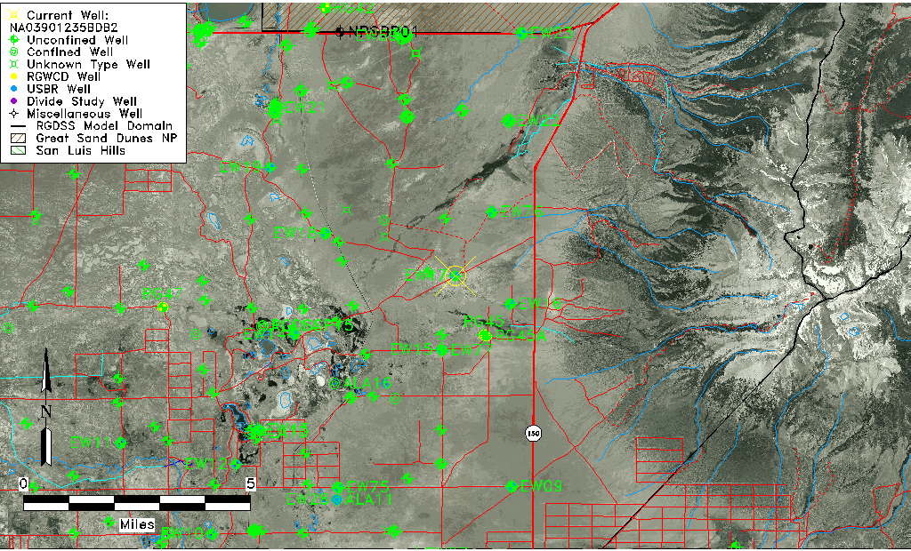
| Common Well ID | NA03901235BDB2 |
| USGS Well ID | 373508105375602 |
| USGS Station Name | NA03901235BDB2 |
| USGS Construction Date | 12/20/1977 |
| USGS Site Type | Well |
| USGS Site Use Information | Observation |
| USGS Groundwater Use Information | Unknown |
| Data Source(s) | USGS |
| Location Data |
|---|
| TRS | NA03901235BDB2 |
| USGS TRS 1 | NA03901235BDB2 |
| Longitude/Latitude (NAD83) | -105.63279320 , 37.58555924 |
| Longitude/Latitude Data Source | GWSI decimal LAT/LONG field |
| USGS Longitude/Latitude (NAD83) | -105.6327932 , 37.58555924 |
| Easting, Northing RGDSS-NAD83 (US ft) | 211961.51 , 214656.88 |
| USGS Topography | Valley flat |
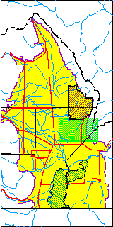
| USGS County | Alamosa County |
| USGS Map Name | DRY LAKES |
| USGS Map Scale | 24000 |
| Elevation and Depth Data |
|---|
| Ground Elevation (ft NAVD88) | 7570.49000000000 |
| Elevation Data Source | USGS GWSI database |
| USGS Ground Elevation (ft NGVD29) | 7566.30 |
| 1/3-Arc Second NED Ground Elevation (ft NAVD88) | 7570.71 |
| 1-Arc Second NED Ground Elevation (ft NAVD88) | 7570.69 |
| SRTM Ground Elevation (ft NAVD88) | 7562.20 |
| Total Depth (ft) | 5.60 |
| USGS Hole Depth (ft) | 5.60 |
| USGS Well Depth (ft) | 5.60 |
| Model Layer | 1 |
| Model Layer Source | Well Depth |
| Depth of Bottom of Layer 1 | 111 |
| Depth of Bottom of Layer 2 | 496 |
| Depth of Bottom of Layer 3 | 949 |
| Depth of Bottom of Layer 4 | 2391 |
| Additional Well Information | Construction |
| Aquifer Information |
|---|
| Aquifer Type | Unconfined |
| Aquifer Type Source | TD Elevation/Model Layer |
| USGS Hydrologic Unit | San Luis |
| USGS Data Available | Miscellaneous (GW.MISC) |
| Water-level Database Information |
|---|
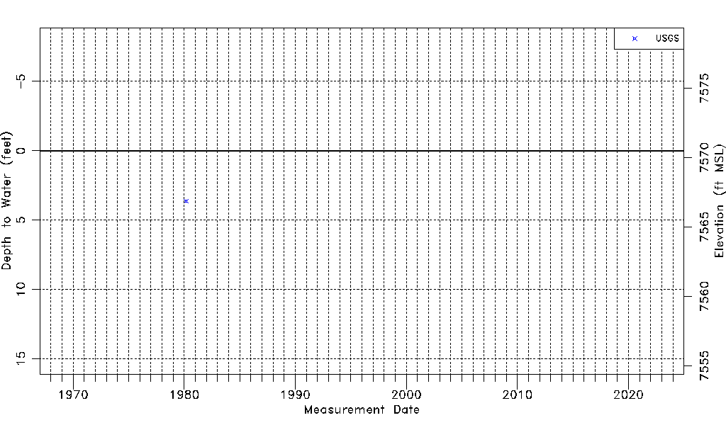
| Water-level Count | 1 |
| Water-level Date Range | 03/04/1980 thru 03/04/1980 |
| Monitored within the last 18 months | No, most recently on 03/04/1980 |
| Depth-to-Water Range (ft) | 3.62 to 3.62 |
| Water Table Elevation Range (ft NAVD88) | 7566.87 to 7566.87 |
| Water-Level-Source:Number-of-Measurements | USGSaguache Creek:1 |