| Well Information Table |
|---|
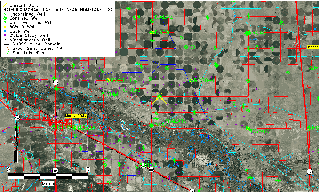
| Common Well ID | NA03900930BAA DIAZ LANE NEAR HOMELAKE, CO |
| USGS Well ID | 373611106014501 |
| USGS Station Name | NA03900930BAA DIAZ LANE NEAR HOMELAKE, CO |
| USGS Construction Date | 08/09/1993 |
| USGS Site Type | Well |
| USGS Site Use Information | Observation |
| USGS Groundwater Use Information | Unused |
| Data Source(s) | USGS |
| Location Data |
|---|
| TRS | NA03900930BAA DIAZ LANE NEAR HOMELAKE, CO |
| USGS TRS 1 | NA03900930BAA DIAZ LANE NEAR HOMELAKE, CO |
| USGS TRS | NENENWS 30T 39NR 9E |
| Longitude/Latitude (NAD83) | -106.02997780 , 37.60331389 |
| Longitude/Latitude Data Source | GWSI decimal LAT/LONG field |
| USGS Longitude/Latitude (NAD83) | -106.0299778 , 37.60331389 |
| Easting, Northing RGDSS-NAD83 (US ft) | 96929.59 , 221318.92 |
| USGS Topography | Valley flat |
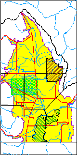
| USGS County | Alamosa County |
| USGS Map Name | HOMELAKE |
| USGS Map Scale | 2400 |
| Elevation and Depth Data |
|---|
| Ground Elevation (ft NAVD88) | 7611.00000000000 |
| Elevation Data Source | USGS GWSI database |
| USGS Ground Elevation (ft NAVD88) | 7611.00 |
| 1/3-Arc Second NED Ground Elevation (ft NAVD88) | 7611.27 |
| 1-Arc Second NED Ground Elevation (ft NAVD88) | 7611.51 |
| SRTM Ground Elevation (ft NAVD88) | 7620.90 |
| Total Depth (ft) | 26.00 |
| USGS Hole Depth (ft) | 26.00 |
| USGS Well Depth (ft) | 26.00 |
| Model Layer | 1 |
| Model Layer Source | Well Depth |
| Depth of Bottom of Layer 1 | 81 |
| Depth of Bottom of Layer 2 | 220 |
| Depth of Bottom of Layer 3 | 662 |
| Depth of Bottom of Layer 4 | 2141 |
| Additional Well Information | Logs, Geohydrology, Construction, Aquifer |
| Aquifer Information |
|---|
| Aquifer Type | Unconfined |
| Aquifer Type Source | TD Elevation/Model Layer |
| USGS Primary Aquifer | Cenozoic Erathem |
| USGS Aquifer Type | Unconfined Single Aquifer |
| USGS Hydrologic Unit | San Luis |
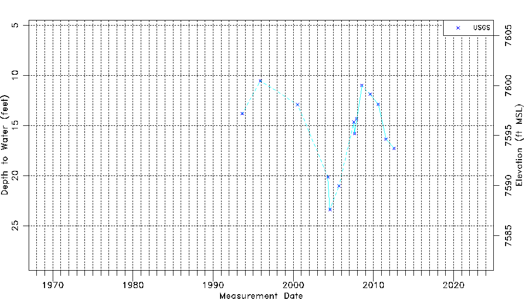
| USGS Data Available | Water-level (GW.LEV) |
| Water-level Database Information |
|---|
| Water-level Count | 14 |
| Water-level Date Range | 08/27/1993 thru 07/27/2012 |
| Monitored within the last 18 months | No, most recently on 07/27/2012 |
| Depth-to-Water Range (ft) | 10.53 to 23.39 |
| Water Table Elevation Range (ft NAVD88) | 7587.61 to 7600.47 |
| Water-Level-Source:Number-of-Measurements | USGSaguache Creek:14 |