| Well Information Table |
|---|
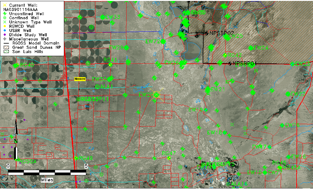
| Common Well ID | NA03901116AAA |
| USGS Well ID | 373713105461501 |
| GSDNP Well Name | 373713105461501 |
| USGS Station Name | NA03901116AAA |
| USGS Construction Date | 01/01/1967 |
| USGS Site Type | Well |
| USGS Site Use Information | Observation |
| USGS Groundwater Use Information | Unused |
| Data Source(s) | USGS |
| Location Data |
|---|
| TRS | NA03901116AAA |
| USGS TRS 1 | NA03901116AAA |
| USGS TRS | NENENES016T0039NR0011EN |
| Longitude/Latitude (NAD83) | -105.76476890 , 37.63444647 |
| Longitude/Latitude Data Source | GWSI decimal LAT/LONG field |
| USGS Longitude/Latitude (NAD83) | -105.7647689 , 37.63444647 |
| Easting, Northing RGDSS-NAD83 (US ft) | 173749.61 , 232464.50 |
| USGS Topography | Valley flat |
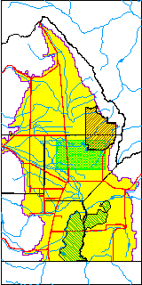
| USGS County | Alamosa County |
| USGS Map Name | HOOPER EAST |
| USGS Map Scale | 24000 |
| Elevation and Depth Data |
|---|
| Ground Elevation (ft NAVD88) | 7525.97000000000 |
| Elevation Data Source | USGS GWSI database |
| USGS Ground Elevation (ft NGVD29) | 7522.00 |
| 1/3-Arc Second NED Ground Elevation (ft NAVD88) | 7526.95 |
| 1-Arc Second NED Ground Elevation (ft NAVD88) | 7525.86 |
| SRTM Ground Elevation (ft NAVD88) | 7536.12 |
| Total Depth (ft) | 16.00 |
| USGS Well Depth (ft) | 16.00 |
| Model Layer | 1 |
| Model Layer Source | Dunes Layer |
| Depth of Bottom of Layer 1 | 83 |
| Depth of Bottom of Layer 2 | 399 |
| Depth of Bottom of Layer 3 | 1256 |
| Depth of Bottom of Layer 4 | 2537 |
| Additional Well Information | Geohydrology, Construction |
| Aquifer Information |
|---|
| Aquifer Type | Unconfined |
| Aquifer Type Source | TD Elevation/Model Layer |
| USGS Primary Aquifer | Cenozoic Erathem |
| USGS Aquifer Type | Unconfined Single Aquifer |
| USGS Hydrologic Unit | San Luis |
| USGS Data Available | Water-level (GW.LEV) |
| Water-level Database Information |
|---|
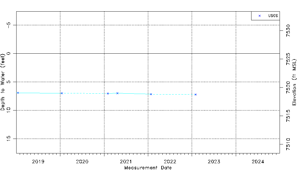
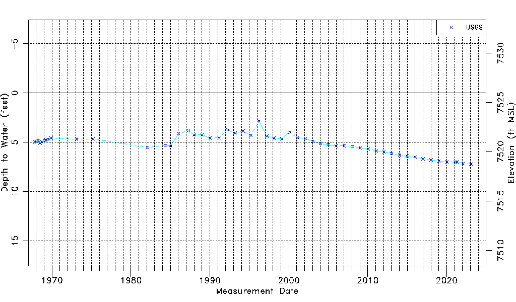
| Water-level Count | 53 |
| Water-level Date Range | 10/31/1967 thru 01/31/2023 |
| Monitored within the last 18 months | Yes, most recently on 01/31/2023 |
| Depth-to-Water Range (ft) | 2.90 to 7.23 |
| Water Table Elevation Range (ft NAVD88) | 7518.74 to 7523.07 |
| Water-Level-Source:Number-of-Measurements | USGS:53 |