| Well Information Table |
|---|
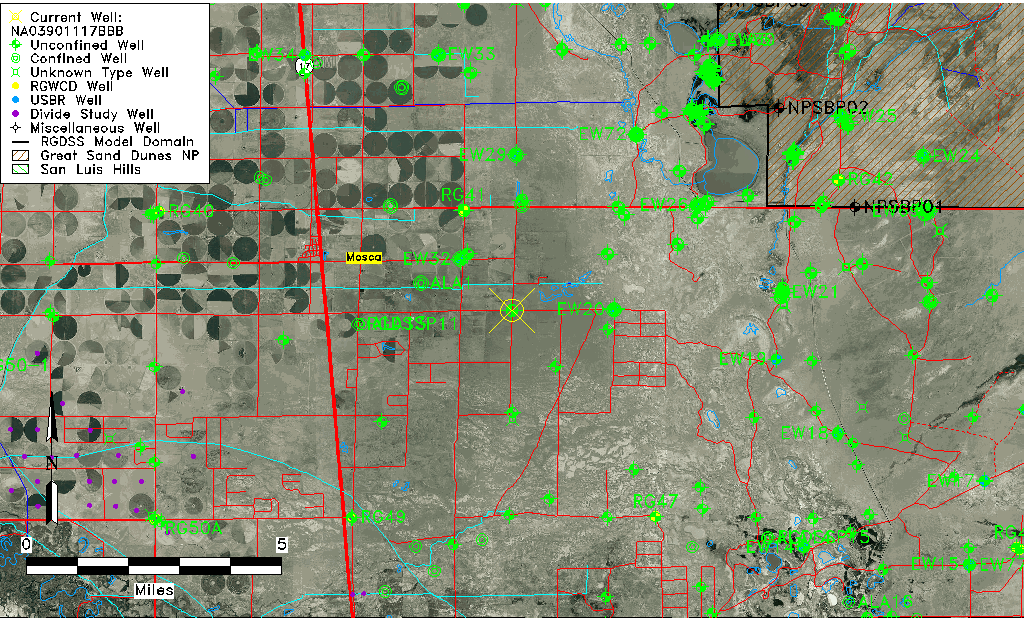
| Common Well ID | NA03901117BBB |
| USGS Well ID | 373728105481801 |
| GSDNP Well Name | 373728105481801 |
| USGS Station Name | NA03901117BBB |
| USGS Construction Date | 01/01/1967 |
| USGS Site Type | Well |
| USGS Site Use Information | Observation |
| USGS Groundwater Use Information | Unused |
| Data Source(s) | USGS |
| Location Data |
|---|
| TRS | NA03901117BBB |
| USGS TRS 1 | NA03901117BBB |
| USGS TRS | NWNWNWS017T0039NR0011EN |
| Longitude/Latitude (NAD83) | -105.80138080 , 37.63397410 |
| Longitude/Latitude Data Source | GWSI decimal LAT/LONG field |
| USGS Longitude/Latitude (NAD83) | -105.8013808 , 37.63397410 |
| Easting, Northing RGDSS-NAD83 (US ft) | 163150.62 , 232305.52 |
| USGS Topography | Valley flat |
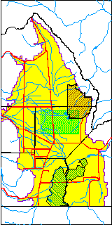
| USGS County | Alamosa County |
| USGS Map Name | HOOPER EAST |
| USGS Map Scale | 24000 |
| Elevation and Depth Data |
|---|
| Ground Elevation (ft NAVD88) | 7536.88000000000 |
| Elevation Data Source | USGS GWSI database |
| USGS Ground Elevation (ft NGVD29) | 7533.00 |
| 1/3-Arc Second NED Ground Elevation (ft NAVD88) | 7536.00 |
| 1-Arc Second NED Ground Elevation (ft NAVD88) | 7536.00 |
| SRTM Ground Elevation (ft NAVD88) | 7549.28 |
| Total Depth (ft) | 16.00 |
| USGS Well Depth (ft) | 16.00 |
| Model Layer | 1 |
| Model Layer Source | Dunes Layer |
| Depth of Bottom of Layer 1 | 71 |
| Depth of Bottom of Layer 2 | 460 |
| Depth of Bottom of Layer 3 | 1263 |
| Depth of Bottom of Layer 4 | 2132 |
| Additional Well Information | Geohydrology, Construction |
| Aquifer Information |
|---|
| Aquifer Type | Unconfined |
| Aquifer Type Source | TD Elevation/Model Layer |
| USGS Primary Aquifer | Cenozoic Erathem |
| USGS Aquifer Type | Unconfined Single Aquifer |
| USGS Hydrologic Unit | San Luis |
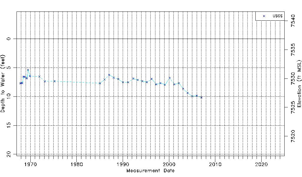
| USGS Data Available | Water-level (GW.LEV) |
| Water-level Database Information |
|---|
| Water-level Count | 35 |
| Water-level Date Range | 10/31/1967 thru 01/09/2007 |
| Monitored within the last 18 months | No, most recently on 01/09/2007 |
| Depth-to-Water Range (ft) | 5.40 to 10.16 |
| Water Table Elevation Range (ft NAVD88) | 7526.72 to 7531.48 |
| Water-Level-Source:Number-of-Measurements | USGS:35 |