| Well Information Table |
|---|
| Common Well ID | NA03900914BBB3 |
| USGS Well ID | 373754105575203 |
| USGS Station Name | NA03900914BBB3 |
| USGS Construction Date | 11/11/2006 |
| USGS Site Type | Well |
| USGS Site Use Information | Unknown |
| USGS Groundwater Use Information | Unknown |
| Data Source(s) | USGS |
| Location Data |
|---|
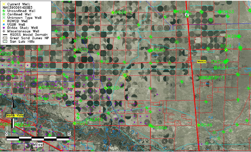
| TRS | NA03900914BBB3 |
| USGS TRS 1 | NA03900914BBB3 |
| USGS TRS | NWNWNWS14 T39N R9E N |
| Longitude/Latitude (NAD83) | -105.96499440 , 37.63184167 |
| Longitude/Latitude Data Source | GWSI decimal LAT/LONG field |
| USGS Longitude/Latitude (NAD83) | -105.9649944 , 37.63184167 |
| Easting, Northing RGDSS-NAD83 (US ft) | 115782.82 , 231637.77 |
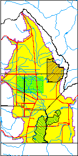
| USGS County | Alamosa County |
| USGS Map Name | HOOPER WEST |
| USGS Map Scale | 24000 |
| Elevation and Depth Data |
|---|
| Ground Elevation (ft NAVD88) | 7587.00000000000 |
| Elevation Data Source | USGS GWSI database |
| USGS Ground Elevation (ft NAVD88) | 7587.00 |
| 1/3-Arc Second NED Ground Elevation (ft NAVD88) | 7585.10 |
| 1-Arc Second NED Ground Elevation (ft NAVD88) | 7584.52 |
| SRTM Ground Elevation (ft NAVD88) | 7590.70 |
| Total Depth (ft) | 30.00 |
| USGS Hole Depth (ft) | 45.00 |
| USGS Well Depth (ft) | 30.00 |
| Model Layer | 1 |
| Model Layer Source | Well Depth |
| Depth of Bottom of Layer 1 | 92 |
| Depth of Bottom of Layer 2 | 231 |
| Depth of Bottom of Layer 3 | 784 |
| Depth of Bottom of Layer 4 | 1825 |
| Additional Well Information | NONE |
| Aquifer Information |
|---|
| Aquifer Type | Unconfined |
| Aquifer Type Source | TD Elevation/Model Layer |
| USGS Primary Aquifer | 112ALMS |
| USGS Hydrologic Unit | San Luis |
| USGS Data Available | Geohydrologic |
| Water-level Database Information |
|---|
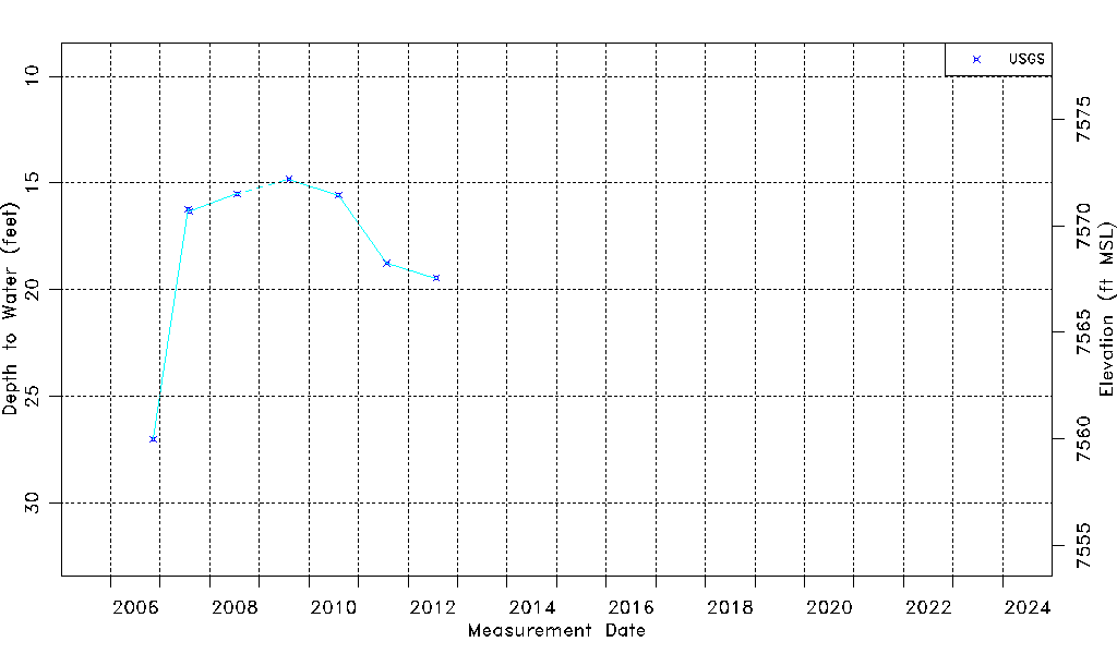
| Water-level Count | 9 |
| Water-level Date Range | 11/11/2006 thru 07/27/2012 |
| Monitored within the last 18 months | No, most recently on 07/27/2012 |
| Depth-to-Water Range (ft) | 14.83 to 27.00 |
| Water Table Elevation Range (ft NAVD88) | 7560.00 to 7572.17 |
| Water-Level-Source:Number-of-Measurements | USGS:9 |