| Well Information Table |
|---|
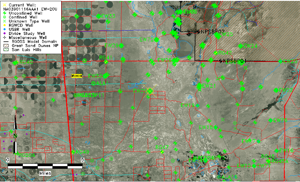
| Common Well ID | NA03901116AAA1 EW-20U |
| USBR Well ID | EW20U |
| USGS Well ID | 373802105455201 |
| GSDNP Well Name | 373802105455201 |
| USGS Station Name | NA03901116AAA1 EW-20U |
| USGS Construction Date | 10/23/1980 |
| USGS Site Type | Well |
| USGS Site Use Information | Observation |
| USGS Groundwater Use Information | Unused |
| Data Source(s) | USGS, USBR |
| Location Data |
|---|
| TRS | NA03901116AAA1 EW-20U |
| USBR TRS | NA03901116AAA1 |
| USGS TRS 1 | NA03901116AAA1 EW-20U |
| Longitude/Latitude (NAD83) | -105.76497632 , 37.63419643 |
| Longitude/Latitude Data Source | USBOR EW well locations |
| USGS Longitude/Latitude (NAD83) | -105.7650189 , 37.63389090 |
| USBR Longitude/Latitude (NAD27) | -105.764401886567 , 37.6341944004732 |
| Easting, Northing RGDSS-NAD83 (US ft) | 173689.47 , 232373.55 |
| USGS Topography | Valley flat |
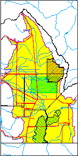
| USGS County | Alamosa County |
| USGS Map Name | HOOPER EAST |
| USGS Map Scale | 24000 |
| Elevation and Depth Data |
|---|
| Ground Elevation (ft NAVD88) | 7525.97000000000 |
| Elevation Data Source | USBOR EW well database |
| USBR Ground Elevation (ft NGVD29) | 7522.0 |
| USGS Ground Elevation (ft NGVD29) | 7522.20 |
| 1/3-Arc Second NED Ground Elevation (ft NAVD88) | 7526.80 |
| 1-Arc Second NED Ground Elevation (ft NAVD88) | 7525.76 |
| SRTM Ground Elevation (ft NAVD88) | 7533.16 |
| Total Depth (ft) | 41.00 |
| USBR Total Depth (ft) | 41 |
| USGS Hole Depth (ft) | 128.00 |
| USGS Well Depth (ft) | 39.00 |
| Model Layer | 1 |
| Model Layer Source | Aquifer Type |
| Depth of Bottom of Layer 1 | 83 |
| Depth of Bottom of Layer 2 | 400 |
| Depth of Bottom of Layer 3 | 1255 |
| Depth of Bottom of Layer 4 | 2538 |
| Additional Well Information | Logs, Construction |
| Aquifer Information |
|---|
| Aquifer Type | Unconfined |
| Aquifer Type Source | EW_AQFR |
| USGS Hydrologic Unit | San Luis |
| USGS Data Available | Water-level (GW.LEV) |
| Water-level Database Information |
|---|
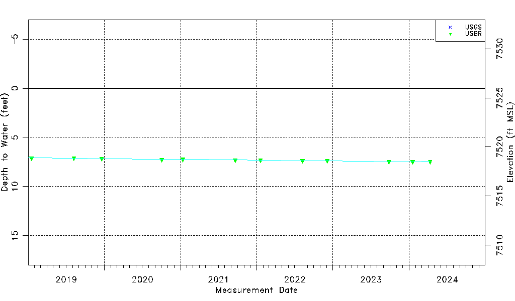
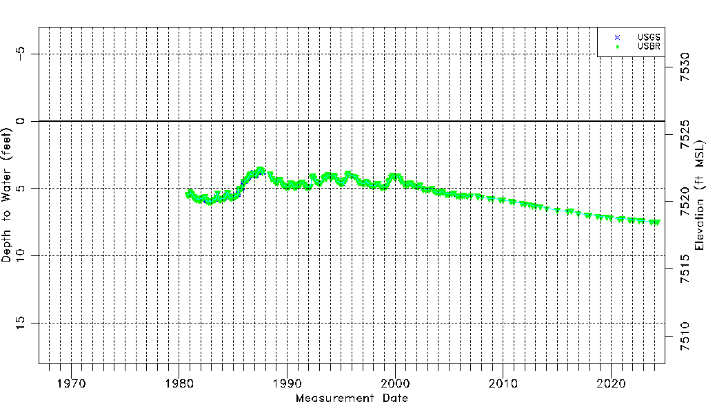
| Water-level Count | 631 |
| Water-level Date Range | 10/14/1980 thru 09/26/2023 |
| Monitored within the last 18 months | Yes, most recently on 09/26/2023 |
| Depth-to-Water Range (ft) | 3.52 to 7.47 |
| Water Table Elevation Range (ft NAVD88) | 7518.50 to 7522.45 |
| Water-Level-Source:Number-of-Measurements | USGS:361 USBR:284 |