| Well Information Table |
|---|
| Common Well ID | NA03901008ABB |
| USGS Well ID | 373820105541501 |
| USGS Station Name | NA03901008ABB |
| USGS Site Type | Well |
| USGS Site Use Information | Withdrawal of Water |
| USGS Groundwater Use Information | Irrigation |
| Data Source(s) | USGS |
| Location Data |
|---|
| TRS | NA03901008ABB |
| USGS TRS 1 | NA03901008ABB |
| USGS TRS | NWNWNES008T0039NR0010EN |
| Longitude/Latitude (NAD83) | -105.90088300 , 37.64725136 |
| Longitude/Latitude Data Source | GWSI decimal LAT/LONG field |
| USGS Longitude/Latitude (NAD83) | -105.9008830 , 37.64725136 |
| Easting, Northing RGDSS-NAD83 (US ft) | 134357.34 , 237194.86 |
| USGS Topography | Valley flat |
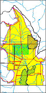
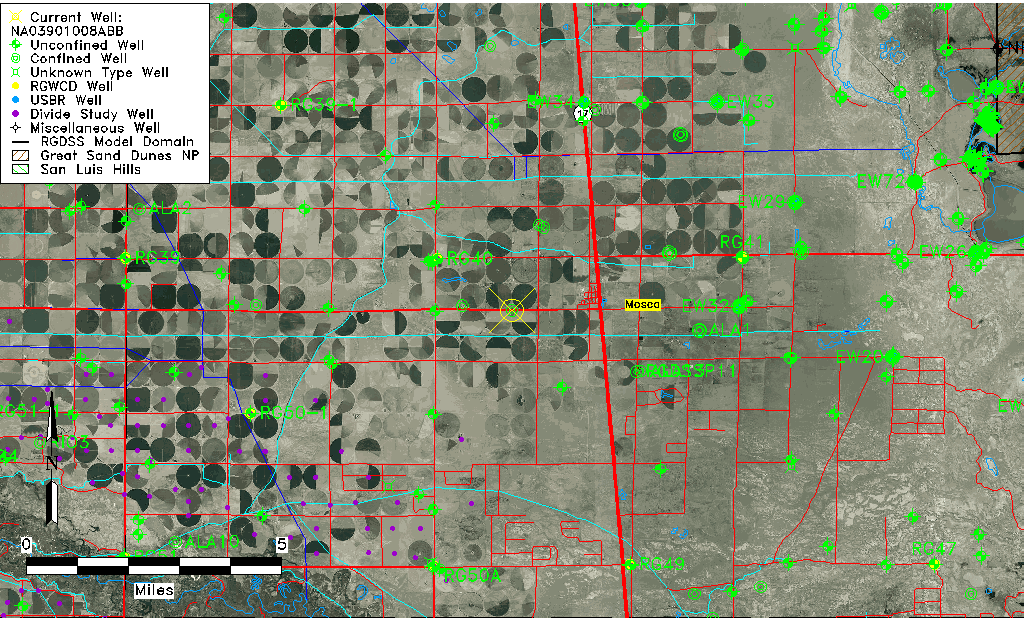
| USGS County | Alamosa County |
| Elevation and Depth Data |
|---|
| Ground Elevation (ft NAVD88) | 7567.84000000000 |
| Elevation Data Source | USGS GWSI database |
| USGS Ground Elevation (ft NGVD29) | 7564.00 |
| 1/3-Arc Second NED Ground Elevation (ft NAVD88) | 7568.98 |
| 1-Arc Second NED Ground Elevation (ft NAVD88) | 7566.99 |
| SRTM Ground Elevation (ft NAVD88) | 7581.78 |
| Total Depth (ft) | 104.00 |
| USGS Well Depth (ft) | 104.00 |
| Model Layer | 2 |
| Model Layer Source | Well Depth |
| Depth of Bottom of Layer 1 | 84 |
| Depth of Bottom of Layer 2 | 265 |
| Depth of Bottom of Layer 3 | 910 |
| Depth of Bottom of Layer 4 | 1847 |
| Additional Well Information | Geohydrology, Construction |
| Aquifer Information |
|---|
| Aquifer Type | Confined |
| Aquifer Type Source | TD Elevation/Model Layer |
| USGS Primary Aquifer | Cenozoic Erathem |
| USGS Aquifer Type | Confined Single Aquifer |
| USGS Hydrologic Unit | San Luis |
| USGS Data Available | Water-level (GW.LEV) |
| Water-level Database Information |
|---|
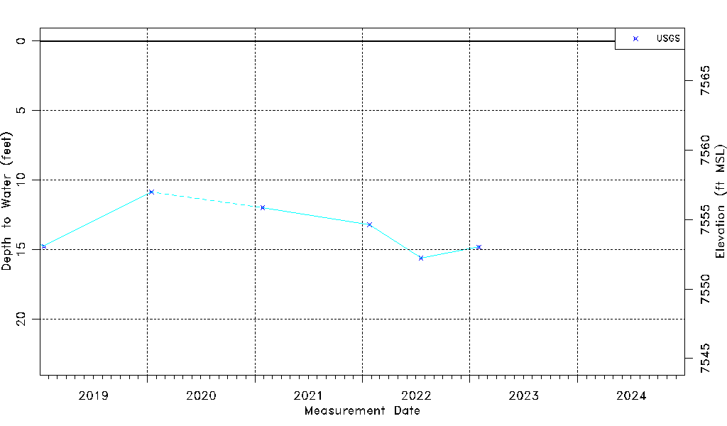
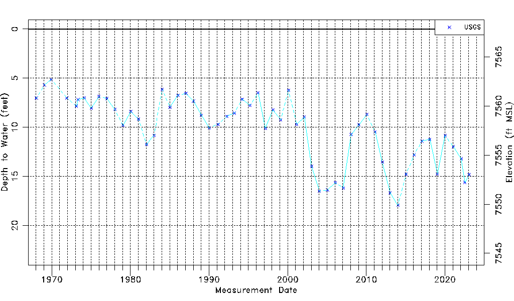
| Water-level Count | 57 |
| Water-level Date Range | 01/15/1968 thru 01/31/2023 |
| Monitored within the last 18 months | Yes, most recently on 01/31/2023 |
| Depth-to-Water Range (ft) | 5.14 to 17.94 |
| Water Table Elevation Range (ft NAVD88) | 7549.90 to 7562.70 |
| Water-Level-Source:Number-of-Measurements | USGS:57 |