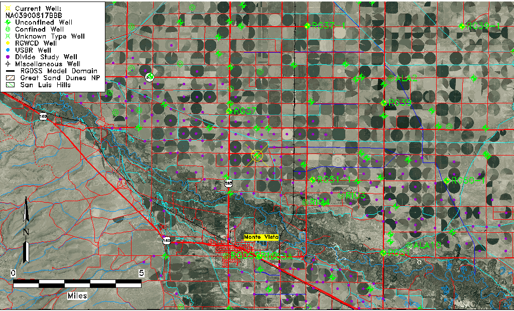
| Well Information Table |
|---|
| Common Well ID | NA03900817BBB |
| USGS Well ID | 373830106073001 |
| USGS Station Name | NA03900817BBB |
| USGS Site Type | Well |
| USGS Site Use Information | Withdrawal of Water |
| USGS Groundwater Use Information | Irrigation |
| Data Source(s) | USGS |
| Location Data |
|---|
| TRS | NA03900817BBB |
| USGS TRS 1 | NA03900817BBB |
| USGS TRS | NWNWNWS017T0039NR0008EN |
| Longitude/Latitude (NAD83) | -106.12891680 , 37.63166890 |
| Longitude/Latitude Data Source | GWSI decimal LAT/LONG field |
| USGS Longitude/Latitude (NAD83) | -106.1289168 , 37.63166890 |
| Easting, Northing RGDSS-NAD83 (US ft) | 68325.25 , 231766.40 |
| USGS Topography | Flat Surface |
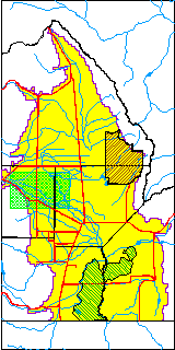
| USGS County | Rio Grande County |
| USGS Map Name | SEVENMILE PLAZA |
| USGS Map Scale | 24000 |
| Elevation and Depth Data |
|---|
| Ground Elevation (ft NAVD88) | 7665.54000000000 |
| Elevation Data Source | USGS GWSI database |
| USGS Ground Elevation (ft NGVD29) | 7661.00 |
| 1/3-Arc Second NED Ground Elevation (ft NAVD88) | 7663.37 |
| 1-Arc Second NED Ground Elevation (ft NAVD88) | 7663.38 |
| SRTM Ground Elevation (ft NAVD88) | 7670.58 |
| Total Depth (ft) | 30.00 |
| USGS Well Depth (ft) | 30.00 |
| Model Layer | 1 |
| Model Layer Source | Well Depth |
| Depth of Bottom of Layer 1 | 81 |
| Depth of Bottom of Layer 2 | 262 |
| Depth of Bottom of Layer 3 | 429 |
| Depth of Bottom of Layer 4 | 2228 |
| Additional Well Information | Geohydrology, Construction |
| Aquifer Information |
|---|
| Aquifer Type | Unconfined |
| Aquifer Type Source | TD Elevation/Model Layer |
| USGS Primary Aquifer | Cenozoic Erathem |
| USGS Hydrologic Unit | San Luis |
| USGS Data Available | Water-level (GW.LEV) |
| Water-level Database Information |
|---|
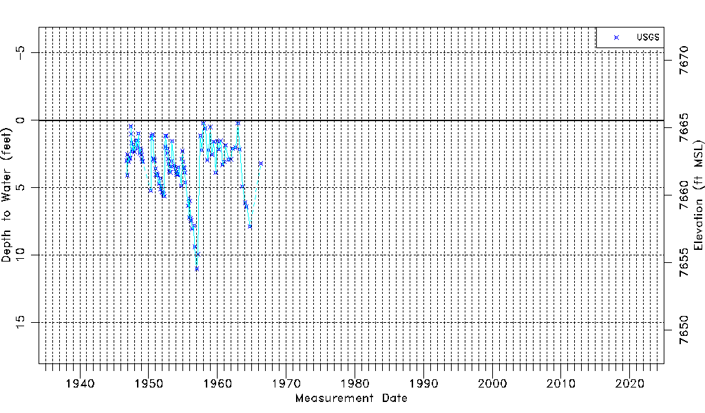
| Water-level Count | 115 |
| Water-level Date Range | 11/01/1946 thru 05/10/1966 |
| Monitored within the last 18 months | No, most recently on 05/10/1966 |
| Depth-to-Water Range (ft) | 0.20 to 11.02 |
| Water Table Elevation Range (ft NAVD88) | 7654.52 to 7665.34 |
| Water-Level-Source:Number-of-Measurements | USGSaguache Creek:115 |