| Well Information Table |
|---|
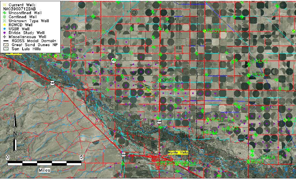
| Common Well ID | NA03900712BAB |
| USGS Well ID | 373830106094001 |
| USGS Station Name | NA03900712BAB |
| USGS Construction Date | 01/01/1940 |
| USGS Site Type | Well |
| USGS Site Use Information | Withdrawal of Water |
| USGS Groundwater Use Information | Irrigation |
| Data Source(s) | USGS, Divide Study |
| Location Data |
|---|
| TRS | NA03900712BAB |
| USGS TRS 1 | NA03900712BAB |
| USGS TRS | NWNENWS012T0039NR0007EN |
| Longitude/Latitude (NAD83) | -106.16301961 , 37.64721312 |
| Longitude/Latitude Data Source | Divide Study |
| USGS Longitude/Latitude (NAD83) | -106.1636400 , 37.64722455 |
| Easting, Northing RGDSS-NAD83 (US ft) | 58481.79 , 237475.31 |
| USGS Topography | Valley flat |
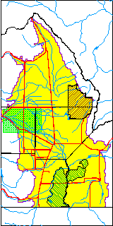
| USGS County | Rio Grande County |
| Elevation and Depth Data |
|---|
| Ground Elevation (ft NAVD88) | 7694.38000000000 |
| Elevation Data Source | Divide study surveying by Davis Engineering |
| USGS Ground Elevation (ft NGVD29) | 7702.00 |
| 1/3-Arc Second NED Ground Elevation (ft NAVD88) | 7694.46 |
| 1-Arc Second NED Ground Elevation (ft NAVD88) | 7694.35 |
| SRTM Ground Elevation (ft NAVD88) | 7703.00 |
| Total Depth (ft) | 107.00 |
| USGS Well Depth (ft) | 107.00 |
| Model Layer | 1 |
| Model Layer Source | Aquifer Type |
| Depth of Bottom of Layer 1 | 71 |
| Depth of Bottom of Layer 2 | 223 |
| Depth of Bottom of Layer 3 | 335 |
| Depth of Bottom of Layer 4 | 1881 |
| Additional Well Information | Geohydrology, Construction |
| Aquifer Information |
|---|
| Aquifer Type | Unconfined |
| Aquifer Type Source | DIV_AQ |
| USGS Primary Aquifer | Cenozoic Erathem |
| USGS Aquifer Type | Unconfined Single Aquifer |
| USGS Hydrologic Unit | San Luis |
| USGS Data Available | Water-level (GW.LEV) |
| Water-level Database Information |
|---|
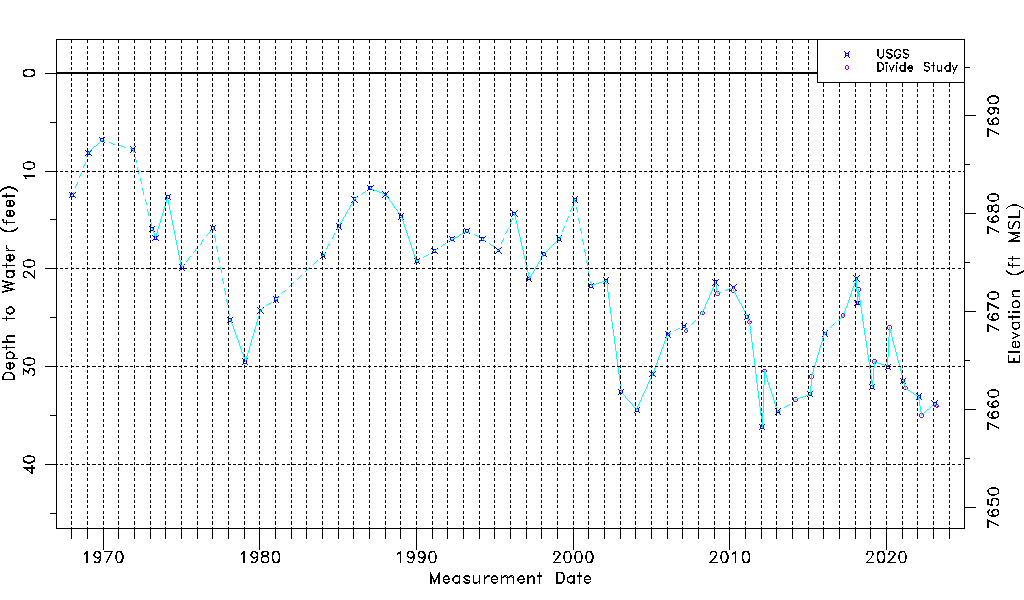
| Water-level Count | 66 |
| Water-level Date Range | 01/15/1968 thru 03/24/2023 |
| Monitored within the last 18 months | Yes, most recently on 03/24/2023 |
| Depth-to-Water Range (ft) | 6.85 to 36.18 |
| Water Table Elevation Range (ft NAVD88) | 7658.20 to 7687.53 |
| Water-Level-Source:Number-of-Measurements | USGS:51 Divide Study:15 |