| Well Information Table |
|---|
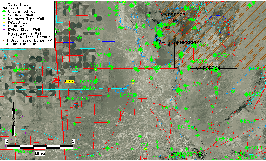
| Common Well ID | NA03901133DDD |
| USGS Well ID | 373900105460001 |
| GSDNP Well Name | 373900105460001 |
| USGS Station Name | NA03901133DDD |
| USGS Construction Date | 01/01/1946 |
| USGS Site Type | Well |
| USGS Site Use Information | Observation |
| USGS Groundwater Use Information | Unused |
| Data Source(s) | USGS |
| Location Data |
|---|
| TRS | NA03901133DDD |
| USGS TRS 1 | NA03901133DDD |
| USGS TRS | SESESES033T0039NR0011EN |
| Longitude/Latitude (NAD83) | -105.76724110 , 37.65000170 |
| Longitude/Latitude Data Source | GWSI decimal LAT/LONG field |
| USGS Longitude/Latitude (NAD83) | -105.7672411 , 37.65000170 |
| Easting, Northing RGDSS-NAD83 (US ft) | 173039.92 , 238127.56 |
| USGS Topography | Flat Surface |
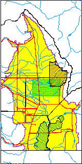
| USGS County | Alamosa County |
| Elevation and Depth Data |
|---|
| Ground Elevation (ft NAVD88) | 7527.97000000000 |
| Elevation Data Source | USGS GWSI database |
| USGS Ground Elevation (ft NGVD29) | 7524.00 |
| 1/3-Arc Second NED Ground Elevation (ft NAVD88) | 7528.79 |
| 1-Arc Second NED Ground Elevation (ft NAVD88) | 7526.00 |
| SRTM Ground Elevation (ft NAVD88) | 7539.33 |
| Total Depth (ft) | 30.00 |
| USGS Well Depth (ft) | 30.00 |
| Model Layer | 1 |
| Model Layer Source | Well Depth |
| Depth of Bottom of Layer 1 | 100 |
| Depth of Bottom of Layer 2 | 376 |
| Depth of Bottom of Layer 3 | 1337 |
| Depth of Bottom of Layer 4 | 2304 |
| Additional Well Information | Geohydrology, Construction |
| Aquifer Information |
|---|
| Aquifer Type | Unconfined |
| Aquifer Type Source | TD Elevation/Model Layer |
| USGS Primary Aquifer | Cenozoic Erathem |
| USGS Hydrologic Unit | San Luis |
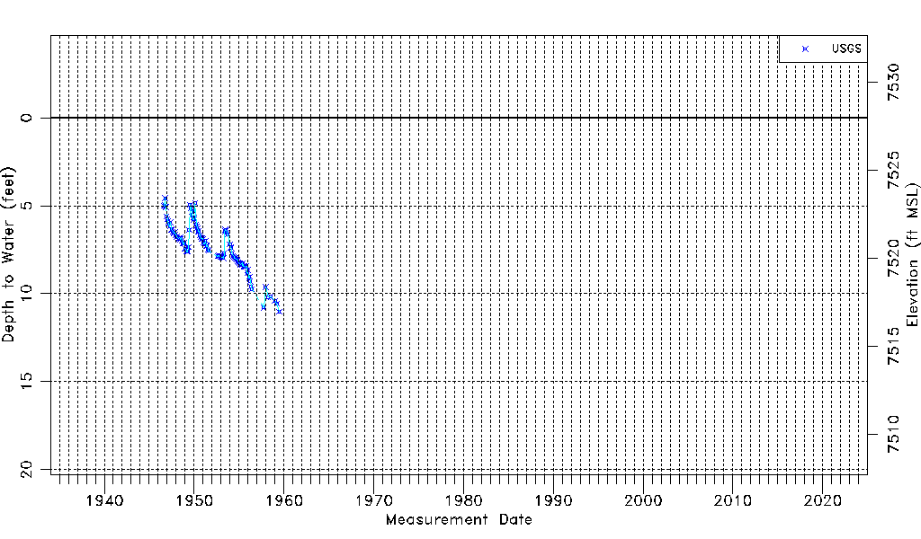
| USGS Data Available | Water-level (GW.LEV) |
| Water-level Database Information |
|---|
| Water-level Count | 113 |
| Water-level Date Range | 09/01/1946 thru 06/25/1959 |
| Monitored within the last 18 months | No, most recently on 06/25/1959 |
| Depth-to-Water Range (ft) | 4.57 to 11.01 |
| Water Table Elevation Range (ft NAVD88) | 7516.96 to 7523.40 |
| Water-Level-Source:Number-of-Measurements | USGSaguache Creek:113 |