| Well Information Table |
|---|
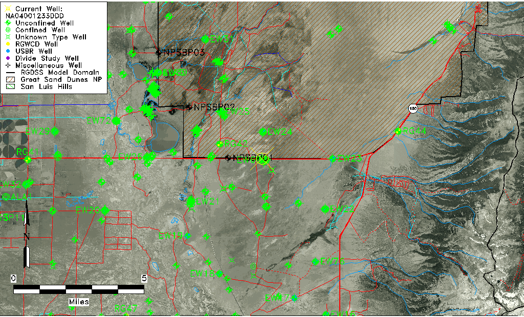
| Common Well ID | NA04001233DDD |
| USGS Well ID | 373915105393901 |
| GSDNP Well Name | 373915105393901 |
| USGS Station Name | NA04001233DDD |
| USGS Construction Date | 01/01/1966 |
| USGS Site Type | Well |
| USGS Site Use Information | Observation |
| USGS Groundwater Use Information | Unused |
| Data Source(s) | USGS |
| Location Data |
|---|
| TRS | NA04001233DDD |
| USGS TRS 1 | NA04001233DDD |
| USGS TRS | SESESES033T0040NR0012EN |
| Longitude/Latitude (NAD83) | -105.65534920 , 37.66300199 |
| Longitude/Latitude Data Source | GWSI decimal LAT/LONG field |
| USGS Longitude/Latitude (NAD83) | -105.6553492 , 37.66300199 |
| Easting, Northing RGDSS-NAD83 (US ft) | 205423.71 , 242844.85 |
| USGS Topography | Valley flat |
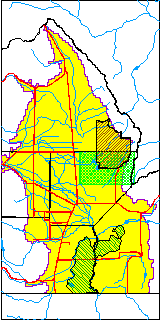
| USGS County | Alamosa County |
| USGS Map Name | MEDANO RANCH |
| USGS Map Scale | 24000 |
| Elevation and Depth Data |
|---|
| Ground Elevation (ft NAVD88) | 7583.17000000000 |
| Elevation Data Source | USGS GWSI database |
| USGS Ground Elevation (ft NGVD29) | 7579.00 |
| 1/3-Arc Second NED Ground Elevation (ft NAVD88) | 7584.78 |
| 1-Arc Second NED Ground Elevation (ft NAVD88) | 7583.99 |
| SRTM Ground Elevation (ft NAVD88) | 7582.82 |
| Total Depth (ft) | 12.00 |
| USGS Well Depth (ft) | 12.00 |
| Model Layer | 1 |
| Model Layer Source | Dunes Layer |
| Depth of Bottom of Layer 1 | 171 |
| Depth of Bottom of Layer 2 | 544 |
| Depth of Bottom of Layer 3 | 1466 |
| Depth of Bottom of Layer 4 | 3864 |
| Additional Well Information | Geohydrology, Construction |
| Aquifer Information |
|---|
| Aquifer Type | Unconfined |
| Aquifer Type Source | TD Elevation/Model Layer |
| USGS Primary Aquifer | Cenozoic Erathem |
| USGS Aquifer Type | Unconfined Single Aquifer |
| USGS Hydrologic Unit | San Luis |
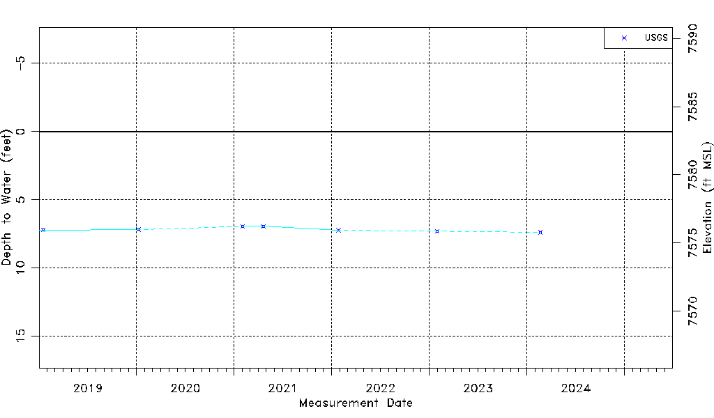
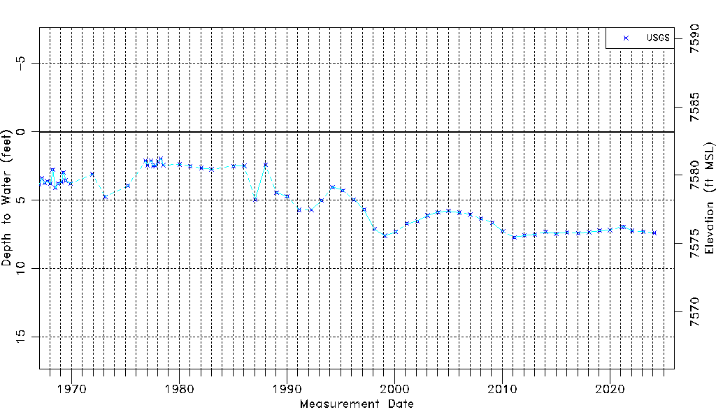
| USGS Data Available | Water-level (GW.LEV) |
| Water-level Database Information |
|---|
| Water-level Count | 67 |
| Water-level Date Range | 01/04/1967 thru 01/30/2023 |
| Monitored within the last 18 months | Yes, most recently on 01/30/2023 |
| Depth-to-Water Range (ft) | 1.98 to 7.71 |
| Water Table Elevation Range (ft NAVD88) | 7575.46 to 7581.19 |
| Water-Level-Source:Number-of-Measurements | USGS:67 |