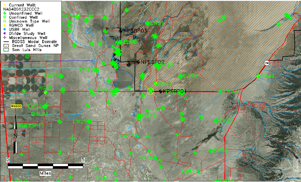
| Well Information Table |
|---|
| Common Well ID | NA04001232CCC2 |
| USGS Well ID | 373915105414502 |
| GSDNP Well Name | 373915105414502 |
| USGS Station Name | NA04001232CCC2 |
| USGS Construction Date | 01/01/1967 |
| USGS Site Type | Well |
| USGS Site Use Information | Observation |
| USGS Groundwater Use Information | Unused |
| Data Source(s) | USGS |
| Location Data |
|---|
| TRS | NA04001232CCC2 |
| USGS TRS 1 | NA04001232CCC2 |
| USGS TRS | SWSWSWS032T0040NR0012EN |
| Longitude/Latitude (NAD83) | -105.69112800 , 37.66361290 |
| Longitude/Latitude Data Source | GWSI decimal LAT/LONG field |
| USGS Longitude/Latitude (NAD83) | -105.6911280 , 37.66361290 |
| Easting, Northing RGDSS-NAD83 (US ft) | 195070.30 , 243067.82 |
| USGS Topography | Valley flat |
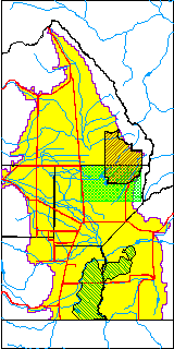
| USGS County | Alamosa County |
| USGS Map Name | MEDANO RANCH |
| USGS Map Scale | 24000 |
| Elevation and Depth Data |
|---|
| Ground Elevation (ft NAVD88) | 7538.13000000000 |
| Elevation Data Source | USGS GWSI database |
| USGS Ground Elevation (ft NGVD29) | 7534.00 |
| 1/3-Arc Second NED Ground Elevation (ft NAVD88) | 7539.12 |
| 1-Arc Second NED Ground Elevation (ft NAVD88) | 7538.39 |
| SRTM Ground Elevation (ft NAVD88) | 7529.33 |
| Total Depth (ft) | 11.00 |
| USGS Well Depth (ft) | 11.00 |
| Model Layer | 1 |
| Model Layer Source | Well Depth |
| Depth of Bottom of Layer 1 | 161 |
| Depth of Bottom of Layer 2 | 519 |
| Depth of Bottom of Layer 3 | 1666 |
| Depth of Bottom of Layer 4 | 4367 |
| Additional Well Information | Geohydrology, Construction |
| Aquifer Information |
|---|
| Aquifer Type | Unconfined |
| Aquifer Type Source | TD Elevation/Model Layer |
| USGS Primary Aquifer | Cenozoic Erathem |
| USGS Hydrologic Unit | San Luis |
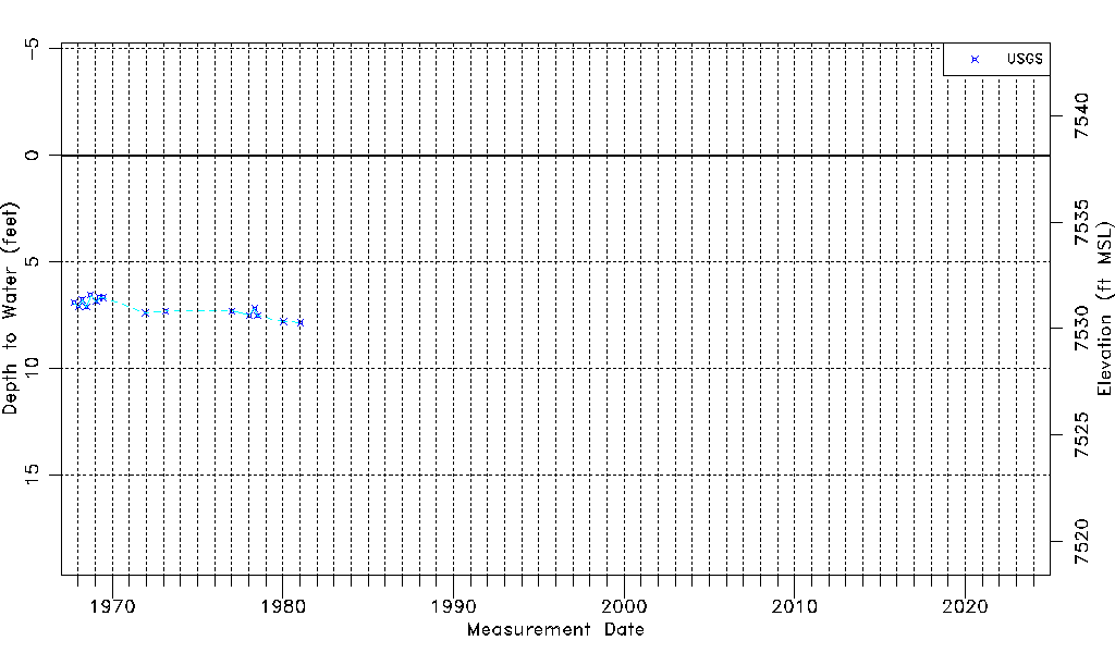
| USGS Data Available | Water-level (GW.LEV) |
| Water-level Database Information |
|---|
| Water-level Count | 16 |
| Water-level Date Range | 10/03/1967 thru 01/15/1981 |
| Monitored within the last 18 months | No, most recently on 01/15/1981 |
| Depth-to-Water Range (ft) | 6.55 to 7.85 |
| Water Table Elevation Range (ft NAVD88) | 7530.28 to 7531.58 |
| Water-Level-Source:Number-of-Measurements | USGS:16 |