| Well Information Table |
|---|
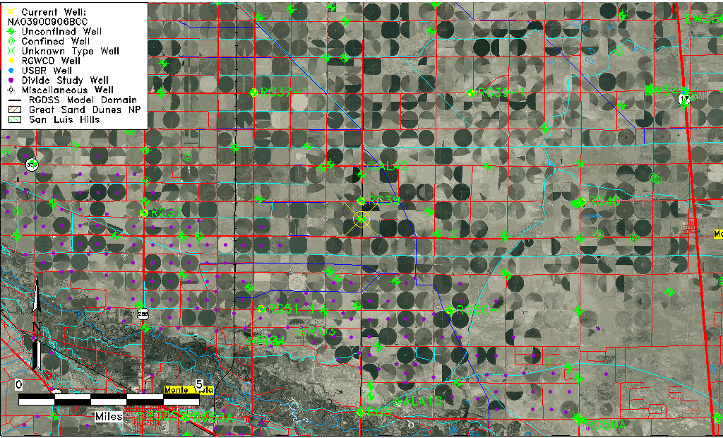
| Common Well ID | NA03900906BCC |
| USGS Well ID | 373916106021701 |
| USGS Station Name | NA03900906BCC |
| USGS Construction Date | 08/09/1993 |
| USGS Site Type | Well |
| USGS Site Use Information | Observation |
| USGS Groundwater Use Information | Unused |
| Data Source(s) | USGS |
| Location Data |
|---|
| TRS | NA03900906BCC |
| USGS TRS 1 | NA03900906BCC |
| USGS TRS | SWSWNWS 6T 39NR 9E |
| Longitude/Latitude (NAD83) | -106.03878060 , 37.65444167 |
| Longitude/Latitude Data Source | GWSI decimal LAT/LONG field |
| USGS Longitude/Latitude (NAD83) | -106.0387806 , 37.65444167 |
| Easting, Northing RGDSS-NAD83 (US ft) | 94453.60 , 239940.75 |
| USGS Topography | Valley flat |
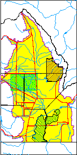
| USGS County | Alamosa County |
| USGS Map Name | CENTER SOUTH |
| USGS Map Scale | 24000 |
| Elevation and Depth Data |
|---|
| Ground Elevation (ft NAVD88) | 7624.00000000000 |
| Elevation Data Source | USGS GWSI database |
| USGS Ground Elevation (ft NAVD88) | 7624.00 |
| 1/3-Arc Second NED Ground Elevation (ft NAVD88) | 7616.82 |
| 1-Arc Second NED Ground Elevation (ft NAVD88) | 7616.81 |
| SRTM Ground Elevation (ft NAVD88) | 7620.14 |
| Total Depth (ft) | 19.70 |
| USGS Hole Depth (ft) | 20.00 |
| USGS Well Depth (ft) | 19.70 |
| Model Layer | 1 |
| Model Layer Source | Well Depth |
| Depth of Bottom of Layer 1 | 104 |
| Depth of Bottom of Layer 2 | 237 |
| Depth of Bottom of Layer 3 | 694 |
| Depth of Bottom of Layer 4 | 2268 |
| Additional Well Information | Logs, Geohydrology, Construction, Aquifer |
| Aquifer Information |
|---|
| Aquifer Type | Unconfined |
| Aquifer Type Source | TD Elevation/Model Layer |
| USGS Primary Aquifer | 112ALMS |
| USGS Aquifer Type | Unconfined Single Aquifer |
| USGS Hydrologic Unit | San Luis |
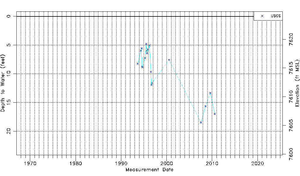
| USGS Data Available | Water-level (GW.LEV) |
| Water-level Database Information |
|---|
| Water-level Count | 19 |
| Water-level Date Range | 08/29/1993 thru 08/07/2010 |
| Monitored within the last 18 months | No, most recently on 08/07/2010 |
| Depth-to-Water Range (ft) | 4.81 to 18.48 |
| Water Table Elevation Range (ft NAVD88) | 7605.52 to 7619.19 |
| Water-Level-Source:Number-of-Measurements | USGSaguache Creek:19 |