| Well Information Table |
|---|
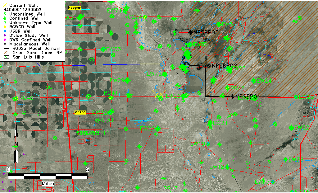
| Common Well ID | NA04001133DDD2 |
| USGS Well ID | 373920105461502 |
| USGS Station Name | NA04001133DDD2 |
| USGS Construction Date | 08/29/2002 |
| USGS Site Type | Well |
| USGS Site Use Information | Observation |
| USGS Groundwater Use Information | Unused |
| Data Source(s) | USGS |
| Location Data |
|---|
| TRS | NA04001133DDD2 |
| USGS TRS 1 | NA04001133DDD2 |
| Longitude/Latitude (NAD83) | -105.76357430 , 37.66341810 |
| Longitude/Latitude Data Source | GWSI decimal LAT/LONG field |
| USGS Longitude/Latitude (NAD83) | -105.7635743 , 37.66341810 |
| Easting, Northing RGDSS-NAD83 (US ft) | 174106.17 , 243010.22 |
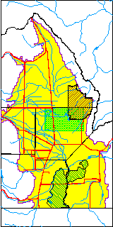
| USGS County | Alamosa County |
| Elevation and Depth Data |
|---|
| Ground Elevation (ft NAVD88) | 7527.99000000000 |
| Elevation Data Source | USGS GWSI database |
| USGS Ground Elevation (ft NGVD29) | 7524.00 |
| 1/3-Arc Second NED Ground Elevation (ft NAVD88) | 7528.90 |
| 1-Arc Second NED Ground Elevation (ft NAVD88) | 7529.42 |
| SRTM Ground Elevation (ft NAVD88) | 7533.98 |
| Total Depth (ft) | 14.00 |
| USGS Hole Depth (ft) | 14.00 |
| USGS Well Depth (ft) | 14.00 |
| Model Layer | 1 |
| Model Layer Source | Well Depth |
| Depth of Bottom of Layer 1 | 114 |
| Depth of Bottom of Layer 2 | 392 |
| Depth of Bottom of Layer 3 | 1465 |
| Depth of Bottom of Layer 4 | 2302 |
| Additional Well Information | NONE |
| Aquifer Information |
|---|
| Aquifer Type | Unconfined |
| Aquifer Type Source | TD Elevation/Model Layer |
| USGS Hydrologic Unit | San Luis |
| USGS Data Available | Discharge (GW.DISC) |
| Water-level Database Information |
|---|
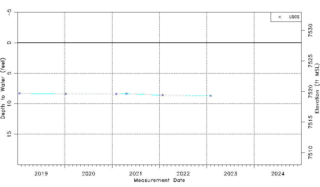
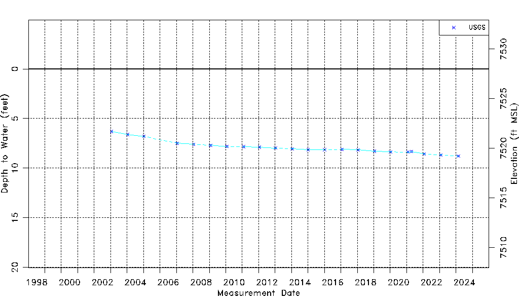
| Water-level Count | 21 |
| Water-level Date Range | 01/21/2003 thru 01/30/2023 |
| Monitored within the last 18 months | Yes, most recently on 01/30/2023 |
| Depth-to-Water Range (ft) | 6.30 to 8.67 |
| Water Table Elevation Range (ft NAVD88) | 7519.32 to 7521.69 |
| Water-Level-Source:Number-of-Measurements | USGS:21 |