| Well Information Table |
|---|
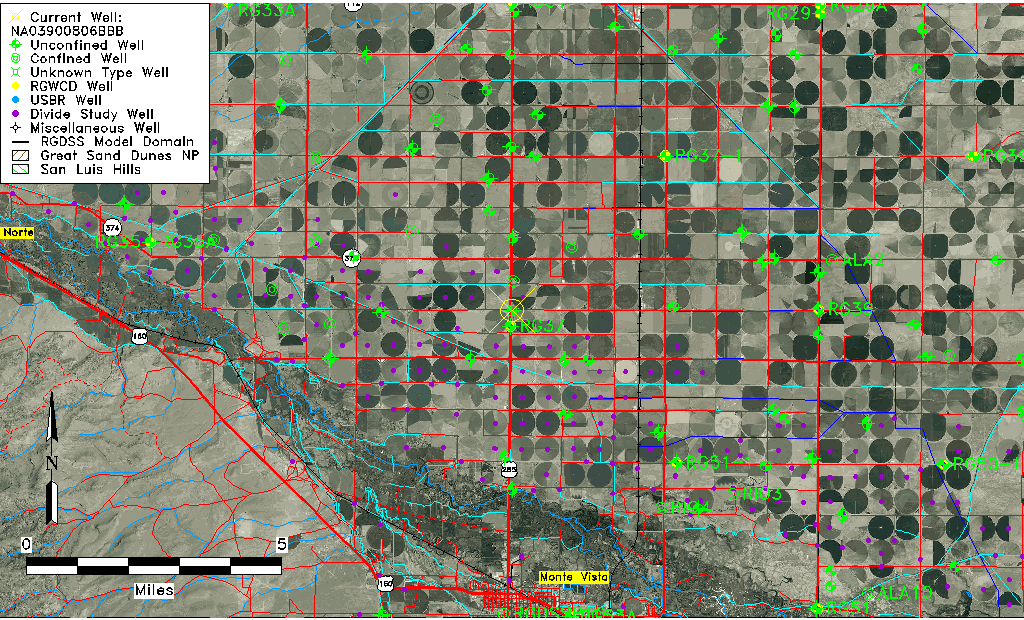
| Common Well ID | NA03900806BBB |
| USGS Well ID | 373924106084801 |
| USGS Station Name | NA03900806BBB |
| USGS Construction Date | 01/01/1967 |
| USGS Site Type | Well |
| USGS Site Use Information | Observation |
| USGS Groundwater Use Information | Unused |
| Data Source(s) | USGS |
| Location Data |
|---|
| TRS | NA03900806BBB |
| USGS TRS 1 | NA03900806BBB |
| USGS TRS | NWNWNWS006T0039NR0008EN |
| Longitude/Latitude (NAD83) | -106.14822280 , 37.66108539 |
| Longitude/Latitude Data Source | GWSI decimal LAT/LONG field |
| USGS Longitude/Latitude (NAD83) | -106.1482228 , 37.66108539 |
| Easting, Northing RGDSS-NAD83 (US ft) | 62790.68 , 242503.04 |
| USGS Topography | Valley flat |
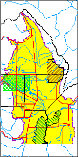
| USGS County | Rio Grande County |
| USGS Map Name | SEVENMILE PLAZA |
| USGS Map Scale | 24000 |
| Elevation and Depth Data |
|---|
| Ground Elevation (ft NAVD88) | 7684.60000000000 |
| Elevation Data Source | USGS GWSI database |
| USGS Ground Elevation (ft NGVD29) | 7680.00 |
| 1/3-Arc Second NED Ground Elevation (ft NAVD88) | 7682.71 |
| 1-Arc Second NED Ground Elevation (ft NAVD88) | 7682.86 |
| SRTM Ground Elevation (ft NAVD88) | 7695.18 |
| Total Depth (ft) | 14.00 |
| USGS Well Depth (ft) | 14.00 |
| Model Layer | 1 |
| Model Layer Source | Well Depth |
| Depth of Bottom of Layer 1 | 84 |
| Depth of Bottom of Layer 2 | 242 |
| Depth of Bottom of Layer 3 | 320 |
| Depth of Bottom of Layer 4 | 2104 |
| Additional Well Information | Geohydrology, Construction |
| Aquifer Information |
|---|
| Aquifer Type | Unconfined |
| Aquifer Type Source | TD Elevation/Model Layer |
| USGS Primary Aquifer | Cenozoic Erathem |
| USGS Aquifer Type | Unconfined Single Aquifer |
| USGS Hydrologic Unit | San Luis |
| USGS Data Available | Water-level (GW.LEV) |
| Water-level Database Information |
|---|
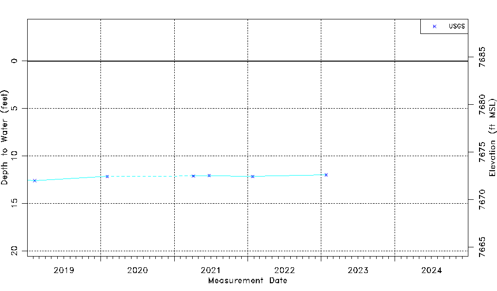
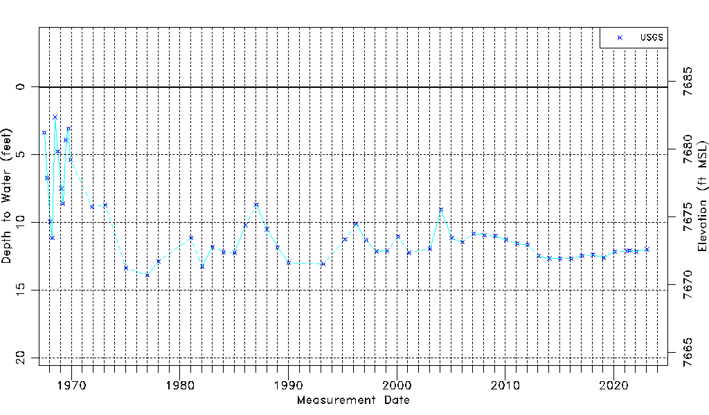
| Water-level Count | 56 |
| Water-level Date Range | 07/05/1967 thru 01/25/2023 |
| Monitored within the last 18 months | Yes, most recently on 01/25/2023 |
| Depth-to-Water Range (ft) | 2.24 to 13.90 |
| Water Table Elevation Range (ft NAVD88) | 7670.70 to 7682.36 |
| Water-Level-Source:Number-of-Measurements | USGS:56 |