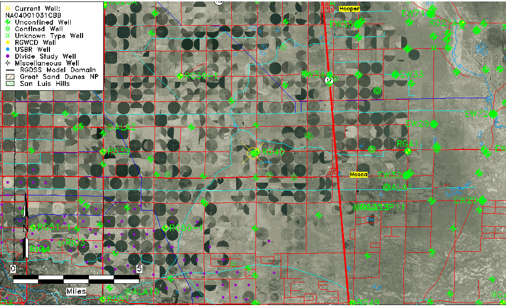
| Well Information Table |
|---|
| Common Well ID | NA04001031CBB |
| USGS Well ID | 373940105554801 |
| USGS Station Name | NA04001031CBB |
| USGS Construction Date | 01/01/1954 |
| USGS Site Type | Well |
| USGS Site Use Information | Withdrawal of Water |
| USGS Groundwater Use Information | Irrigation |
| Data Source(s) | USGS |
| Location Data |
|---|
| TRS | NA04001031CBB |
| USGS TRS 1 | NA04001031CBB |
| USGS TRS | NWNWSWS031T0040NR0010EN |
| Longitude/Latitude (NAD83) | -105.93057800 , 37.66111216 |
| Longitude/Latitude Data Source | GWSI decimal LAT/LONG field |
| USGS Longitude/Latitude (NAD83) | -105.9305780 , 37.66111216 |
| Easting, Northing RGDSS-NAD83 (US ft) | 125776.40 , 242263.20 |
| USGS Topography | Valley flat |
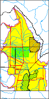
| USGS County | Alamosa County |
| Elevation and Depth Data |
|---|
| Ground Elevation (ft NAVD88) | 7578.91000000000 |
| Elevation Data Source | USGS GWSI database |
| USGS Ground Elevation (ft NGVD29) | 7575.00 |
| 1/3-Arc Second NED Ground Elevation (ft NAVD88) | 7577.45 |
| 1-Arc Second NED Ground Elevation (ft NAVD88) | 7577.03 |
| SRTM Ground Elevation (ft NAVD88) | 7585.30 |
| Total Depth (ft) | 100.00 |
| USGS Well Depth (ft) | 100.00 |
| Model Layer | 1 |
| Model Layer Source | Well Depth |
| Depth of Bottom of Layer 1 | 97 |
| Depth of Bottom of Layer 2 | 216 |
| Depth of Bottom of Layer 3 | 898 |
| Depth of Bottom of Layer 4 | 2005 |
| Additional Well Information | Geohydrology, Construction |
| Aquifer Information |
|---|
| Aquifer Type | Unconfined |
| Aquifer Type Source | TD Elevation/Model Layer |
| USGS Primary Aquifer | Cenozoic Erathem |
| USGS Hydrologic Unit | San Luis |
| USGS Data Available | Water-level (GW.LEV) |
| Water-level Database Information |
|---|
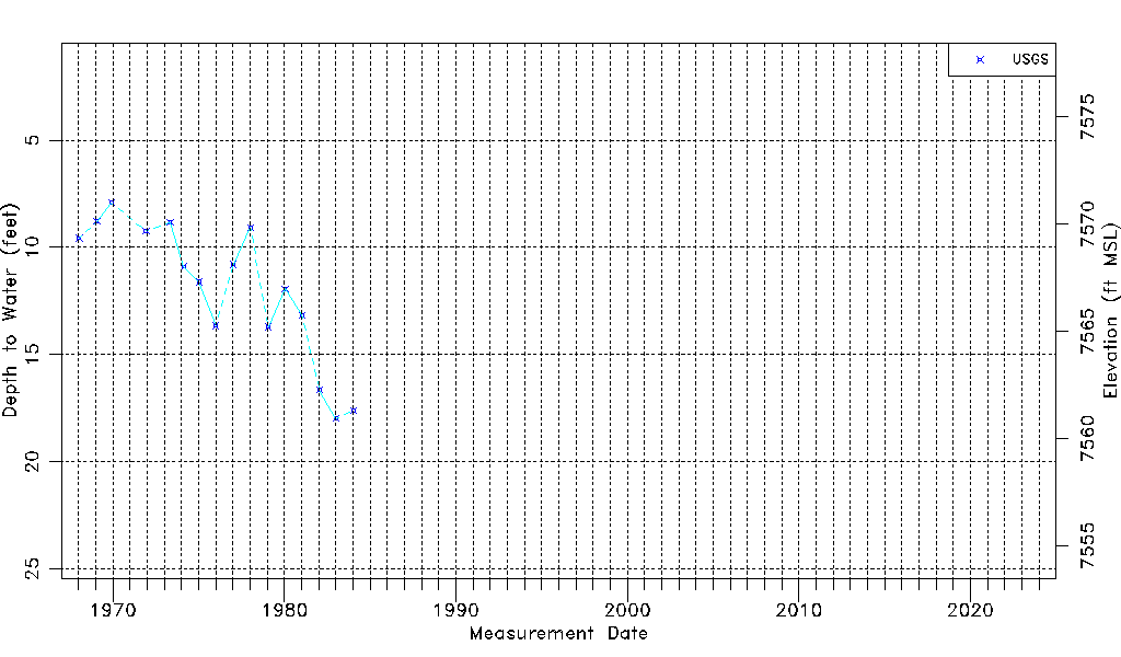
| Water-level Count | 16 |
| Water-level Date Range | 01/15/1968 thru 01/16/1984 |
| Monitored within the last 18 months | No, most recently on 01/16/1984 |
| Depth-to-Water Range (ft) | 7.92 to 17.98 |
| Water Table Elevation Range (ft NAVD88) | 7560.93 to 7570.99 |
| Water-Level-Source:Number-of-Measurements | USGSaguache Creek:16 |