| Well Information Table |
|---|
| Common Well ID | NA03901203BBA3 EW-69U |
| USBR Well ID | EW69U |
| USGS Well ID | 373946105390803 |
| USGS Station Name | NA03901203BBA3 EW-69U |
| USGS Construction Date | 05/02/2002 |
| USGS Site Type | Well |
| USGS Site Use Information | Observation |
| USGS Groundwater Use Information | Unused |
| Data Source(s) | USGS, USBR |
| Location Data |
|---|
| TRS | NA03901203BBA3 EW-69U |
| USBR TRS | NA03901203BBA3 |
| USGS TRS 1 | NA03901203BBA3 EW-69U |
| Longitude/Latitude (NAD83) | -105.65251984 , 37.66218385 |
| Longitude/Latitude Data Source | USBOR EW well locations |
| USGS Longitude/Latitude (NAD83) | -105.6527936 , 37.66277979 |
| USBR Longitude/Latitude (NAD27) | -105.651948508696 , 37.6621818250014 |
| Easting, Northing RGDSS-NAD83 (US ft) | 206242.50 , 242547.16 |
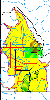
| USGS County | Alamosa County |
| USGS Map Name | MEDANO RANCH |
| USGS Map Scale | 24000 |
| Elevation and Depth Data |
|---|
| Ground Elevation (ft NAVD88) | 7588.67000000000 |
| Elevation Data Source | USBOR EW well database |
| USBR Ground Elevation (ft NGVD29) | 7584.5 |
| USGS Ground Elevation (ft NGVD29) | 7584.50 |
| 1/3-Arc Second NED Ground Elevation (ft NAVD88) | 7590.70 |
| 1-Arc Second NED Ground Elevation (ft NAVD88) | 7588.76 |
| SRTM Ground Elevation (ft NAVD88) | 7586.21 |
| Total Depth (ft) | 15.00 |
| USBR Total Depth (ft) | 15 |
| USGS Well Depth (ft) | 11.20 |
| Model Layer | 1 |
| Model Layer Source | Aquifer Type |
| Depth of Bottom of Layer 1 | 171 |
| Depth of Bottom of Layer 2 | 547 |
| Depth of Bottom of Layer 3 | 1445 |
| Depth of Bottom of Layer 4 | 3781 |
| Additional Well Information | NONE |
| Aquifer Information |
|---|
| Aquifer Type | Unconfined |
| Aquifer Type Source | EW_AQFR |
| USGS Hydrologic Unit | San Luis |
| USGS Data Available | Discharge (GW.DISC) |
| Water-level Database Information |
|---|
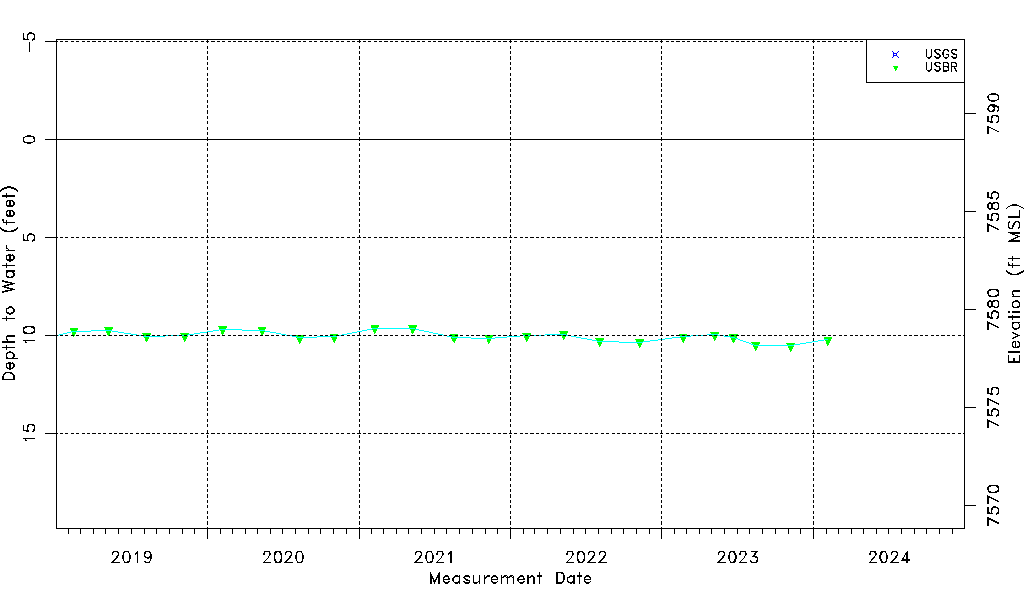
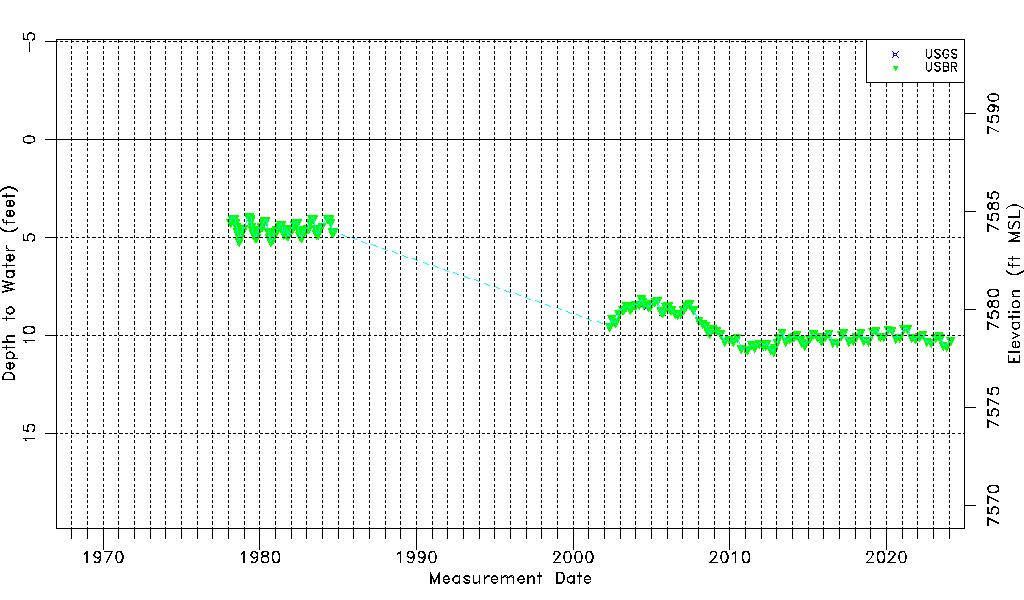
| Water-level Count | 204 |
| Water-level Date Range | 02/18/1978 thru 11/07/2023 |
| Monitored within the last 18 months | Yes, most recently on 11/07/2023 |
| Depth-to-Water Range (ft) | 3.90 to 10.82 |
| Water Table Elevation Range (ft NAVD88) | 7577.85 to 7584.77 |
| Water-Level-Source:Number-of-Measurements | USGS:5 USBR:201 |