| Well Information Table |
|---|
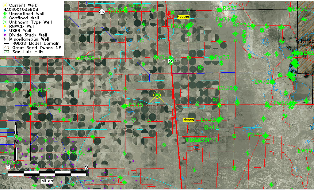
| Common Well ID | NA04001033BCB |
| USGS Well ID | 373950105534001 |
| USGS Station Name | NA04001033BCB |
| USGS Site Type | Well |
| USGS Site Use Information | Withdrawal of Water |
| USGS Groundwater Use Information | Irrigation |
| Data Source(s) | USGS |
| Location Data |
|---|
| TRS | NA04001033BCB |
| USGS TRS 1 | NA04001033BCB |
| USGS TRS | NWSWNWS033T0040NR0010EN |
| Longitude/Latitude (NAD83) | -105.89138270 , 37.67158430 |
| Longitude/Latitude Data Source | GWSI decimal LAT/LONG field |
| USGS Longitude/Latitude (NAD83) | -105.8913827 , 37.67158430 |
| Easting, Northing RGDSS-NAD83 (US ft) | 137128.26 , 246045.87 |
| USGS Topography | Valley flat |
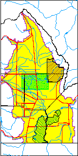
| USGS County | Alamosa County |
| Elevation and Depth Data |
|---|
| Ground Elevation (ft NAVD88) | 7562.85000000000 |
| Elevation Data Source | USGS GWSI database |
| USGS Ground Elevation (ft NGVD29) | 7559.00 |
| 1/3-Arc Second NED Ground Elevation (ft NAVD88) | 7562.83 |
| 1-Arc Second NED Ground Elevation (ft NAVD88) | 7566.61 |
| SRTM Ground Elevation (ft NAVD88) | 7569.80 |
| Total Depth (ft) | 135.00 |
| USGS Well Depth (ft) | 135.00 |
| Model Layer | 2 |
| Model Layer Source | Dunes Layer |
| Depth of Bottom of Layer 1 | 79 |
| Depth of Bottom of Layer 2 | 267 |
| Depth of Bottom of Layer 3 | 1047 |
| Depth of Bottom of Layer 4 | 1998 |
| Additional Well Information | Geohydrology, Construction |
| Aquifer Information |
|---|
| Aquifer Type | Confined |
| Aquifer Type Source | TD Elevation/Model Layer |
| USGS Primary Aquifer | Cenozoic Erathem |
| USGS Aquifer Type | Confined Single Aquifer |
| USGS Hydrologic Unit | San Luis |
| USGS Data Available | Water-level (GW.LEV) |
| Water-level Database Information |
|---|
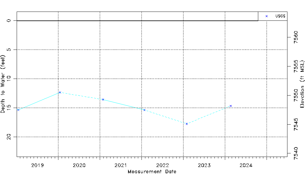
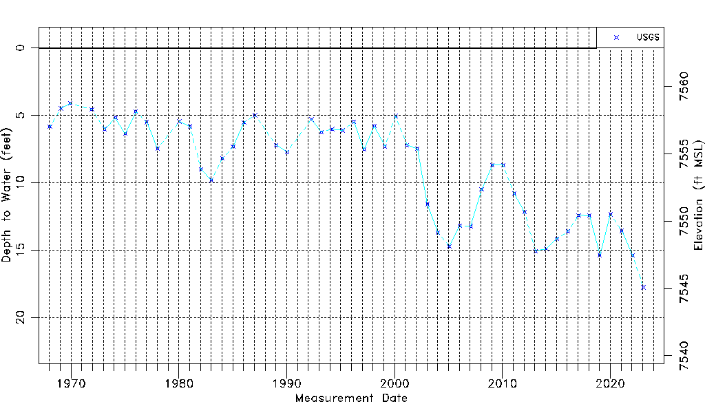
| Water-level Count | 52 |
| Water-level Date Range | 01/15/1968 thru 01/31/2023 |
| Monitored within the last 18 months | Yes, most recently on 01/31/2023 |
| Depth-to-Water Range (ft) | 4.11 to 17.76 |
| Water Table Elevation Range (ft NAVD88) | 7545.09 to 7558.74 |
| Water-Level-Source:Number-of-Measurements | USGS:52 |