| Well Information Table |
|---|
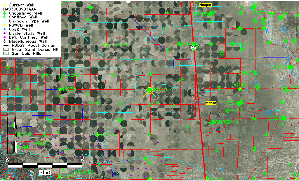
| Common Well ID | NA03900901AAA |
| USGS Well ID | 374024105555401 |
| USGS Station Name | NA03900901AAA |
| USGS Construction Date | 01/01/1948 |
| USGS Site Type | Well |
| USGS Site Use Information | Destroyed |
| USGS Groundwater Use Information | Unused |
| Data Source(s) | USGS |
| Location Data |
|---|
| TRS | NA03900901AAA |
| USGS TRS 1 | NA03900901AAA |
| USGS TRS | NENENES001T0039NR0009EN |
| Longitude/Latitude (NAD83) | -105.92946690 , 37.66083439 |
| Longitude/Latitude Data Source | GWSI decimal LAT/LONG field |
| USGS Longitude/Latitude (NAD83) | -105.9294669 , 37.66083439 |
| Easting, Northing RGDSS-NAD83 (US ft) | 126097.66 , 242161.18 |
| USGS Topography | Valley flat |
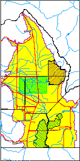
| USGS County | Alamosa County |
| USGS Map Name | HOOPER WEST |
| USGS Map Scale | 24000 |
| Elevation and Depth Data |
|---|
| Ground Elevation (ft NAVD88) | 7576.91000000000 |
| Elevation Data Source | USGS GWSI database |
| USGS Ground Elevation (ft NGVD29) | 7573.00 |
| 1/3-Arc Second NED Ground Elevation (ft NAVD88) | 7576.98 |
| 1-Arc Second NED Ground Elevation (ft NAVD88) | 7576.80 |
| SRTM Ground Elevation (ft NAVD88) | 7594.87 |
| Total Depth (ft) | 10.00 |
| USGS Well Depth (ft) | 10.00 |
| Model Layer | 1 |
| Model Layer Source | Well Depth |
| Depth of Bottom of Layer 1 | 95 |
| Depth of Bottom of Layer 2 | 215 |
| Depth of Bottom of Layer 3 | 898 |
| Depth of Bottom of Layer 4 | 1999 |
| Additional Well Information | Geohydrology, Construction |
| Aquifer Information |
|---|
| Aquifer Type | Unconfined |
| Aquifer Type Source | TD Elevation/Model Layer |
| USGS Primary Aquifer | Cenozoic Erathem |
| USGS Hydrologic Unit | San Luis |
| USGS Data Available | Water-level (GW.LEV) |
| Water-level Database Information |
|---|
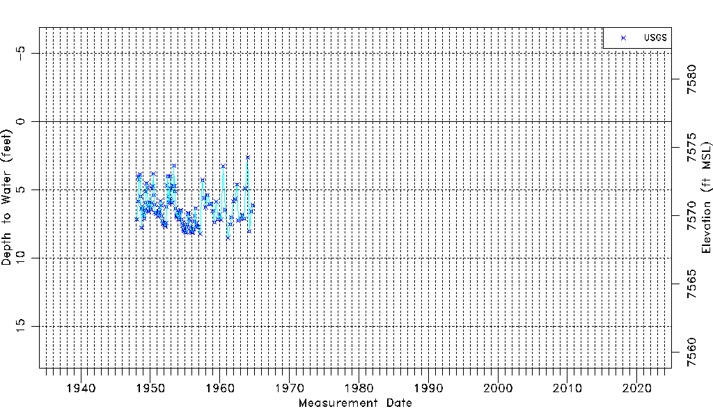
| Water-level Count | 137 |
| Water-level Date Range | 01/22/1948 thru 10/01/1964 |
| Monitored within the last 18 months | No, most recently on 10/01/1964 |
| Depth-to-Water Range (ft) | 2.63 to 8.53 |
| Water Table Elevation Range (ft NAVD88) | 7568.38 to 7574.28 |
| Water-Level-Source:Number-of-Measurements | USGSaguache Creek:137 |