| Well Information Table |
|---|
| Common Well ID | NA04000828DBB2 |
| USGS Well ID | 374032106060202 |
| USGS Station Name | NA04000828DBB2 |
| USGS Construction Date | 01/01/1939 |
| USGS Site Type | Well |
| USGS Site Use Information | Withdrawal of Water |
| USGS Groundwater Use Information | Irrigation |
| Data Source(s) | USGS |
| Location Data |
|---|
| TRS | NA04000828DBB2 |
| USGS TRS 1 | NA04000828DBB2 |
| USGS TRS | NWNWSES028T0040NR0008EN |
| Longitude/Latitude (NAD83) | -106.10297140 , 37.68289030 |
| Longitude/Latitude Data Source | GWSI decimal LAT/LONG field |
| USGS Longitude/Latitude (NAD83) | -106.1029714 , 37.68289030 |
| Easting, Northing RGDSS-NAD83 (US ft) | 75923.33 , 250376.82 |
| USGS Topography | Valley flat |
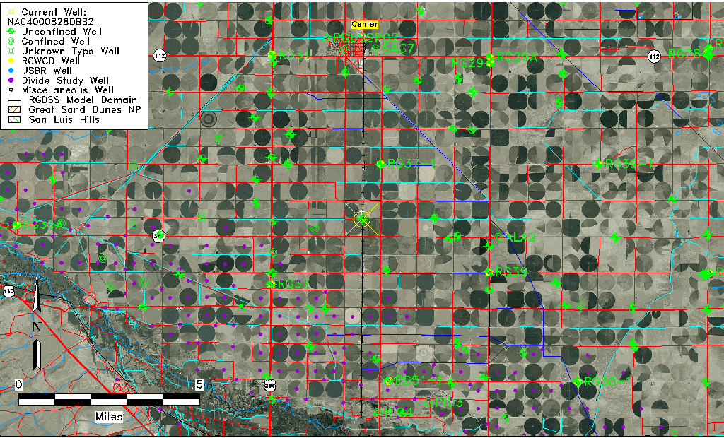
| USGS County | Rio Grande County |
| Elevation and Depth Data |
|---|
| Ground Elevation (ft NAVD88) | 7651.50000000000 |
| Elevation Data Source | USGS GWSI database |
| USGS Ground Elevation (ft NGVD29) | 7647.00 |
| 1/3-Arc Second NED Ground Elevation (ft NAVD88) | 7648.87 |
| 1-Arc Second NED Ground Elevation (ft NAVD88) | 7648.87 |
| SRTM Ground Elevation (ft NAVD88) | 7667.73 |
| Total Depth (ft) | 50.00 |
| USGS Well Depth (ft) | 50.00 |
| Model Layer | 1 |
| Model Layer Source | Well Depth |
| Depth of Bottom of Layer 1 | 99 |
| Depth of Bottom of Layer 2 | 235 |
| Depth of Bottom of Layer 3 | 482 |
| Depth of Bottom of Layer 4 | 2413 |
| Additional Well Information | Geohydrology, Construction |
| Aquifer Information |
|---|
| Aquifer Type | Unconfined |
| Aquifer Type Source | TD Elevation/Model Layer |
| USGS Primary Aquifer | Cenozoic Erathem |
| USGS Aquifer Type | Unconfined Single Aquifer |
| USGS Hydrologic Unit | San Luis |
| USGS Data Available | Water-level (GW.LEV) |
| Water-level Database Information |
|---|
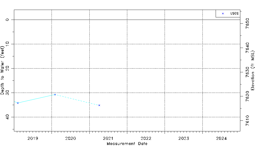
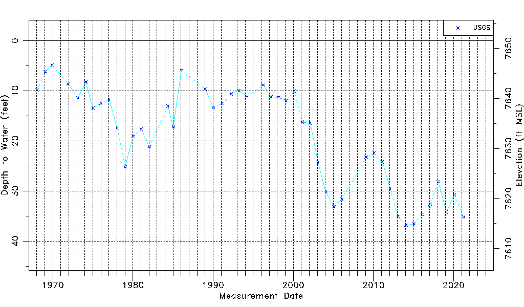
| Water-level Count | 47 |
| Water-level Date Range | 01/15/1968 thru 04/06/2021 |
| Monitored within the last 18 months | No, most recently on 04/06/2021 |
| Depth-to-Water Range (ft) | 4.88 to 36.82 |
| Water Table Elevation Range (ft NAVD88) | 7614.68 to 7646.62 |
| Water-Level-Source:Number-of-Measurements | USGS:47 |