| Well Information Table |
|---|
| Common Well ID | NA04000934BAA2 |
| USGS Well ID | 374033105582802 |
| USGS Station Name | NA04000934BAA2 |
| USGS Construction Date | 11/03/2006 |
| USGS Site Type | Well |
| USGS Site Use Information | Unknown |
| USGS Groundwater Use Information | Unknown |
| Data Source(s) | USGS |
| Location Data |
|---|
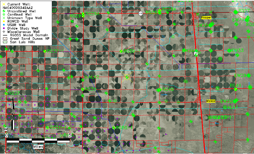
| TRS | NA04000934BAA2 |
| USGS TRS 1 | NA04000934BAA2 |
| USGS TRS | NENENWS34 T40N R9E N |
| Longitude/Latitude (NAD83) | -105.97503060 , 37.67592778 |
| Longitude/Latitude Data Source | GWSI decimal LAT/LONG field |
| USGS Longitude/Latitude (NAD83) | -105.9750306 , 37.67592778 |
| Easting, Northing RGDSS-NAD83 (US ft) | 112929.82 , 247695.56 |
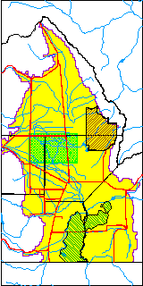
| USGS County | Alamosa County |
| USGS Map Name | HOOPER WEST |
| USGS Map Scale | 24000 |
| Elevation and Depth Data |
|---|
| Ground Elevation (ft NAVD88) | 7595.00000000000 |
| Elevation Data Source | USGS GWSI database |
| USGS Ground Elevation (ft NAVD88) | 7595.00 |
| 1/3-Arc Second NED Ground Elevation (ft NAVD88) | 7590.65 |
| 1-Arc Second NED Ground Elevation (ft NAVD88) | 7591.12 |
| SRTM Ground Elevation (ft NAVD88) | 7607.27 |
| Total Depth (ft) | 36.46 |
| USGS Hole Depth (ft) | 37.00 |
| USGS Well Depth (ft) | 36.46 |
| Model Layer | 1 |
| Model Layer Source | Well Depth |
| Depth of Bottom of Layer 1 | 105 |
| Depth of Bottom of Layer 2 | 214 |
| Depth of Bottom of Layer 3 | 852 |
| Depth of Bottom of Layer 4 | 2206 |
| Additional Well Information | NONE |
| Aquifer Information |
|---|
| Aquifer Type | Unconfined |
| Aquifer Type Source | TD Elevation/Model Layer |
| USGS Primary Aquifer | 112ALMS |
| USGS Hydrologic Unit | San Luis |
| USGS Data Available | Geohydrologic |
| Water-level Database Information |
|---|
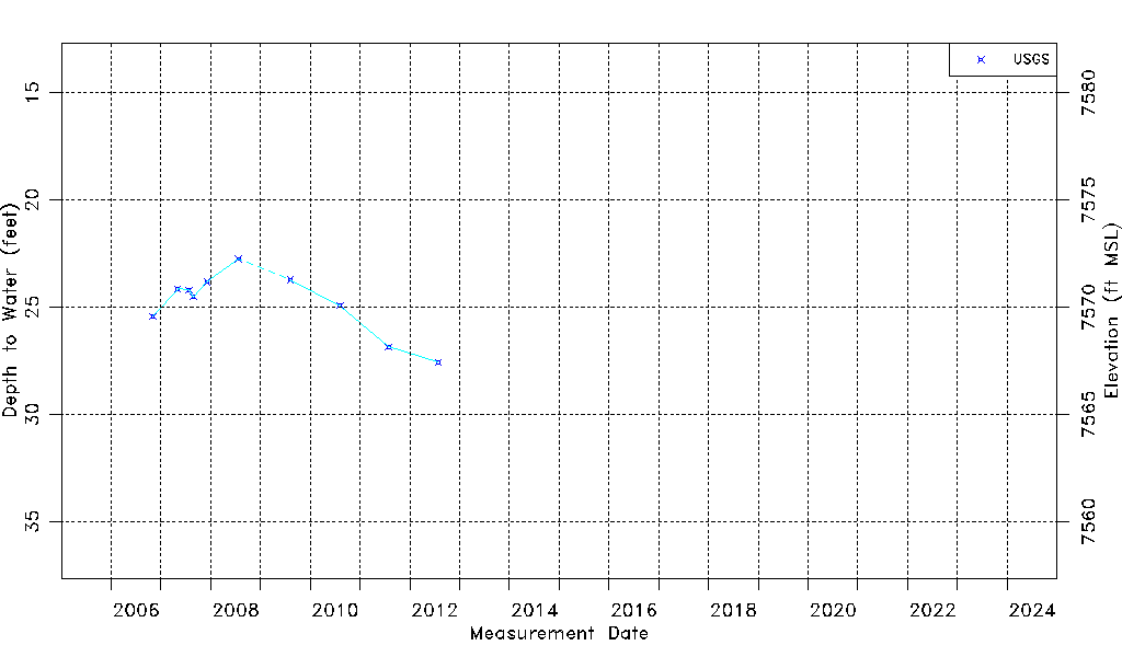
| Water-level Count | 11 |
| Water-level Date Range | 11/03/2006 thru 07/27/2012 |
| Monitored within the last 18 months | No, most recently on 07/27/2012 |
| Depth-to-Water Range (ft) | 22.76 to 27.57 |
| Water Table Elevation Range (ft NAVD88) | 7567.43 to 7572.24 |
| Water-Level-Source:Number-of-Measurements | USGSaguache Creek:11 |