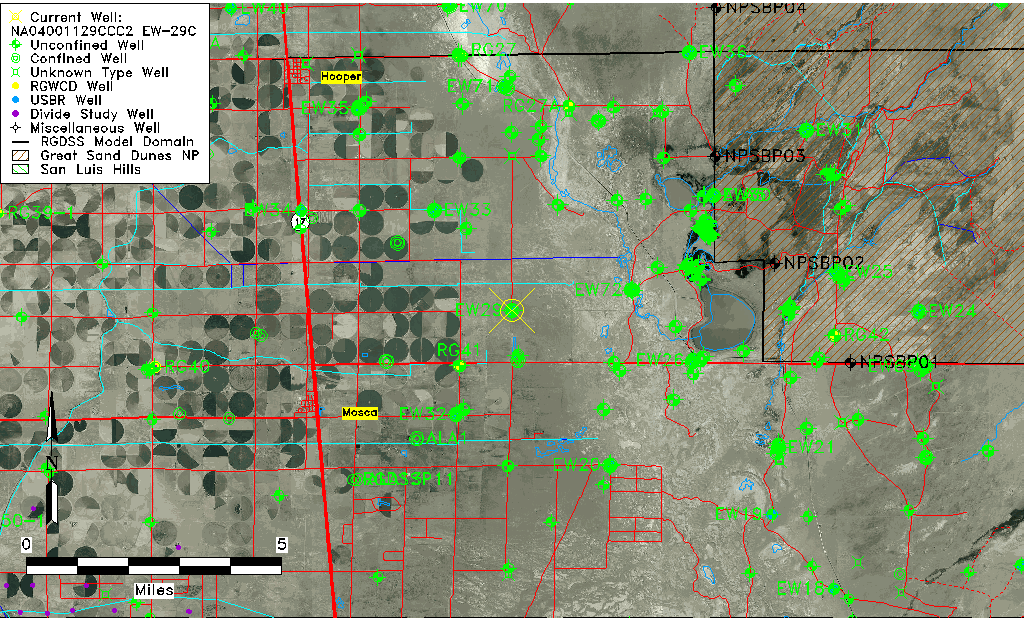
| Well Information Table |
|---|
| Common Well ID | NA04001129CCC2 EW-29C |
| USBR Well ID | EW29C |
| USGS Well ID | 374041105475802 |
| GSDNP Well Name | 374041105475802 |
| USGS Station Name | NA04001129CCC2 EW-29C |
| USGS Site Type | Well |
| USGS Site Use Information | Observation |
| USGS Groundwater Use Information | Unknown |
| Data Source(s) | USGS, USBR |
| Location Data |
|---|
| TRS | NA04001129CCC2 EW-29C |
| USBR TRS | NA04001129CCC2 |
| USGS TRS 1 | NA04001129CCC2 EW-29C |
| Longitude/Latitude (NAD83) | -105.79998704 , 37.67810071 |
| Longitude/Latitude Data Source | USBOR EW well locations |
| USGS Longitude/Latitude (NAD83) | -105.8000196 , 37.67805660 |
| USBR Longitude/Latitude (NAD27) | -105.799411929956 , 37.6780996364562 |
| Easting, Northing RGDSS-NAD83 (US ft) | 163576.71 , 248367.74 |
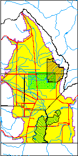
| USGS County | Alamosa County |
| Elevation and Depth Data |
|---|
| Ground Elevation (ft NAVD88) | 7535.41000000000 |
| Elevation Data Source | USBOR EW well database |
| USBR Ground Elevation (ft NGVD29) | 7531.5 |
| USGS Ground Elevation (ft NGVD29) | 7531.50 |
| 1/3-Arc Second NED Ground Elevation (ft NAVD88) | 7536.21 |
| 1-Arc Second NED Ground Elevation (ft NAVD88) | 7535.68 |
| SRTM Ground Elevation (ft NAVD88) | 7539.93 |
| Total Depth (ft) | 130.00 |
| USBR Total Depth (ft) | 130 |
| USGS Well Depth (ft) | 128.00 |
| Model Layer | 2 |
| Model Layer Source | Well Depth |
| Depth of Bottom of Layer 1 | 100 |
| Depth of Bottom of Layer 2 | 344 |
| Depth of Bottom of Layer 3 | 1383 |
| Depth of Bottom of Layer 4 | 2038 |
| Additional Well Information | NONE |
| Aquifer Information |
|---|
| Aquifer Type | Confined |
| Aquifer Type Source | EW_AQFR |
| USGS Hydrologic Unit | San Luis |
| USGS Data Available | Water-level (GW.LEV) |
| Water-level Database Information |
|---|
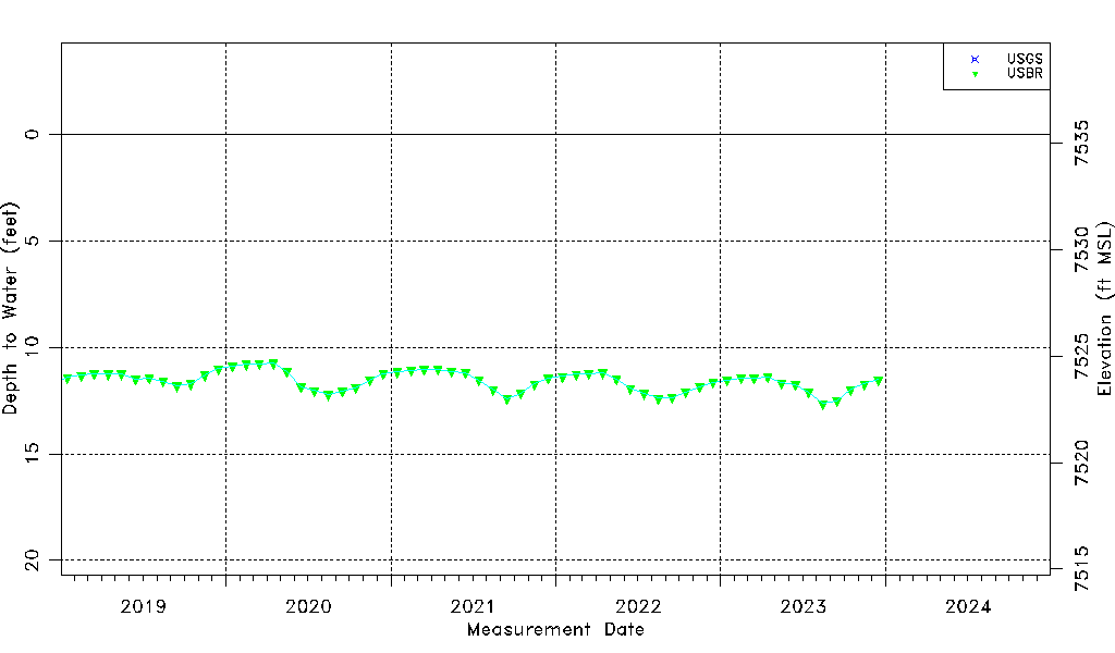
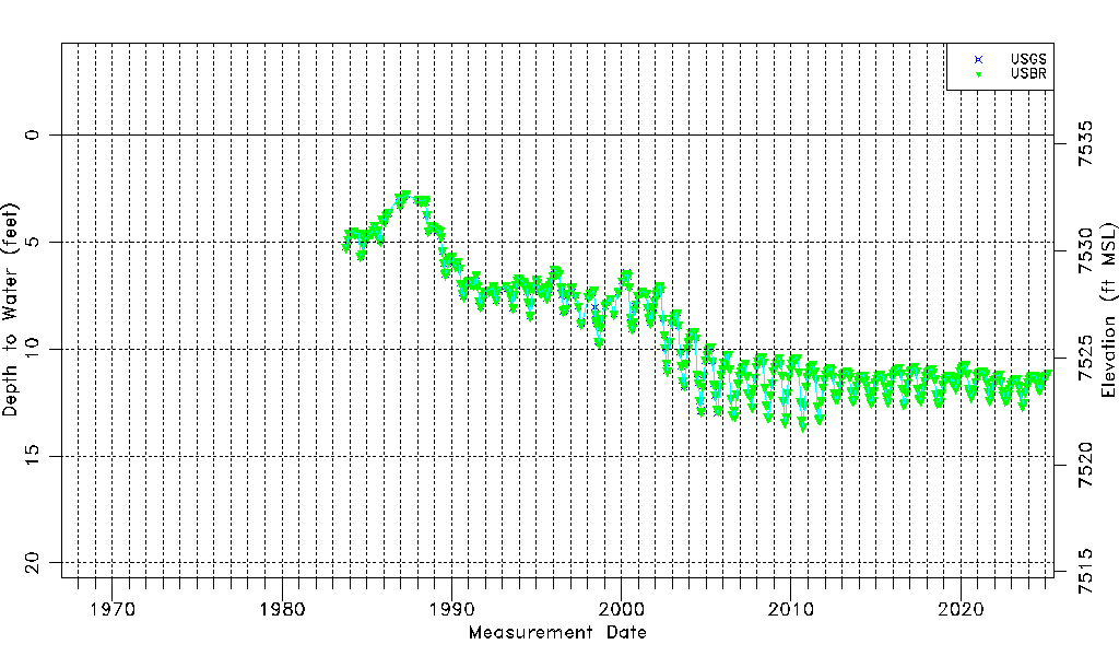
| Water-level Count | 473 |
| Water-level Date Range | 10/12/1983 thru 12/15/2023 |
| Monitored within the last 18 months | Yes, most recently on 12/15/2023 |
| Depth-to-Water Range (ft) | 2.76 to 13.62 |
| Water Table Elevation Range (ft NAVD88) | 7521.79 to 7532.65 |
| Water-Level-Source:Number-of-Measurements | USGS:239 USBR:443 |