| Well Information Table |
|---|
| Common Well ID | NA04000728BCC1 |
| USGS Well ID | 374050106130501 |
| USGS Station Name | NA04000728BCC1 |
| USGS Construction Date | 01/01/1938 |
| USGS Site Type | Well |
| USGS Site Use Information | Withdrawal of Water |
| USGS Groundwater Use Information | Irrigation |
| Data Source(s) | USGS |
| Location Data |
|---|
| TRS | NA04000728BCC1 |
| USGS TRS 1 | NA04000728BCC1 |
| USGS TRS | SWSWNWS028T0040NR0007EN |
| Longitude/Latitude (NAD83) | -106.21864150 , 37.68055800 |
| Longitude/Latitude Data Source | GWSI decimal LAT/LONG field |
| USGS Longitude/Latitude (NAD83) | -106.2186415 , 37.68055800 |
| Easting, Northing RGDSS-NAD83 (US ft) | 42452.93 , 249703.92 |
| USGS Topography | Valley flat |
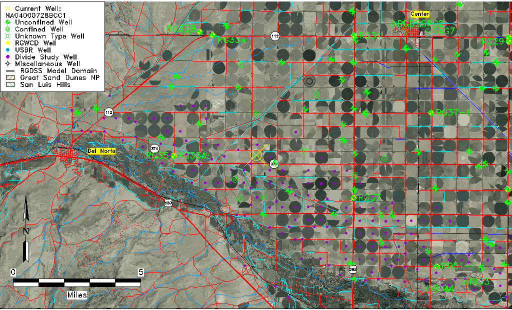
| USGS County | Rio Grande County |
| Elevation and Depth Data |
|---|
| Ground Elevation (ft NAVD88) | 7748.67000000000 |
| Elevation Data Source | USGS GWSI database |
| USGS Ground Elevation (ft NGVD29) | 7744.00 |
| 1/3-Arc Second NED Ground Elevation (ft NAVD88) | 7745.68 |
| 1-Arc Second NED Ground Elevation (ft NAVD88) | 7745.43 |
| SRTM Ground Elevation (ft NAVD88) | 7749.35 |
| Total Depth (ft) | 120.00 |
| USGS Well Depth (ft) | 120.00 |
| Model Layer | 2 |
| Model Layer Source | Well Depth |
| Depth of Bottom of Layer 1 | 71 |
| Depth of Bottom of Layer 2 | 189 |
| Depth of Bottom of Layer 3 | 297 |
| Depth of Bottom of Layer 4 | 1013 |
| Additional Well Information | Geohydrology, Construction |
| Aquifer Information |
|---|
| Aquifer Type | Confined |
| Aquifer Type Source | TD Elevation/Model Layer |
| USGS Primary Aquifer | Cenozoic Erathem |
| USGS Hydrologic Unit | San Luis |
| USGS Data Available | Water-level (GW.LEV) |
| Water-level Database Information |
|---|
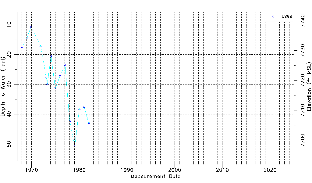
| Water-level Count | 15 |
| Water-level Date Range | 01/15/1968 thru 01/22/1982 |
| Monitored within the last 18 months | No, most recently on 01/22/1982 |
| Depth-to-Water Range (ft) | 10.81 to 50.59 |
| Water Table Elevation Range (ft NAVD88) | 7698.08 to 7737.86 |
| Water-Level-Source:Number-of-Measurements | USGS:15 |