| Well Information Table |
|---|
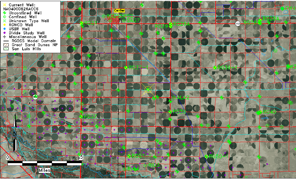
| Common Well ID | NA04000826ACC6 |
| USGS Well ID | 374101106035606 |
| USGS Station Name | NA04000826ACC6 |
| USGS Construction Date | 11/10/2006 |
| USGS Site Type | Well |
| USGS Site Use Information | Unknown |
| USGS Groundwater Use Information | Unknown |
| Data Source(s) | USGS |
| Location Data |
|---|
| TRS | NA04000826ACC6 |
| USGS TRS 1 | NA04000826ACC6 |
| USGS TRS | SWSWNES26 T40N R8E N |
| Longitude/Latitude (NAD83) | -106.06623060 , 37.68356110 |
| Longitude/Latitude Data Source | GWSI decimal LAT/LONG field |
| USGS Longitude/Latitude (NAD83) | -106.0662306 , 37.68356110 |
| Easting, Northing RGDSS-NAD83 (US ft) | 86553.99 , 250573.71 |
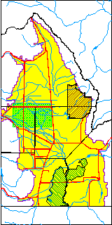
| USGS County | Rio Grande County |
| USGS Map Name | CENTER SOUTH |
| USGS Map Scale | 24000 |
| Elevation and Depth Data |
|---|
| Ground Elevation (ft NAVD88) | 7626.00000000000 |
| Elevation Data Source | USGS GWSI database |
| USGS Ground Elevation (ft NAVD88) | 7626.00 |
| 1/3-Arc Second NED Ground Elevation (ft NAVD88) | 7628.66 |
| 1-Arc Second NED Ground Elevation (ft NAVD88) | 7628.64 |
| SRTM Ground Elevation (ft NAVD88) | 7634.51 |
| Total Depth (ft) | 45.00 |
| USGS Hole Depth (ft) | 45.00 |
| USGS Well Depth (ft) | 45.00 |
| Model Layer | 1 |
| Model Layer Source | Well Depth |
| Depth of Bottom of Layer 1 | 101 |
| Depth of Bottom of Layer 2 | 222 |
| Depth of Bottom of Layer 3 | 634 |
| Depth of Bottom of Layer 4 | 2374 |
| Additional Well Information | NONE |
| Aquifer Information |
|---|
| Aquifer Type | Unconfined |
| Aquifer Type Source | TD Elevation/Model Layer |
| USGS Primary Aquifer | 112ALMS |
| USGS Hydrologic Unit | San Luis |
| USGS Data Available | Geohydrologic |
| Water-level Database Information |
|---|
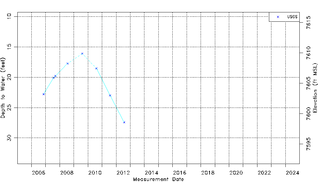
| Water-level Count | 8 |
| Water-level Date Range | 11/10/2006 thru 07/27/2012 |
| Monitored within the last 18 months | No, most recently on 07/27/2012 |
| Depth-to-Water Range (ft) | 16.11 to 27.42 |
| Water Table Elevation Range (ft NAVD88) | 7598.58 to 7609.89 |
| Water-Level-Source:Number-of-Measurements | USGS:8 |