| Well Information Table |
|---|
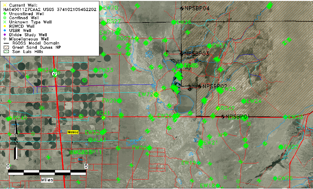
| Common Well ID | NA04001127CAA2 USGS 374102105452202 |
| USGS Well ID | 374102105452202 |
| GSDNP Well Name | 374102105452202 |
| USGS Station Name | NA04001127CAA2 USGS 374102105452202 |
| USGS Construction Date | 12/20/1977 |
| USGS Site Type | Well |
| USGS Site Use Information | Observation |
| USGS Groundwater Use Information | Unknown |
| Data Source(s) | USGS |
| Location Data |
|---|
| TRS | NA04001127CAA2 USGS 374102105452202 |
| USGS TRS 1 | NA04001127CAA2 USGS 374102105452202 |
| Longitude/Latitude (NAD83) | -105.75668530 , 37.68388994 |
| Longitude/Latitude Data Source | GWSI decimal LAT/LONG field |
| USGS Longitude/Latitude (NAD83) | -105.7566853 , 37.68388994 |
| Easting, Northing RGDSS-NAD83 (US ft) | 176106.76 , 250460.31 |
| USGS Topography | Valley flat |
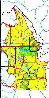
| USGS County | Alamosa County |
| USGS Map Name | HOOPER EAST |
| USGS Map Scale | 24000 |
| Elevation and Depth Data |
|---|
| Ground Elevation (ft NAVD88) | 7530.10000000000 |
| Elevation Data Source | USGS GWSI database |
| USGS Ground Elevation (ft NGVD29) | 7526.10 |
| 1/3-Arc Second NED Ground Elevation (ft NAVD88) | 7528.90 |
| 1-Arc Second NED Ground Elevation (ft NAVD88) | 7528.67 |
| SRTM Ground Elevation (ft NAVD88) | 7539.37 |
| Depth of Bottom of Layer 1 | 127 |
| Depth of Bottom of Layer 2 | 405 |
| Depth of Bottom of Layer 3 | 1584 |
| Depth of Bottom of Layer 4 | 2666 |
| Additional Well Information | Construction |
| Aquifer Information |
|---|
| Aquifer Type | Unknown |
| Aquifer Type Source | None |
| USGS Hydrologic Unit | San Luis |
| USGS Data Available | Water-level (GW.LEV) |
| Water-level Database Information |
|---|
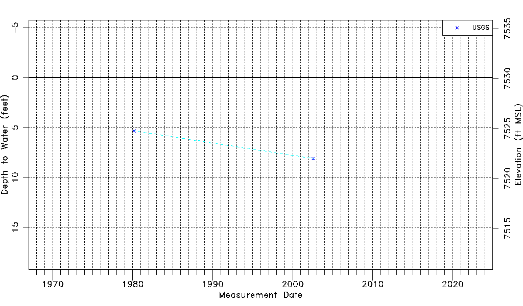
| Water-level Count | 2 |
| Water-level Date Range | 03/06/1980 thru 08/01/2002 |
| Monitored within the last 18 months | No, most recently on 08/01/2002 |
| Depth-to-Water Range (ft) | 5.34 to 8.12 |
| Water Table Elevation Range (ft NAVD88) | 7521.98 to 7524.76 |
| Water-Level-Source:Number-of-Measurements | USGS:2 |