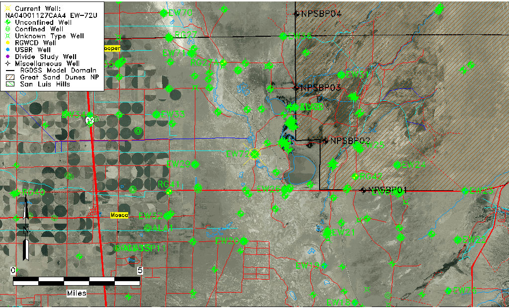
| Well Information Table |
|---|
| Common Well ID | NA04001127CAA4 EW-72U |
| USBR Well ID | EW72U |
| USGS Well ID | 374102105452203 |
| USGS Station Name | NA04001127CAA4 EW-72U |
| USGS Construction Date | 05/03/2002 |
| USGS Site Type | Well |
| USGS Site Use Information | Observation |
| USGS Groundwater Use Information | Unused |
| Data Source(s) | USGS, USBR |
| Location Data |
|---|
| TRS | NA04001127CAA4 EW-72U |
| USBR TRS | NA04001127CAA4 |
| USGS TRS 1 | NA04001127CAA4 EW-72U |
| Longitude/Latitude (NAD83) | -105.75727450 , 37.68393897 |
| Longitude/Latitude Data Source | USBOR EW well locations |
| USGS Longitude/Latitude (NAD83) | -105.7566853 , 37.68388994 |
| USBR Longitude/Latitude (NAD27) | -105.756700329745 , 37.6839379203064 |
| Easting, Northing RGDSS-NAD83 (US ft) | 175936.32 , 250478.32 |
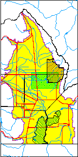
| USGS County | Alamosa County |
| USGS Map Name | HOOPER EAST |
| USGS Map Scale | 24000 |
| Elevation and Depth Data |
|---|
| Ground Elevation (ft NAVD88) | 7528.80000000000 |
| Elevation Data Source | USBOR EW well database |
| USBR Ground Elevation (ft NGVD29) | 7524.8 |
| USGS Ground Elevation (ft NGVD29) | 7524.80 |
| 1/3-Arc Second NED Ground Elevation (ft NAVD88) | 7528.90 |
| 1-Arc Second NED Ground Elevation (ft NAVD88) | 7528.89 |
| SRTM Ground Elevation (ft NAVD88) | 7532.19 |
| Total Depth (ft) | 15.00 |
| USBR Total Depth (ft) | 15 |
| USGS Well Depth (ft) | 10.70 |
| Model Layer | 1 |
| Model Layer Source | Aquifer Type |
| Depth of Bottom of Layer 1 | 126 |
| Depth of Bottom of Layer 2 | 402 |
| Depth of Bottom of Layer 3 | 1581 |
| Depth of Bottom of Layer 4 | 2648 |
| Additional Well Information | NONE |
| Aquifer Information |
|---|
| Aquifer Type | Unconfined |
| Aquifer Type Source | EW_AQFR |
| USGS Hydrologic Unit | San Luis |
| USGS Data Available | Discharge (GW.DISC) |
| Water-level Database Information |
|---|
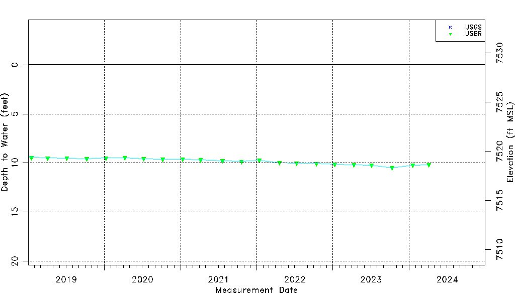
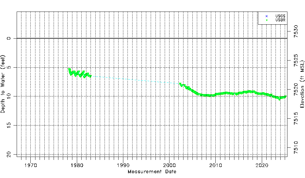
| Water-level Count | 163 |
| Water-level Date Range | 05/12/1978 thru 10/12/2023 |
| Monitored within the last 18 months | Yes, most recently on 10/12/2023 |
| Depth-to-Water Range (ft) | 5.30 to 10.49 |
| Water Table Elevation Range (ft NAVD88) | 7518.31 to 7523.50 |
| Water-Level-Source:Number-of-Measurements | USGS:4 USBR:160 |