| Well Information Table |
|---|
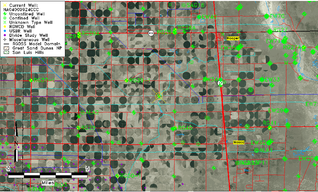
| Common Well ID | NA04000924CCC |
| USGS Well ID | 374110105565501 |
| USGS Station Name | NA04000924CCC |
| USGS Site Type | Well |
| USGS Site Use Information | Withdrawal of Water |
| USGS Groundwater Use Information | Irrigation |
| Data Source(s) | USGS |
| Location Data |
|---|
| TRS | NA04000924CCC |
| USGS TRS 1 | NA04000924CCC |
| USGS TRS | SWSWSWS024T0040NR0009EN |
| Longitude/Latitude (NAD83) | -105.94621710 , 37.69111165 |
| Longitude/Latitude Data Source | GWSI decimal LAT/LONG field |
| USGS Longitude/Latitude (NAD83) | -105.9462171 , 37.69111165 |
| Easting, Northing RGDSS-NAD83 (US ft) | 121283.03 , 253196.81 |
| USGS Topography | Valley flat |
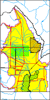
| USGS County | Alamosa County |
| Elevation and Depth Data |
|---|
| Ground Elevation (ft NAVD88) | 7579.96000000000 |
| Elevation Data Source | USGS GWSI database |
| USGS Ground Elevation (ft NGVD29) | 7576.00 |
| 1/3-Arc Second NED Ground Elevation (ft NAVD88) | 7578.94 |
| 1-Arc Second NED Ground Elevation (ft NAVD88) | 7581.16 |
| SRTM Ground Elevation (ft NAVD88) | 7588.59 |
| Total Depth (ft) | 62.00 |
| USGS Well Depth (ft) | 62.00 |
| Model Layer | 1 |
| Model Layer Source | Well Depth |
| Depth of Bottom of Layer 1 | 96 |
| Depth of Bottom of Layer 2 | 206 |
| Depth of Bottom of Layer 3 | 950 |
| Depth of Bottom of Layer 4 | 2346 |
| Additional Well Information | Geohydrology, Construction |
| Aquifer Information |
|---|
| Aquifer Type | Unconfined |
| Aquifer Type Source | TD Elevation/Model Layer |
| USGS Primary Aquifer | Cenozoic Erathem |
| USGS Aquifer Type | Unconfined Single Aquifer |
| USGS Hydrologic Unit | San Luis |
| USGS Data Available | Water-level (GW.LEV) |
| Water-level Database Information |
|---|
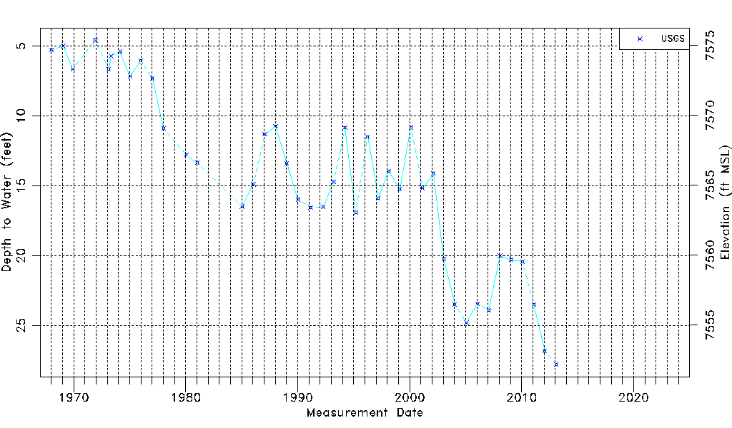
| Water-level Count | 42 |
| Water-level Date Range | 01/15/1968 thru 01/29/2013 |
| Monitored within the last 18 months | No, most recently on 01/29/2013 |
| Depth-to-Water Range (ft) | 4.57 to 27.80 |
| Water Table Elevation Range (ft NAVD88) | 7552.16 to 7575.39 |
| Water-Level-Source:Number-of-Measurements | USGSaguache Creek:42 |