| Well Information Table |
|---|
| Common Well ID | NA04000623DCC |
| USGS Well ID | 374120106170001 |
| USGS Station Name | NA04000623DCC |
| USGS Construction Date | 01/01/1946 |
| USGS Site Type | Well |
| USGS Site Use Information | Withdrawal of Water |
| USGS Groundwater Use Information | Irrigation |
| Data Source(s) | USGS, Divide Study |
| Location Data |
|---|
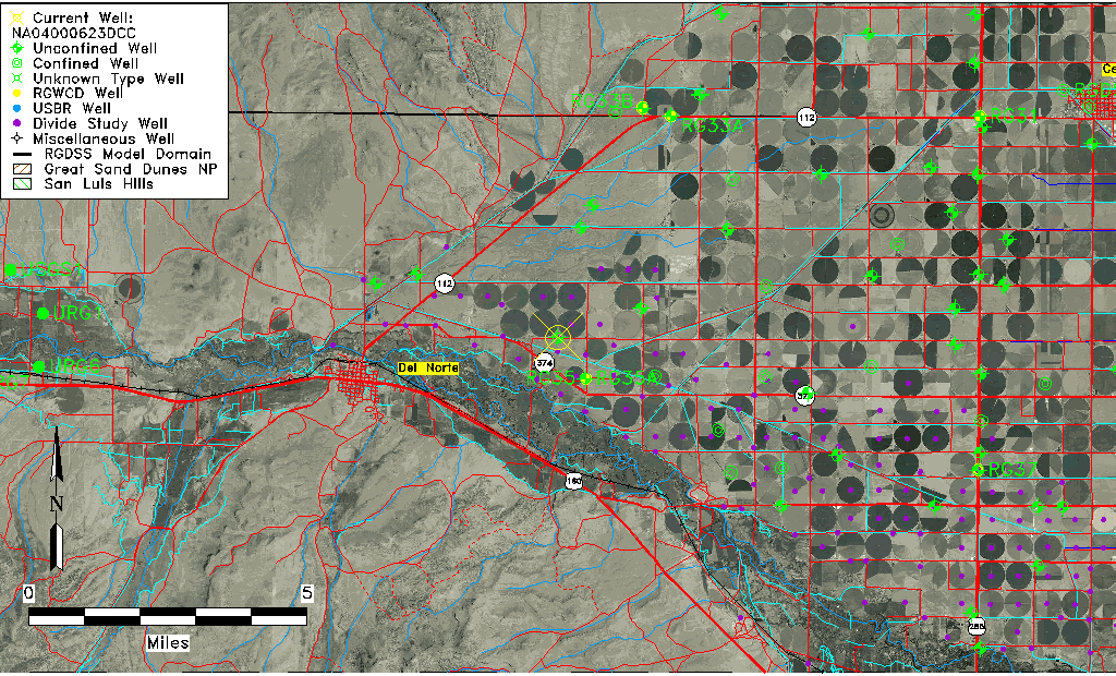
| TRS | NA04000623DCC |
| USGS TRS 1 | NA04000623DCC |
| USGS TRS | SWSWSES023T0040NR0006EN |
| Longitude/Latitude (NAD83) | -106.28665974 , 37.69039333 |
| Longitude/Latitude Data Source | Divide Study |
| USGS Longitude/Latitude (NAD83) | -106.2866437 , 37.69041938 |
| Easting, Northing RGDSS-NAD83 (US ft) | 22796.78 , 253407.29 |
| USGS Topography | Valley flat |
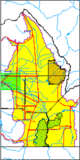
| USGS County | Rio Grande County |
| Elevation and Depth Data |
|---|
| Ground Elevation (ft NAVD88) | 7821.30000000000 |
| Elevation Data Source | Divide study surveying by Davis Engineering |
| USGS Ground Elevation (ft NGVD29) | 7816.00 |
| 1/3-Arc Second NED Ground Elevation (ft NAVD88) | 7820.86 |
| 1-Arc Second NED Ground Elevation (ft NAVD88) | 7819.95 |
| SRTM Ground Elevation (ft NAVD88) | 7828.08 |
| Total Depth (ft) | 122.00 |
| USGS Well Depth (ft) | 122.00 |
| Model Layer | 1 |
| Model Layer Source | Aquifer Type |
| Depth of Bottom of Layer 1 | 91 |
| Depth of Bottom of Layer 2 | 240 |
| Depth of Bottom of Layer 3 | 314 |
| Additional Well Information | Geohydrology, Construction |
| Aquifer Information |
|---|
| Aquifer Type | Unconfined |
| Aquifer Type Source | DIV_AQ |
| USGS Primary Aquifer | Cenozoic Erathem |
| USGS Aquifer Type | Unconfined Single Aquifer |
| USGS Hydrologic Unit | San Luis |
| USGS Data Available | Water-level (GW.LEV) |
| Water-level Database Information |
|---|
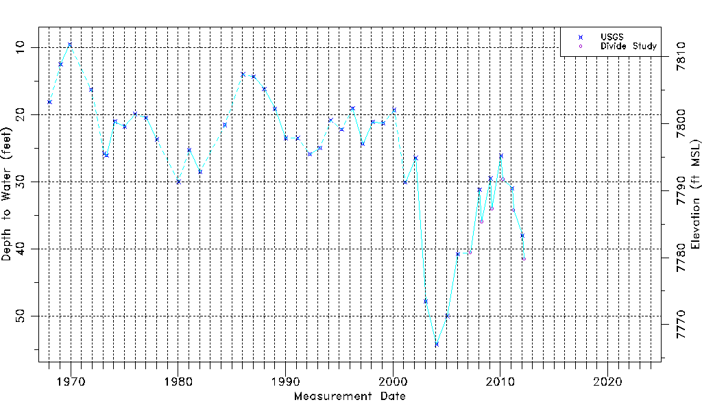
| Water-level Count | 47 |
| Water-level Date Range | 01/15/1968 thru 03/29/2012 |
| Monitored within the last 18 months | No, most recently on 03/29/2012 |
| Depth-to-Water Range (ft) | 9.52 to 54.22 |
| Water Table Elevation Range (ft NAVD88) | 7767.08 to 7811.78 |
| Water-Level-Source:Number-of-Measurements | USGS:41 Divide Study:6 |