| Well Information Table |
|---|
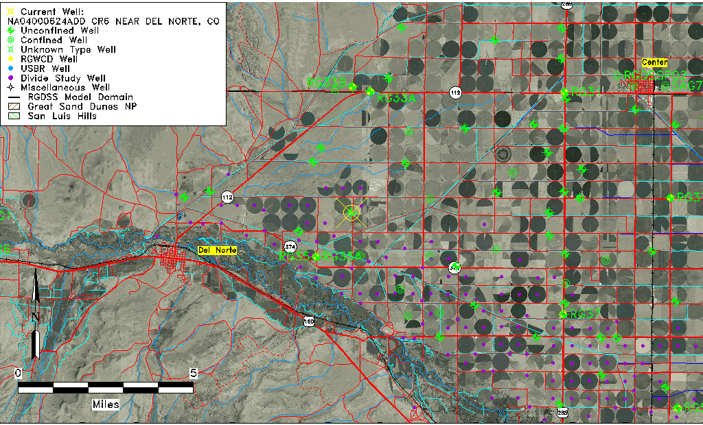
| Common Well ID | NA04000624ADD CR6 NEAR DEL NORTE, CO |
| USGS Well ID | 374153106153201 |
| USGS Station Name | NA04000624ADD CR6 NEAR DEL NORTE, CO |
| USGS Construction Date | 08/12/1993 |
| USGS Site Type | Well |
| USGS Site Use Information | Observation |
| USGS Groundwater Use Information | Unused |
| Data Source(s) | USGS |
| Location Data |
|---|
| TRS | NA04000624ADD CR6 NEAR DEL NORTE, CO |
| USGS TRS 1 | NA04000624ADD CR6 NEAR DEL NORTE, CO |
| USGS TRS | SESENES 24T 40NR 6E |
| Longitude/Latitude (NAD83) | -106.25936940 , 37.69823330 |
| Longitude/Latitude Data Source | GWSI decimal LAT/LONG field |
| USGS Longitude/Latitude (NAD83) | -106.2593694 , 37.69823330 |
| Easting, Northing RGDSS-NAD83 (US ft) | 30709.75 , 256210.36 |
| USGS Topography | Valley flat |
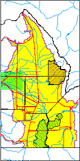
| USGS County | Rio Grande County |
| USGS Map Name | DEL NORTE |
| USGS Map Scale | 2400 |
| Elevation and Depth Data |
|---|
| Ground Elevation (ft NAVD88) | 7791.00000000000 |
| Elevation Data Source | USGS GWSI database |
| USGS Ground Elevation (ft NAVD88) | 7791.00 |
| 1/3-Arc Second NED Ground Elevation (ft NAVD88) | 7784.99 |
| 1-Arc Second NED Ground Elevation (ft NAVD88) | 7785.01 |
| SRTM Ground Elevation (ft NAVD88) | 7788.42 |
| Total Depth (ft) | 36.00 |
| USGS Hole Depth (ft) | 36.00 |
| USGS Well Depth (ft) | 36.00 |
| Model Layer | 1 |
| Model Layer Source | Well Depth |
| Depth of Bottom of Layer 1 | 94 |
| Depth of Bottom of Layer 2 | 237 |
| Depth of Bottom of Layer 3 | 316 |
| Depth of Bottom of Layer 4 | 521 |
| Additional Well Information | Logs, Geohydrology, Construction, Aquifer |
| Aquifer Information |
|---|
| Aquifer Type | Unconfined |
| Aquifer Type Source | TD Elevation/Model Layer |
| USGS Primary Aquifer | Cenozoic Erathem |
| USGS Aquifer Type | Unconfined Single Aquifer |
| USGS Hydrologic Unit | San Luis |
| USGS Data Available | Water-level (GW.LEV) |
| Water-level Database Information |
|---|
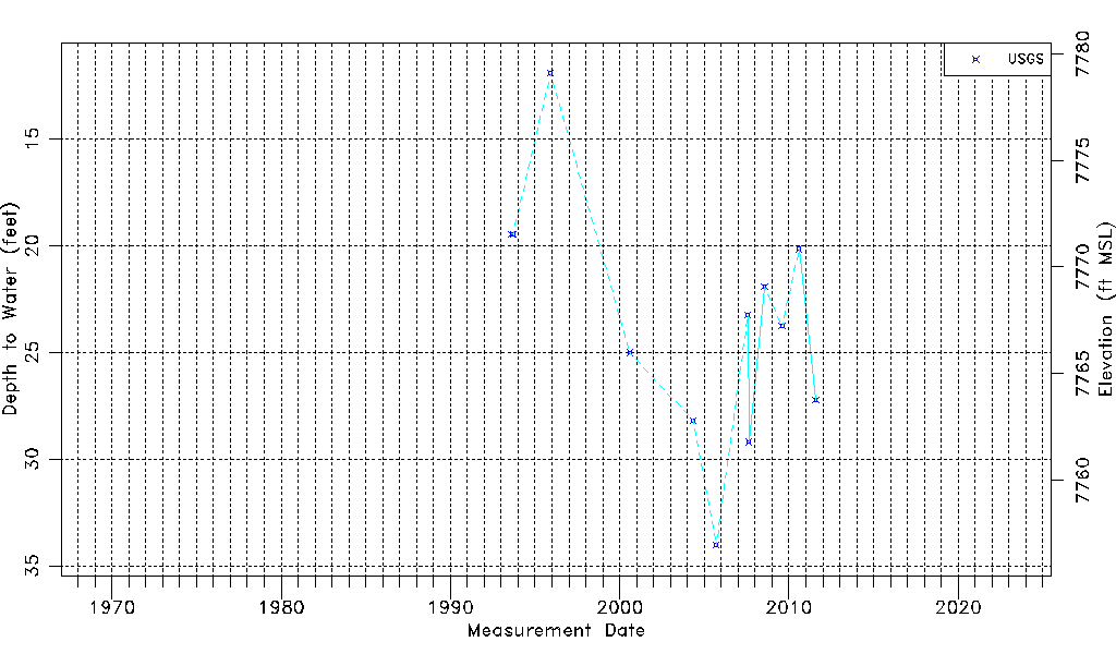
| Water-level Count | 12 |
| Water-level Date Range | 08/12/1993 thru 07/28/2011 |
| Monitored within the last 18 months | No, most recently on 07/28/2011 |
| Depth-to-Water Range (ft) | 11.92 to 34.04 |
| Water Table Elevation Range (ft NAVD88) | 7756.96 to 7779.08 |
| Water-Level-Source:Number-of-Measurements | USGSaguache Creek:12 |