| Well Information Table |
|---|
| Common Well ID | NA04000813ABB1 |
| USGS Well ID | 374245106025501 |
| USGS Station Name | NA04000813ABB1 |
| USGS Construction Date | 01/01/1956 |
| USGS Site Type | Well |
| USGS Site Use Information | Withdrawal of Water |
| USGS Groundwater Use Information | Irrigation |
| Data Source(s) | USGS |
| Location Data |
|---|
| TRS | NA04000813ABB1 |
| USGS TRS 1 | NA04000813ABB1 |
| USGS TRS | NWNWNES013T0040NR0008EN |
| Longitude/Latitude (NAD83) | -106.04766400 , 37.71902825 |
| Longitude/Latitude Data Source | GWSI decimal LAT/LONG field |
| USGS Longitude/Latitude (NAD83) | -106.0476640 , 37.71902825 |
| Easting, Northing RGDSS-NAD83 (US ft) | 91977.93 , 263462.56 |
| USGS Topography | Valley flat |
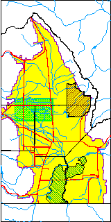
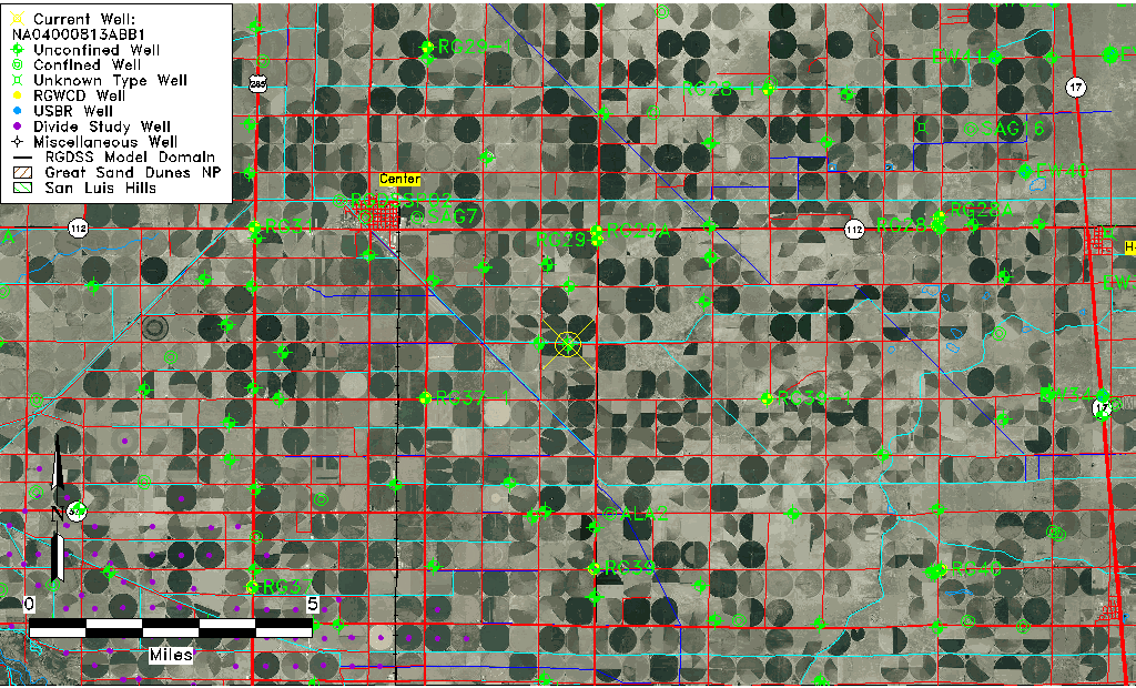
| USGS County | Rio Grande County |
| Elevation and Depth Data |
|---|
| Ground Elevation (ft NAVD88) | 7616.34000000000 |
| Elevation Data Source | USGS GWSI database |
| USGS Ground Elevation (ft NGVD29) | 7612.00 |
| 1/3-Arc Second NED Ground Elevation (ft NAVD88) | 7617.04 |
| 1-Arc Second NED Ground Elevation (ft NAVD88) | 7616.56 |
| SRTM Ground Elevation (ft NAVD88) | 7630.86 |
| Total Depth (ft) | 60.00 |
| USGS Well Depth (ft) | 60.00 |
| Model Layer | 1 |
| Model Layer Source | Well Depth |
| Depth of Bottom of Layer 1 | 107 |
| Depth of Bottom of Layer 2 | 190 |
| Depth of Bottom of Layer 3 | 780 |
| Depth of Bottom of Layer 4 | 2362 |
| Additional Well Information | Geohydrology, Construction |
| Aquifer Information |
|---|
| Aquifer Type | Unconfined |
| Aquifer Type Source | TD Elevation/Model Layer |
| USGS Primary Aquifer | Cenozoic Erathem |
| USGS Aquifer Type | Unconfined Single Aquifer |
| USGS Hydrologic Unit | San Luis |
| USGS Data Available | Water-level (GW.LEV) |
| Water-level Database Information |
|---|
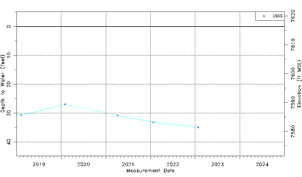
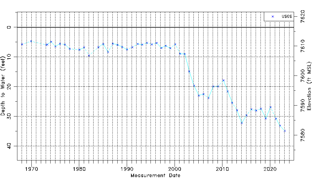
| Water-level Count | 52 |
| Water-level Date Range | 01/15/1968 thru 01/25/2023 |
| Monitored within the last 18 months | Yes, most recently on 01/25/2023 |
| Depth-to-Water Range (ft) | 4.70 to 34.90 |
| Water Table Elevation Range (ft NAVD88) | 7581.44 to 7611.64 |
| Water-Level-Source:Number-of-Measurements | USGS:52 |