| Well Information Table |
|---|
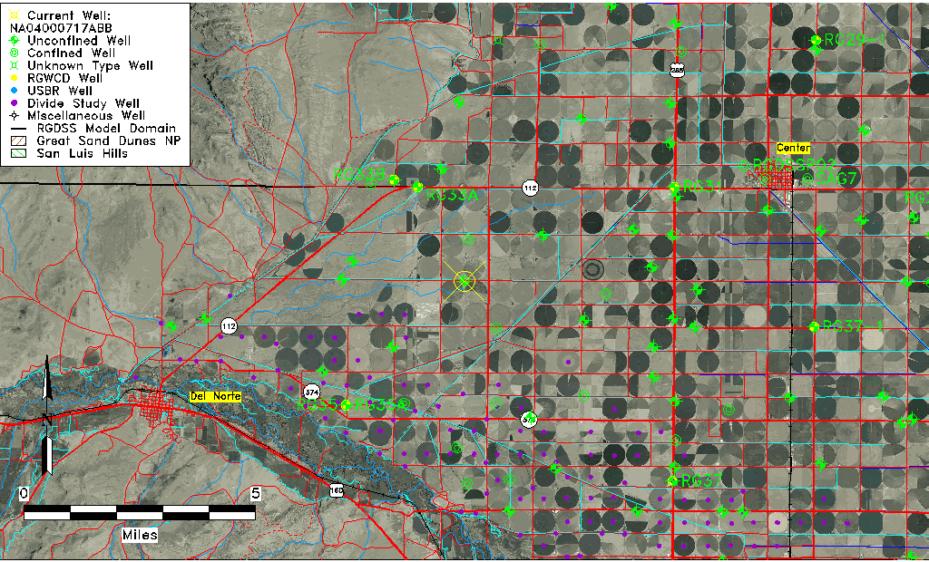
| Common Well ID | NA04000717ABB |
| USGS Well ID | 374307106135001 |
| USGS Station Name | NA04000717ABB |
| USGS Construction Date | 08/12/1993 |
| USGS Site Type | Well |
| USGS Site Use Information | Observation |
| USGS Groundwater Use Information | Unused |
| Data Source(s) | USGS |
| Location Data |
|---|
| TRS | NA04000717ABB |
| USGS TRS 1 | NA04000717ABB |
| USGS TRS | NWNWNES 17T 40NR 7E |
| Longitude/Latitude (NAD83) | -106.23127220 , 37.71885278 |
| Longitude/Latitude Data Source | GWSI decimal LAT/LONG field |
| USGS Longitude/Latitude (NAD83) | -106.2312722 , 37.71885278 |
| Easting, Northing RGDSS-NAD83 (US ft) | 38882.42 , 263666.60 |
| USGS Topography | Valley flat |
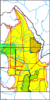
| USGS County | Rio Grande County |
| USGS Map Name | SEVENMILE PLAZA |
| USGS Map Scale | 2400 |
| Elevation and Depth Data |
|---|
| Ground Elevation (ft NAVD88) | 7752.00000000000 |
| Elevation Data Source | USGS GWSI database |
| USGS Ground Elevation (ft NAVD88) | 7752.00 |
| 1/3-Arc Second NED Ground Elevation (ft NAVD88) | 7752.90 |
| 1-Arc Second NED Ground Elevation (ft NAVD88) | 7752.30 |
| SRTM Ground Elevation (ft NAVD88) | 7760.81 |
| Total Depth (ft) | 40.00 |
| USGS Hole Depth (ft) | 40.00 |
| USGS Well Depth (ft) | 40.00 |
| Model Layer | 1 |
| Model Layer Source | Well Depth |
| Depth of Bottom of Layer 1 | 105 |
| Depth of Bottom of Layer 2 | 251 |
| Depth of Bottom of Layer 3 | 316 |
| Depth of Bottom of Layer 4 | 891 |
| Additional Well Information | Logs, Geohydrology, Construction, Aquifer |
| Aquifer Information |
|---|
| Aquifer Type | Unconfined |
| Aquifer Type Source | TD Elevation/Model Layer |
| USGS Primary Aquifer | 112ALMS |
| USGS Aquifer Type | Unconfined Single Aquifer |
| USGS Hydrologic Unit | San Luis |
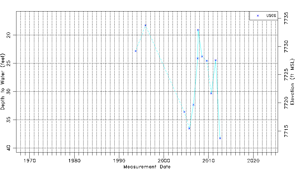
| USGS Data Available | Water-level (GW.LEV) |
| Water-level Database Information |
|---|
| Water-level Count | 12 |
| Water-level Date Range | 09/13/1993 thru 07/26/2012 |
| Monitored within the last 18 months | No, most recently on 07/26/2012 |
| Depth-to-Water Range (ft) | 18.26 to 38.27 |
| Water Table Elevation Range (ft NAVD88) | 7713.73 to 7733.74 |
| Water-Level-Source:Number-of-Measurements | USGSaguache Creek:12 |