| Well Information Table |
|---|
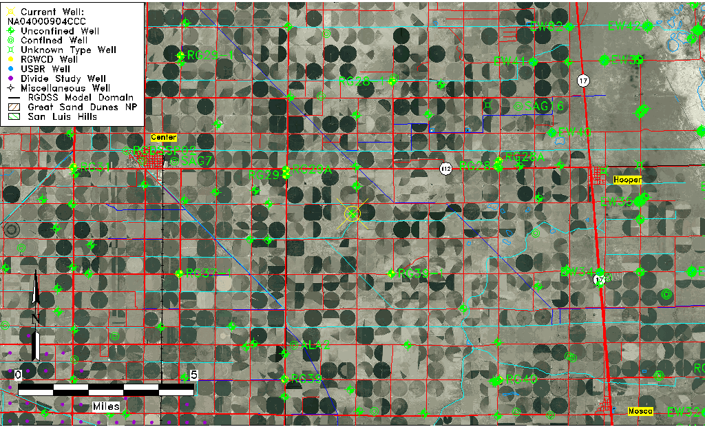
| Common Well ID | NA04000904CCC |
| USGS Well ID | 374348106001201 |
| USGS Station Name | NA04000904CCC |
| USGS Construction Date | 01/01/1966 |
| USGS Site Type | Well |
| USGS Site Use Information | Observation |
| USGS Groundwater Use Information | Unused |
| Data Source(s) | USGS |
| Location Data |
|---|
| TRS | NA04000904CCC |
| USGS TRS 1 | NA04000904CCC |
| USGS TRS | SWSWSWS004T0040NR0009EN |
| Longitude/Latitude (NAD83) | -106.00391270 , 37.72999990 |
| Longitude/Latitude Data Source | GWSI decimal LAT/LONG field |
| USGS Longitude/Latitude (NAD83) | -106.0039127 , 37.72999990 |
| Easting, Northing RGDSS-NAD83 (US ft) | 104643.91 , 267408.11 |
| USGS Topography | Valley flat |
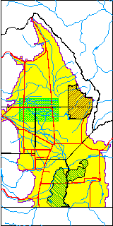
| USGS County | Alamosa County |
| Elevation and Depth Data |
|---|
| Ground Elevation (ft NAVD88) | 7593.16000000000 |
| Elevation Data Source | USGS GWSI database |
| USGS Ground Elevation (ft NGVD29) | 7589.00 |
| 1/3-Arc Second NED Ground Elevation (ft NAVD88) | 7597.98 |
| 1-Arc Second NED Ground Elevation (ft NAVD88) | 7597.17 |
| SRTM Ground Elevation (ft NAVD88) | 7608.27 |
| Total Depth (ft) | 10.00 |
| USGS Well Depth (ft) | 10.00 |
| Model Layer | 1 |
| Model Layer Source | Well Depth |
| Depth of Bottom of Layer 1 | 96 |
| Depth of Bottom of Layer 2 | 176 |
| Depth of Bottom of Layer 3 | 935 |
| Depth of Bottom of Layer 4 | 2405 |
| Additional Well Information | Geohydrology, Construction |
| Aquifer Information |
|---|
| Aquifer Type | Unconfined |
| Aquifer Type Source | TD Elevation/Model Layer |
| USGS Primary Aquifer | Cenozoic Erathem |
| USGS Hydrologic Unit | San Luis |
| USGS Data Available | Water-level (GW.LEV) |
| Water-level Database Information |
|---|
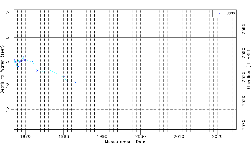
| Water-level Count | 20 |
| Water-level Date Range | 01/05/1967 thru 01/16/1983 |
| Monitored within the last 18 months | No, most recently on 01/16/1983 |
| Depth-to-Water Range (ft) | 3.92 to 9.30 |
| Water Table Elevation Range (ft NAVD88) | 7583.86 to 7589.24 |
| Water-Level-Source:Number-of-Measurements | USGSaguache Creek:20 |