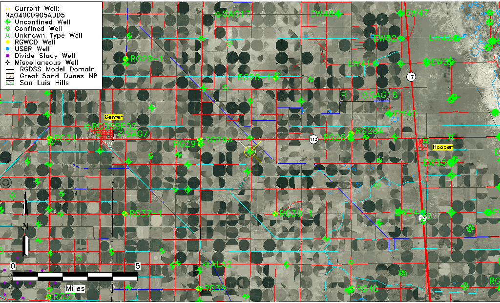
| Well Information Table |
|---|
| Common Well ID | NA04000905ADD5 |
| USGS Well ID | 374431106000705 |
| USGS Station Name | NA04000905ADD5 |
| USGS Construction Date | 11/08/2006 |
| USGS Site Type | Well |
| USGS Site Use Information | Unknown |
| USGS Groundwater Use Information | Unknown |
| Data Source(s) | USGS |
| Location Data |
|---|
| TRS | NA04000905ADD5 |
| USGS TRS 1 | NA04000905ADD5 |
| USGS TRS | SESENES5 T40N R9E N |
| Longitude/Latitude (NAD83) | -106.00208890 , 37.74139167 |
| Longitude/Latitude Data Source | GWSI decimal LAT/LONG field |
| USGS Longitude/Latitude (NAD83) | -106.0020889 , 37.74139167 |
| Easting, Northing RGDSS-NAD83 (US ft) | 105186.08 , 271553.18 |
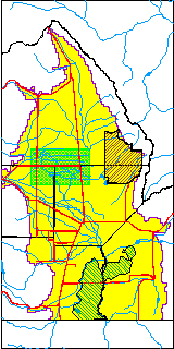
| USGS County | Alamosa County |
| USGS Map Name | CENTER SOUTH |
| USGS Map Scale | 24000 |
| Elevation and Depth Data |
|---|
| Ground Elevation (ft NAVD88) | 7596.00000000000 |
| Elevation Data Source | USGS GWSI database |
| USGS Ground Elevation (ft NAVD88) | 7596.00 |
| 1/3-Arc Second NED Ground Elevation (ft NAVD88) | 7593.60 |
| 1-Arc Second NED Ground Elevation (ft NAVD88) | 7593.07 |
| SRTM Ground Elevation (ft NAVD88) | 7598.42 |
| Total Depth (ft) | 37.83 |
| USGS Hole Depth (ft) | 43.00 |
| USGS Well Depth (ft) | 37.83 |
| Model Layer | 1 |
| Model Layer Source | Well Depth |
| Depth of Bottom of Layer 1 | 99 |
| Depth of Bottom of Layer 2 | 177 |
| Depth of Bottom of Layer 3 | 972 |
| Depth of Bottom of Layer 4 | 2433 |
| Additional Well Information | NONE |
| Aquifer Information |
|---|
| Aquifer Type | Unconfined |
| Aquifer Type Source | TD Elevation/Model Layer |
| USGS Primary Aquifer | 112ALMS |
| USGS Hydrologic Unit | San Luis |
| USGS Data Available | Geohydrologic |
| Water-level Database Information |
|---|
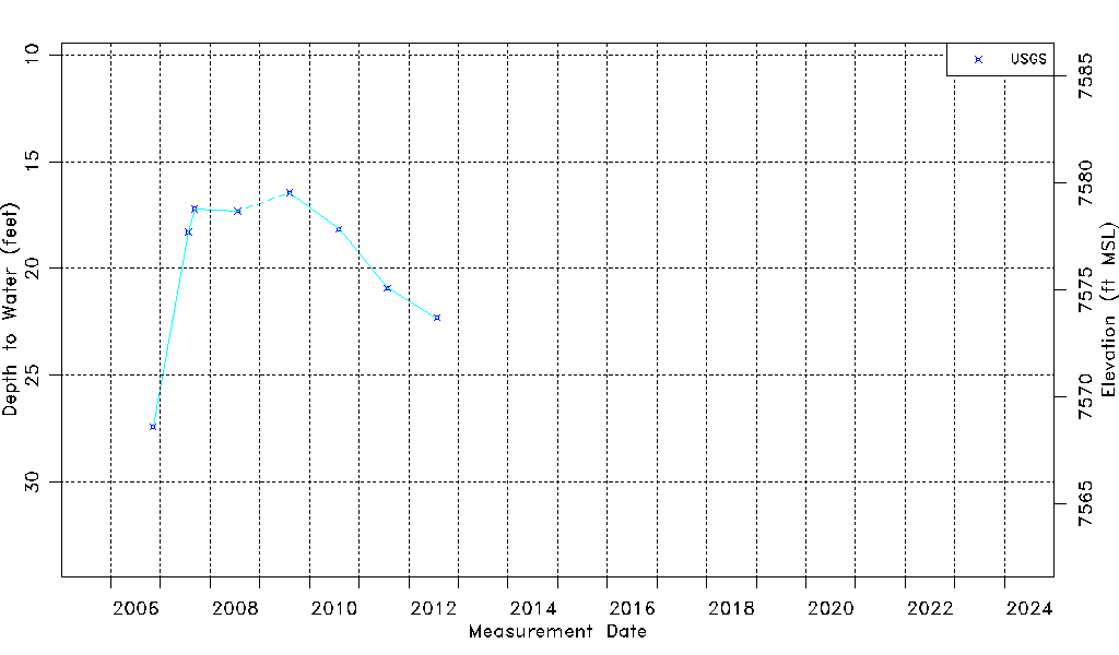
| Water-level Count | 8 |
| Water-level Date Range | 11/08/2006 thru 07/27/2012 |
| Monitored within the last 18 months | No, most recently on 07/27/2012 |
| Depth-to-Water Range (ft) | 16.46 to 27.40 |
| Water Table Elevation Range (ft NAVD88) | 7568.60 to 7579.54 |
| Water-Level-Source:Number-of-Measurements | USGSaguache Creek:8 |