| Well Information Table |
|---|
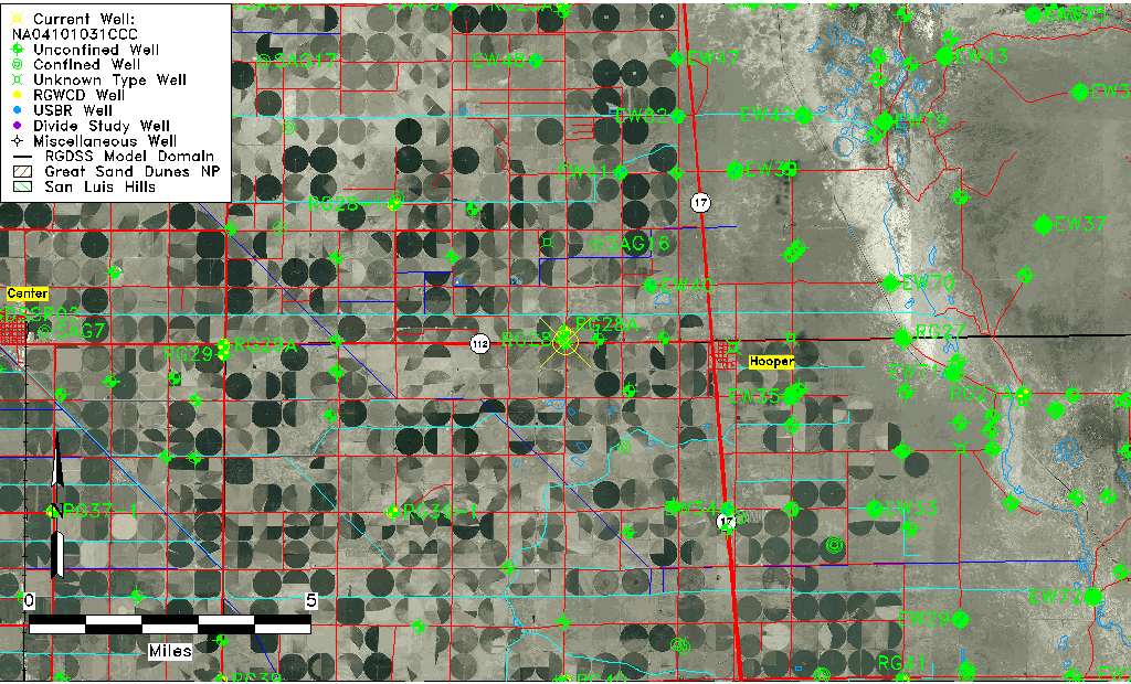
| Common Well ID | NA04101031CCC |
| USGS Well ID | 374445106104001 |
| USGS Station Name | NA04101031CCC |
| USGS Construction Date | 01/01/1946 |
| USGS Site Type | Well |
| USGS Site Use Information | Withdrawal of Water |
| USGS Groundwater Use Information | Irrigation |
| Data Source(s) | USGS |
| Location Data |
|---|
| TRS | NA04101031CCC |
| USGS TRS 1 | NA04101031CCC |
| USGS TRS | SWSWSWS031T0041NR0010EN |
| Longitude/Latitude (NAD83) | -105.92791100 , 37.74911075 |
| Longitude/Latitude Data Source | GWSI decimal LAT/LONG field |
| USGS Longitude/Latitude (NAD83) | -105.9279110 , 37.74911075 |
| Easting, Northing RGDSS-NAD83 (US ft) | 126637.37 , 274294.78 |
| USGS Topography | Valley flat |
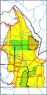
| USGS County | Saguache County |
| Elevation and Depth Data |
|---|
| Ground Elevation (ft NAVD88) | 7576.92000000000 |
| Elevation Data Source | USGS GWSI database |
| USGS Ground Elevation (ft NGVD29) | 7573.00 |
| 1/3-Arc Second NED Ground Elevation (ft NAVD88) | 7573.90 |
| 1-Arc Second NED Ground Elevation (ft NAVD88) | 7575.95 |
| SRTM Ground Elevation (ft NAVD88) | 7580.45 |
| Total Depth (ft) | 60.00 |
| USGS Well Depth (ft) | 60.00 |
| Model Layer | 1 |
| Model Layer Source | Well Depth |
| Depth of Bottom of Layer 1 | 109 |
| Depth of Bottom of Layer 2 | 216 |
| Depth of Bottom of Layer 3 | 1161 |
| Depth of Bottom of Layer 4 | 2782 |
| Additional Well Information | Geohydrology, Construction |
| Aquifer Information |
|---|
| Aquifer Type | Unconfined |
| Aquifer Type Source | TD Elevation/Model Layer |
| USGS Primary Aquifer | Cenozoic Erathem |
| USGS Aquifer Type | Unconfined Single Aquifer |
| USGS Hydrologic Unit | San Luis |
| USGS Data Available | Water-level (GW.LEV) |
| Water-level Database Information |
|---|
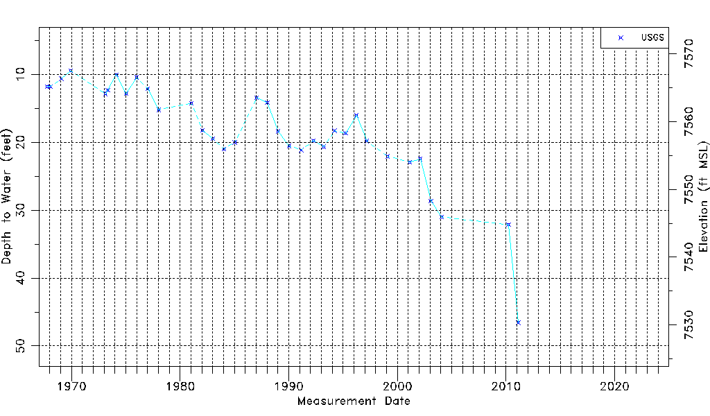
| Water-level Count | 34 |
| Water-level Date Range | 10/10/1967 thru 02/18/2011 |
| Monitored within the last 18 months | No, most recently on 02/18/2011 |
| Depth-to-Water Range (ft) | 9.46 to 46.56 |
| Water Table Elevation Range (ft NAVD88) | 7530.36 to 7567.46 |
| Water-Level-Source:Number-of-Measurements | USGSaguache Creek:34 |