| Well Information Table |
|---|
| Common Well ID | NA04001110AAA |
| USGS Well ID | 374448105445401 |
| GSDNP Well Name | 374448105445401 |
| USGS Station Name | NA04001110AAA |
| USGS Construction Date | 01/01/1946 |
| USGS Site Type | Well |
| USGS Site Use Information | Destroyed |
| USGS Groundwater Use Information | Unused |
| Data Source(s) | USGS |
| Location Data |
|---|
| TRS | NA04001110AAA |
| USGS TRS 1 | NA04001110AAA |
| USGS TRS | NENESES010T0040NR0011EN |
| Longitude/Latitude (NAD83) | -105.74632380 , 37.73455560 |
| Longitude/Latitude Data Source | GWSI decimal LAT/LONG field |
| USGS Longitude/Latitude (NAD83) | -105.7463238 , 37.73455560 |
| Easting, Northing RGDSS-NAD83 (US ft) | 179119.89 , 268900.76 |
| USGS Topography | Valley flat |
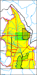
| USGS County | Alamosa County |
| Elevation and Depth Data |
|---|
| Ground Elevation (ft NAVD88) | 7537.05000000000 |
| Elevation Data Source | USGS GWSI database |
| USGS Ground Elevation (ft NGVD29) | 7533.00 |
| 1/3-Arc Second NED Ground Elevation (ft NAVD88) | 7538.15 |
| 1-Arc Second NED Ground Elevation (ft NAVD88) | 7536.37 |
| SRTM Ground Elevation (ft NAVD88) | 7541.57 |
| Total Depth (ft) | 43.00 |
| USGS Well Depth (ft) | 43.00 |
| Model Layer | 1 |
| Model Layer Source | Dunes Layer |
| Depth of Bottom of Layer 1 | 115 |
| Depth of Bottom of Layer 2 | 394 |
| Depth of Bottom of Layer 3 | 1586 |
| Depth of Bottom of Layer 4 | 3088 |
| Additional Well Information | Geohydrology, Construction |
| Aquifer Information |
|---|
| Aquifer Type | Unconfined |
| Aquifer Type Source | TD Elevation/Model Layer |
| USGS Primary Aquifer | Cenozoic Erathem |
| USGS Aquifer Type | Unconfined Single Aquifer |
| USGS Hydrologic Unit | San Luis |
| USGS Data Available | Water-level (GW.LEV) |
| Water-level Database Information |
|---|
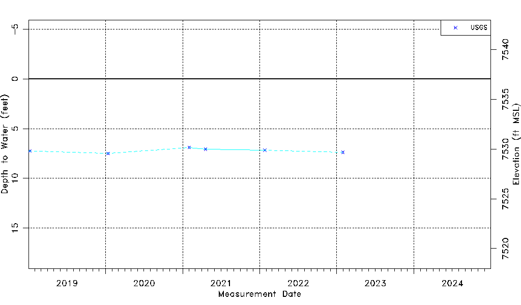
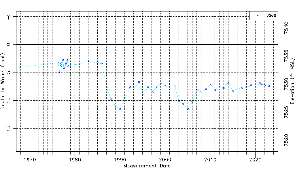
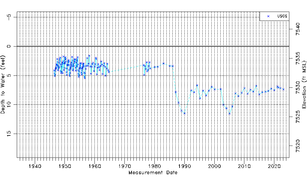
| Water-level Count | 207 |
| Water-level Date Range | 07/02/1946 thru 01/30/2023 |
| Monitored within the last 18 months | Yes, most recently on 01/30/2023 |
| Depth-to-Water Range (ft) | 1.61 to 11.52 |
| Water Table Elevation Range (ft NAVD88) | 7525.53 to 7535.44 |
| Water-Level-Source:Number-of-Measurements | USGS:207 |