| Well Information Table |
|---|
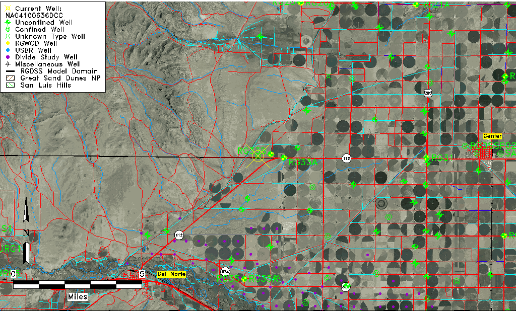
| Common Well ID | NA04100636DCC |
| USGS Well ID | 374457106160401 |
| USGS Station Name | NA04100636DCC |
| USGS Site Type | Well |
| USGS Site Use Information | Withdrawal of Water |
| USGS Groundwater Use Information | Domestic |
| Data Source(s) | USGS |
| Location Data |
|---|
| TRS | NA04100636DCC |
| USGS TRS 1 | NA04100636DCC |
| USGS TRS | SWSWSES036T0041NR0006EN |
| Longitude/Latitude (NAD83) | -106.26836510 , 37.74916880 |
| Longitude/Latitude Data Source | GWSI decimal LAT/LONG field |
| USGS Longitude/Latitude (NAD83) | -106.2683651 , 37.74916880 |
| Easting, Northing RGDSS-NAD83 (US ft) | 28226.75 , 274769.83 |
| USGS Topography | Hillside (slope) |
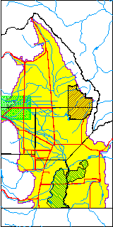
| USGS County | Saguache County |
| Elevation and Depth Data |
|---|
| Ground Elevation (ft NAVD88) | 7767.69000000000 |
| Elevation Data Source | USGS GWSI database |
| USGS Ground Elevation (ft NGVD29) | 7763.00 |
| 1/3-Arc Second NED Ground Elevation (ft NAVD88) | 7765.32 |
| 1-Arc Second NED Ground Elevation (ft NAVD88) | 7765.86 |
| SRTM Ground Elevation (ft NAVD88) | 7769.03 |
| Total Depth (ft) | 200.00 |
| USGS Well Depth (ft) | 200.00 |
| Model Layer | 2 |
| Model Layer Source | Well Depth |
| Depth of Bottom of Layer 1 | 156 |
| Depth of Bottom of Layer 2 | 344 |
| Additional Well Information | Geohydrology, Construction |
| Aquifer Information |
|---|
| Aquifer Type | Confined |
| Aquifer Type Source | TD Elevation/Model Layer |
| USGS Primary Aquifer | Cenozoic Erathem |
| USGS Hydrologic Unit | Saguache |
| USGS Data Available | Water-level (GW.LEV) |
| Water-level Database Information |
|---|
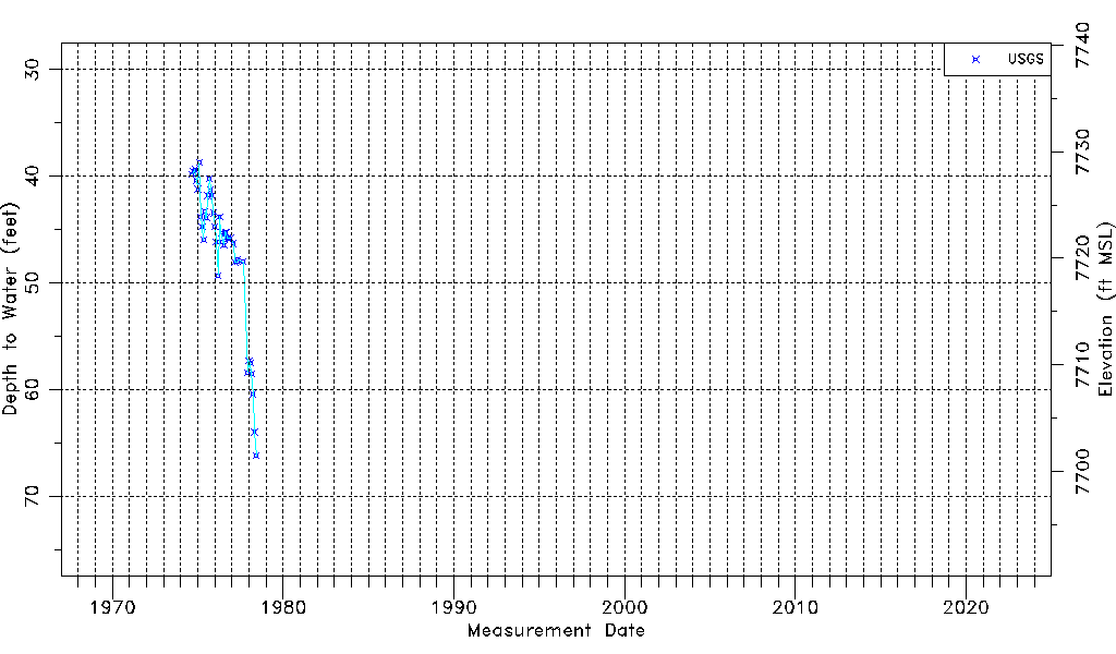
| Water-level Count | 40 |
| Water-level Date Range | 09/05/1974 thru 06/09/1978 |
| Monitored within the last 18 months | No, most recently on 06/09/1978 |
| Depth-to-Water Range (ft) | 38.73 to 66.20 |
| Water Table Elevation Range (ft NAVD88) | 7701.49 to 7728.96 |
| Water-Level-Source:Number-of-Measurements | USGS:40 |