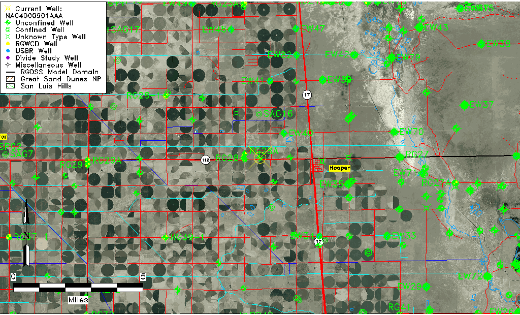
| Well Information Table |
|---|
| Common Well ID | NA04000901AAA |
| USGS Well ID | 374500105550001 |
| USGS Station Name | NA04000901AAA |
| USGS Construction Date | 01/01/1946 |
| USGS Site Type | Well |
| USGS Site Use Information | Observation |
| USGS Groundwater Use Information | Unused |
| Data Source(s) | USGS |
| Location Data |
|---|
| TRS | NA04000901AAA |
| USGS TRS 1 | NA04000901AAA |
| USGS TRS | NENENES001T0040NR0009EN |
| Longitude/Latitude (NAD83) | -105.91724400 , 37.74999960 |
| Longitude/Latitude Data Source | GWSI decimal LAT/LONG field |
| USGS Longitude/Latitude (NAD83) | -105.9172440 , 37.74999960 |
| Easting, Northing RGDSS-NAD83 (US ft) | 129721.52 , 274609.91 |
| USGS Topography | Flat Surface |
| USGS County | Alamosa County |
| Elevation and Depth Data |
|---|
| Ground Elevation (ft NAVD88) | 7575.89000000000 |
| Elevation Data Source | USGS GWSI database |
| USGS Ground Elevation (ft NGVD29) | 7572.00 |
| 1/3-Arc Second NED Ground Elevation (ft NAVD88) | 7568.98 |
| 1-Arc Second NED Ground Elevation (ft NAVD88) | 7570.25 |
| SRTM Ground Elevation (ft NAVD88) | 7578.74 |
| Total Depth (ft) | 17.00 |
| USGS Well Depth (ft) | 17.00 |
| Model Layer | 1 |
| Model Layer Source | Well Depth |
| Depth of Bottom of Layer 1 | 112 |
| Depth of Bottom of Layer 2 | 223 |
| Depth of Bottom of Layer 3 | 1197 |
| Depth of Bottom of Layer 4 | 2828 |
| Additional Well Information | Geohydrology, Construction |
| Aquifer Information |
|---|
| Aquifer Type | Unconfined |
| Aquifer Type Source | TD Elevation/Model Layer |
| USGS Primary Aquifer | Cenozoic Erathem |
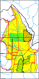
| USGS Hydrologic Unit | San Luis |
| USGS Data Available | Water-level (GW.LEV) |
| Water-level Database Information |
|---|
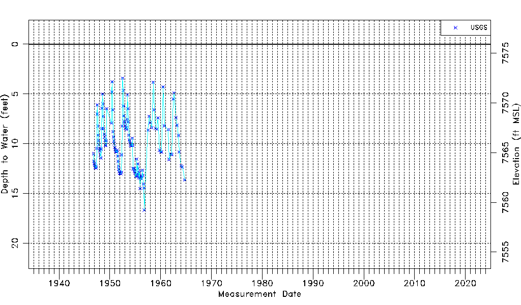
| Water-level Count | 139 |
| Water-level Date Range | 11/01/1946 thru 10/01/1964 |
| Monitored within the last 18 months | No, most recently on 10/01/1964 |
| Depth-to-Water Range (ft) | 3.42 to 16.68 |
| Water Table Elevation Range (ft NAVD88) | 7559.21 to 7572.47 |
| Water-Level-Source:Number-of-Measurements | USGS:139 |