| Well Information Table |
|---|
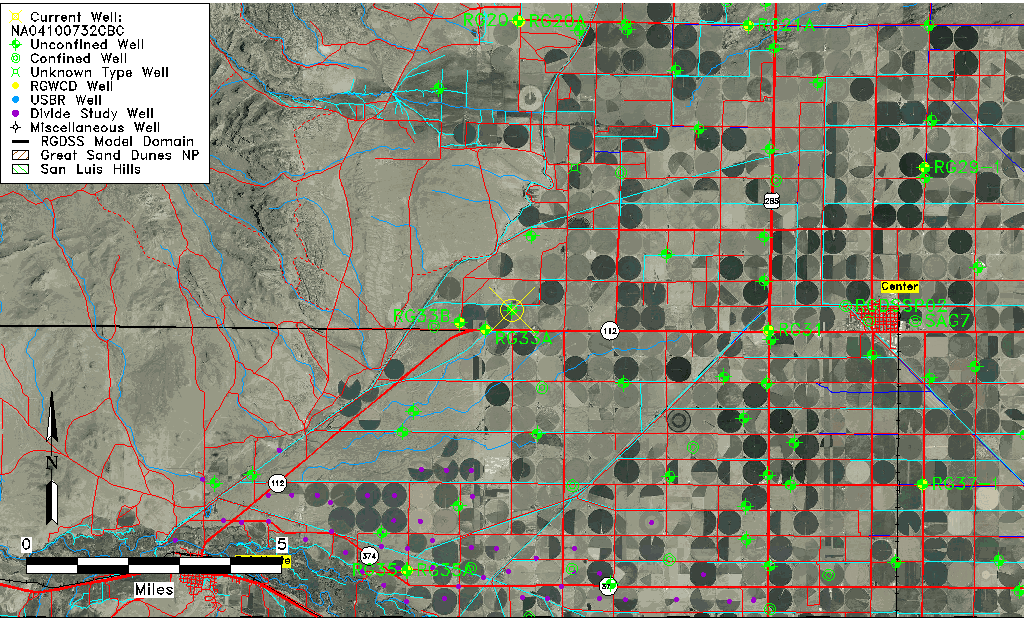
| Common Well ID | NA04100732CBC |
| USGS Well ID | 374515106192101 |
| USGS Station Name | NA04100732CBC |
| USGS Construction Date | 08/12/1993 |
| USGS Site Type | Well |
| USGS Site Use Information | Unknown |
| USGS Groundwater Use Information | Unknown |
| Data Source(s) | USGS |
| Location Data |
|---|
| TRS | NA04100732CBC |
| USGS TRS 1 | NA04100732CBC |
| USGS TRS | SWNWSWS 32T 41NR 7E |
| Longitude/Latitude (NAD83) | -106.24060830 , 37.75388056 |
| Longitude/Latitude Data Source | GWSI decimal LAT/LONG field |
| USGS Longitude/Latitude (NAD83) | -106.2406083 , 37.75388056 |
| Easting, Northing RGDSS-NAD83 (US ft) | 36260.78 , 276434.71 |
| USGS Topography | Valley flat |
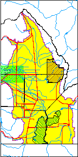
| USGS County | Saguache County |
| USGS Map Name | LA GARITA |
| USGS Map Scale | 2400 |
| Elevation and Depth Data |
|---|
| Ground Elevation (ft NAVD88) | 7739.00000000000 |
| Elevation Data Source | USGS GWSI database |
| USGS Ground Elevation (ft NAVD88) | 7739.00 |
| 1/3-Arc Second NED Ground Elevation (ft NAVD88) | 7739.16 |
| 1-Arc Second NED Ground Elevation (ft NAVD88) | 7739.03 |
| SRTM Ground Elevation (ft NAVD88) | 7749.33 |
| Total Depth (ft) | 46.00 |
| USGS Hole Depth (ft) | 46.00 |
| USGS Well Depth (ft) | 46.00 |
| Model Layer | 1 |
| Model Layer Source | Well Depth |
| Depth of Bottom of Layer 1 | 149 |
| Depth of Bottom of Layer 2 | 334 |
| Additional Well Information | Logs, Geohydrology, Construction, Aquifer |
| Aquifer Information |
|---|
| Aquifer Type | Unconfined |
| Aquifer Type Source | TD Elevation/Model Layer |
| USGS Primary Aquifer | 112ALMS |
| USGS Aquifer Type | Unconfined Single Aquifer |
| USGS Hydrologic Unit | Saguache |
| USGS Data Available | Water-level (GW.LEV) |
| Water-level Database Information |
|---|
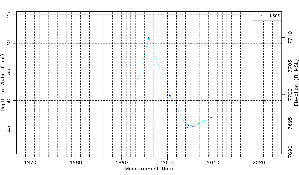
| Water-level Count | 7 |
| Water-level Date Range | 09/10/1993 thru 08/06/2009 |
| Monitored within the last 18 months | No, most recently on 08/06/2009 |
| Depth-to-Water Range (ft) | 29.07 to 44.75 |
| Water Table Elevation Range (ft NAVD88) | 7694.25 to 7709.93 |
| Water-Level-Source:Number-of-Measurements | USGSaguache Creek:7 |