| Well Information Table |
|---|
| Common Well ID | NA04100732CBC6 |
| USGS Well ID | 374515106192106 |
| USGS Station Name | NA04100732CBC6 |
| USGS Construction Date | 11/09/2006 |
| USGS Site Type | Well |
| USGS Site Use Information | Unknown |
| USGS Groundwater Use Information | Unknown |
| Data Source(s) | USGS |
| Location Data |
|---|
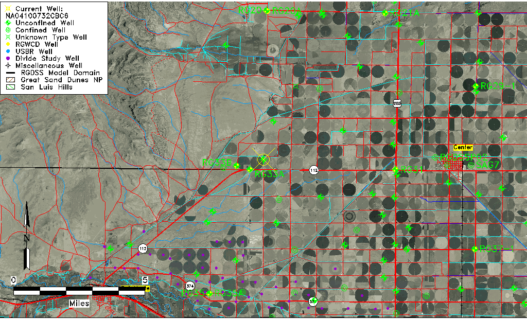
| TRS | NA04100732CBC6 |
| USGS TRS 1 | NA04100732CBC6 |
| USGS TRS | SWNWSWS032T41N R07E N |
| Longitude/Latitude (NAD83) | -106.24061110 , 37.75383610 |
| Longitude/Latitude Data Source | GWSI decimal LAT/LONG field |
| USGS Longitude/Latitude (NAD83) | -106.2406111 , 37.75383610 |
| Easting, Northing RGDSS-NAD83 (US ft) | 36259.87 , 276418.53 |
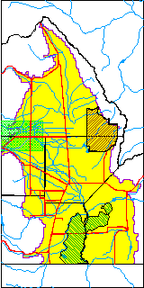
| USGS County | Saguache County |
| USGS Map Name | LA GARITA |
| USGS Map Scale | 24000 |
| Elevation and Depth Data |
|---|
| Ground Elevation (ft NAVD88) | 7738.00000000000 |
| Elevation Data Source | USGS GWSI database |
| USGS Ground Elevation (ft NAVD88) | 7738.00 |
| 1/3-Arc Second NED Ground Elevation (ft NAVD88) | 7739.23 |
| 1-Arc Second NED Ground Elevation (ft NAVD88) | 7739.10 |
| SRTM Ground Elevation (ft NAVD88) | 7749.22 |
| Total Depth (ft) | 70.00 |
| USGS Hole Depth (ft) | 75.00 |
| USGS Well Depth (ft) | 70.00 |
| Model Layer | 1 |
| Model Layer Source | Well Depth |
| Depth of Bottom of Layer 1 | 148 |
| Depth of Bottom of Layer 2 | 333 |
| Additional Well Information | NONE |
| Aquifer Information |
|---|
| Aquifer Type | Unconfined |
| Aquifer Type Source | TD Elevation/Model Layer |
| USGS Primary Aquifer | 112ALMS |
| USGS Hydrologic Unit | Saguache |
| USGS Data Available | Geohydrologic |
| Water-level Database Information |
|---|
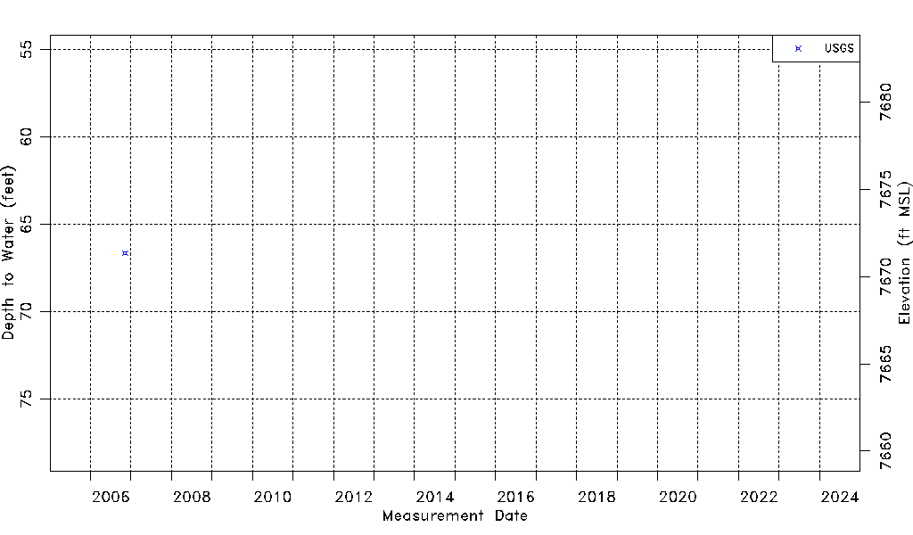
| Water-level Count | 1 |
| Water-level Date Range | 11/09/2006 thru 11/09/2006 |
| Monitored within the last 18 months | No, most recently on 11/09/2006 |
| Depth-to-Water Range (ft) | 66.65 to 66.65 |
| Water Table Elevation Range (ft NAVD88) | 7671.35 to 7671.35 |
| Water-Level-Source:Number-of-Measurements | USGSaguache Creek:1 |