| Well Information Table |
|---|
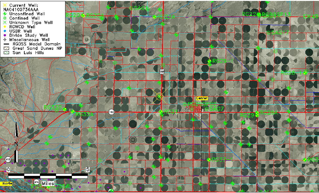
| Common Well ID | NA04100736AAA |
| USGS Well ID | 374545106090001 |
| USGS Station Name | NA04100736AAA |
| USGS Construction Date | 01/01/1968 |
| USGS Site Type | Well |
| USGS Site Use Information | Destroyed |
| USGS Groundwater Use Information | Unused |
| Data Source(s) | USGS |
| Location Data |
|---|
| TRS | NA04100736AAA |
| USGS TRS 1 | NA04100736AAA |
| USGS TRS | NENENES036T0041NR0007EN |
| Longitude/Latitude (NAD83) | -106.15058350 , 37.76250107 |
| Longitude/Latitude Data Source | GWSI decimal LAT/LONG field |
| USGS Longitude/Latitude (NAD83) | -106.1505835 , 37.76250107 |
| Easting, Northing RGDSS-NAD83 (US ft) | 62298.09 , 279425.78 |
| USGS Topography | Valley flat |
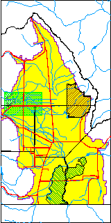
| USGS County | Saguache County |
| Elevation and Depth Data |
|---|
| Ground Elevation (ft NAVD88) | 7664.58000000000 |
| Elevation Data Source | USGS GWSI database |
| USGS Ground Elevation (ft NGVD29) | 7660.00 |
| 1/3-Arc Second NED Ground Elevation (ft NAVD88) | 7664.95 |
| 1-Arc Second NED Ground Elevation (ft NAVD88) | 7664.65 |
| SRTM Ground Elevation (ft NAVD88) | 7670.60 |
| Total Depth (ft) | 18.00 |
| USGS Well Depth (ft) | 18.00 |
| Model Layer | 1 |
| Model Layer Source | Well Depth |
| Depth of Bottom of Layer 1 | 122 |
| Depth of Bottom of Layer 2 | 266 |
| Depth of Bottom of Layer 3 | 631 |
| Depth of Bottom of Layer 4 | 2224 |
| Additional Well Information | Geohydrology, Construction |
| Aquifer Information |
|---|
| Aquifer Type | Unconfined |
| Aquifer Type Source | TD Elevation/Model Layer |
| USGS Primary Aquifer | Cenozoic Erathem |
| USGS Hydrologic Unit | San Luis |
| USGS Data Available | Water-level (GW.LEV) |
| Water-level Database Information |
|---|
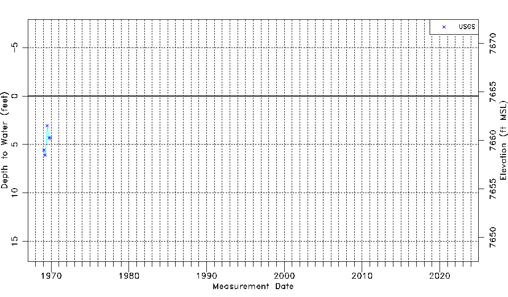
| Water-level Count | 5 |
| Water-level Date Range | 01/27/1969 thru 12/01/1969 |
| Monitored within the last 18 months | No, most recently on 12/01/1969 |
| Depth-to-Water Range (ft) | 3.06 to 6.10 |
| Water Table Elevation Range (ft NAVD88) | 7658.48 to 7661.52 |
| Water-Level-Source:Number-of-Measurements | USGSaguache Creek:5 |