| Well Information Table |
|---|
| Common Well ID | NA04100926BCC |
| USGS Well ID | 374550105575001 |
| USGS Station Name | NA04100926BCC |
| USGS Construction Date | 01/01/1954 |
| USGS Site Type | Well |
| USGS Site Use Information | Withdrawal of Water |
| USGS Groundwater Use Information | Irrigation |
| Data Source(s) | USGS |
| Location Data |
|---|
| TRS | NA04100926BCC |
| USGS TRS 1 | NA04100926BCC |
| USGS TRS | SWSWNWS026T0041NR0009EN |
| Longitude/Latitude (NAD83) | -105.96474450 , 37.77105514 |
| Longitude/Latitude Data Source | GWSI decimal LAT/LONG field |
| USGS Longitude/Latitude (NAD83) | -105.9647445 , 37.77105514 |
| Easting, Northing RGDSS-NAD83 (US ft) | 116016.11 , 282315.05 |
| USGS Topography | Valley flat |
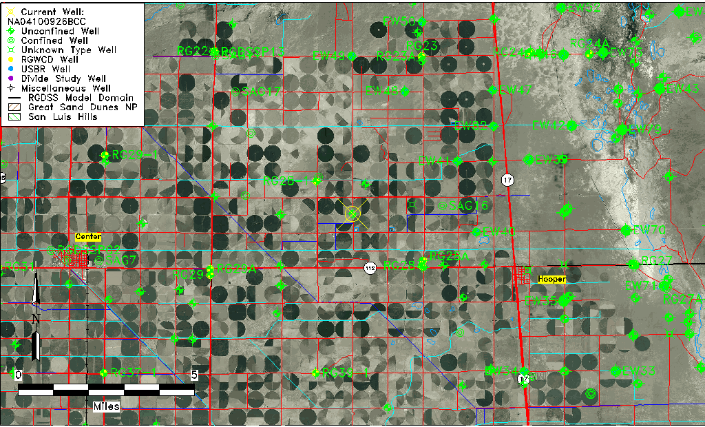
| USGS County | Saguache County |
| Elevation and Depth Data |
|---|
| Ground Elevation (ft NAVD88) | 7574.00000000000 |
| Elevation Data Source | USGS GWSI database |
| USGS Ground Elevation (ft NGVD29) | 7570.00 |
| 1/3-Arc Second NED Ground Elevation (ft NAVD88) | 7574.59 |
| 1-Arc Second NED Ground Elevation (ft NAVD88) | 7574.60 |
| SRTM Ground Elevation (ft NAVD88) | 7578.74 |
| Total Depth (ft) | 100.00 |
| USGS Well Depth (ft) | 100.00 |
| Model Layer | 1 |
| Model Layer Source | Well Depth |
| Depth of Bottom of Layer 1 | 104 |
| Depth of Bottom of Layer 2 | 202 |
| Depth of Bottom of Layer 3 | 1105 |
| Depth of Bottom of Layer 4 | 2668 |
| Additional Well Information | Geohydrology, Construction |
| Aquifer Information |
|---|
| Aquifer Type | Unconfined |
| Aquifer Type Source | TD Elevation/Model Layer |
| USGS Primary Aquifer | Cenozoic Erathem |
| USGS Aquifer Type | Unconfined Single Aquifer |
| USGS Hydrologic Unit | San Luis |
| USGS Data Available | Water-level (GW.LEV) |
| Water-level Database Information |
|---|
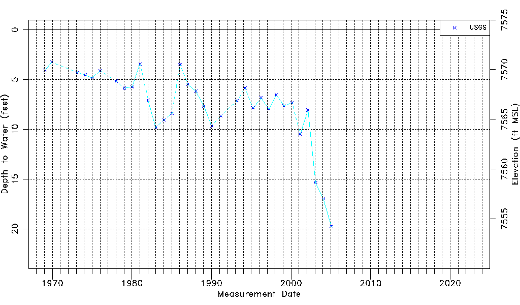
| Water-level Count | 33 |
| Water-level Date Range | 01/27/1969 thru 01/25/2005 |
| Monitored within the last 18 months | No, most recently on 01/25/2005 |
| Depth-to-Water Range (ft) | 3.25 to 19.75 |
| Water Table Elevation Range (ft NAVD88) | 7554.25 to 7570.75 |
| Water-Level-Source:Number-of-Measurements | USGS:33 |