| Well Information Table |
|---|
| Common Well ID | NA04100826BCC2 |
| USGS Well ID | 374600106042502 |
| USGS Station Name | NA04100826BCC2 |
| USGS Construction Date | 01/01/1964 |
| USGS Site Type | Well |
| USGS Site Use Information | Withdrawal of Water |
| USGS Groundwater Use Information | Irrigation |
| Data Source(s) | USGS |
| Location Data |
|---|
| TRS | NA04100826BCC2 |
| USGS TRS 1 | NA04100826BCC2 |
| USGS TRS | SWSWNWS026T0041NR0008EN |
| Longitude/Latitude (NAD83) | -106.07419210 , 37.76666697 |
| Longitude/Latitude Data Source | GWSI decimal LAT/LONG field |
| USGS Longitude/Latitude (NAD83) | -106.0741921 , 37.76666697 |
| Easting, Northing RGDSS-NAD83 (US ft) | 84382.26 , 280837.05 |
| USGS Topography | Valley flat |
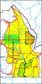
| USGS County | Saguache County |
| Elevation and Depth Data |
|---|
| Ground Elevation (ft NAVD88) | 7618.42000000000 |
| Elevation Data Source | USGS GWSI database |
| USGS Ground Elevation (ft NGVD29) | 7614.00 |
| 1/3-Arc Second NED Ground Elevation (ft NAVD88) | 7619.55 |
| 1-Arc Second NED Ground Elevation (ft NAVD88) | 7619.39 |
| SRTM Ground Elevation (ft NAVD88) | 7630.63 |
| Total Depth (ft) | 103.00 |
| USGS Well Depth (ft) | 103.00 |
| Model Layer | 1 |
| Model Layer Source | Well Depth |
| Depth of Bottom of Layer 1 | 104 |
| Depth of Bottom of Layer 2 | 161 |
| Depth of Bottom of Layer 3 | 854 |
| Depth of Bottom of Layer 4 | 2494 |
| Additional Well Information | Logs, Geohydrology, Construction |
| Aquifer Information |
|---|
| Aquifer Type | Unconfined |
| Aquifer Type Source | TD Elevation/Model Layer |
| USGS Primary Aquifer | Cenozoic Erathem |
| USGS Hydrologic Unit | San Luis |
| USGS Data Available | Water-level (GW.LEV) |
| Water-level Database Information |
|---|
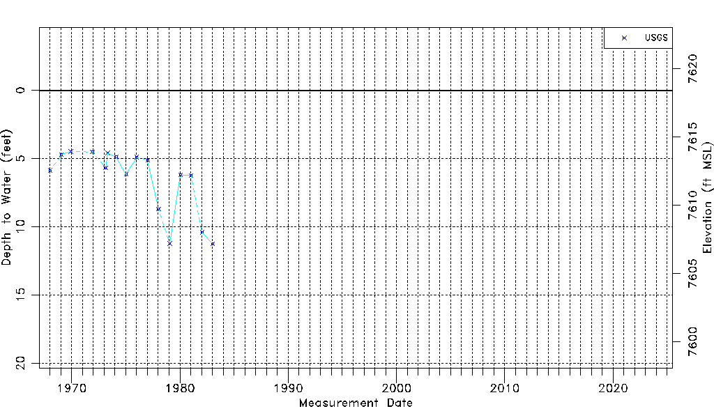
| Water-level Count | 16 |
| Water-level Date Range | 01/16/1968 thru 01/04/1983 |
| Monitored within the last 18 months | No, most recently on 01/04/1983 |
| Depth-to-Water Range (ft) | 4.48 to 11.25 |
| Water Table Elevation Range (ft NAVD88) | 7607.17 to 7613.94 |
| Water-Level-Source:Number-of-Measurements | USGSaguache Creek:16 |