| Well Information Table |
|---|
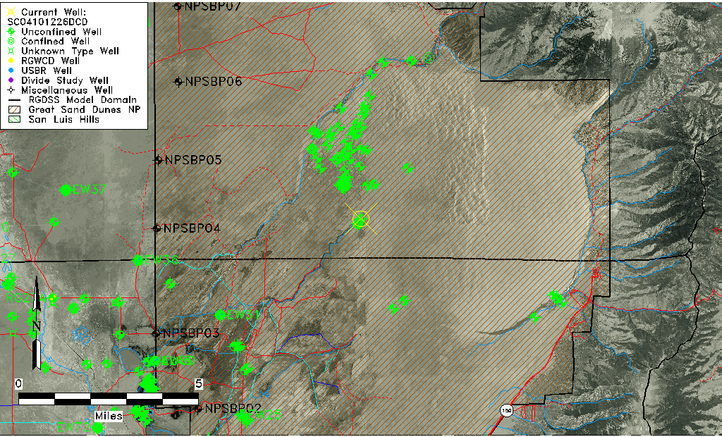
| Common Well ID | SC04101226DCD |
| USGS Well ID | 374605105372301 |
| GSDNP Well Name | 374605105372301 |
| USGS Station Name | SC04101226DCD |
| USGS Construction Date | 09/22/2000 |
| USGS Site Type | Well |
| USGS Site Use Information | Observation |
| USGS Groundwater Use Information | Unused |
| Data Source(s) | USGS |
| Location Data |
|---|
| TRS | SC04101226DCD |
| USGS TRS 1 | SC04101226DCD |
| USGS TRS | SESWSES026T0041NR0012E |
| Longitude/Latitude (NAD83) | -105.62362550 , 37.76805590 |
| Longitude/Latitude Data Source | GWSI decimal LAT/LONG field |
| USGS Longitude/Latitude (NAD83) | -105.6236255 , 37.76805590 |
| Easting, Northing RGDSS-NAD83 (US ft) | 214585.96 , 281088.42 |
| USGS Topography | Dunes |
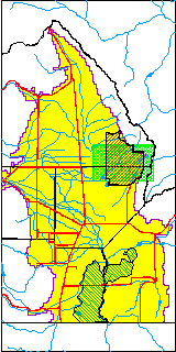
| USGS County | Saguache County |
| USGS Map Name | LIBERTY |
| USGS Map Scale | 24000 |
| Elevation and Depth Data |
|---|
| Ground Elevation (ft NAVD88) | 7764.24000000000 |
| Elevation Data Source | USGS GWSI database |
| USGS Ground Elevation (ft NGVD29) | 7760.00 |
| 1/3-Arc Second NED Ground Elevation (ft NAVD88) | 7683.18 |
| 1-Arc Second NED Ground Elevation (ft NAVD88) | 7681.81 |
| SRTM Ground Elevation (ft NAVD88) | 7683.90 |
| Total Depth (ft) | 14.00 |
| USGS Hole Depth (ft) | 14.00 |
| USGS Well Depth (ft) | 14.00 |
| Model Layer | 1 |
| Model Layer Source | Well Depth |
| Depth of Bottom of Layer 1 | 327 |
| Depth of Bottom of Layer 2 | 718 |
| Depth of Bottom of Layer 3 | 1329 |
| Depth of Bottom of Layer 4 | 2535 |
| Additional Well Information | Construction |
| Aquifer Information |
|---|
| Aquifer Type | Unconfined |
| Aquifer Type Source | TD Elevation/Model Layer |
| USGS Aquifer Type | Unconfined Single Aquifer |
| USGS Hydrologic Unit | San Luis |
| USGS Data Available | Water-level (GW.LEV) |
| Water-level Database Information |
|---|
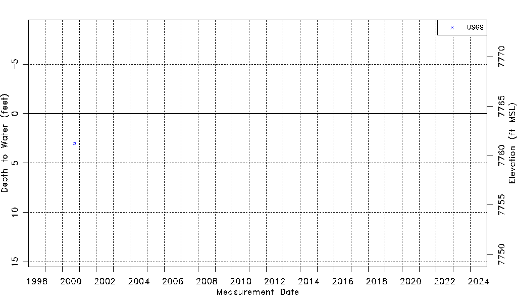
| Water-level Count | 1 |
| Water-level Date Range | 09/26/2000 thru 09/26/2000 |
| Monitored within the last 18 months | No, most recently on 09/26/2000 |
| Depth-to-Water Range (ft) | 3.00 to 3.00 |
| Water Table Elevation Range (ft NAVD88) | 7761.24 to 7761.24 |
| Water-Level-Source:Number-of-Measurements | USGS:1 |