| Well Information Table |
|---|
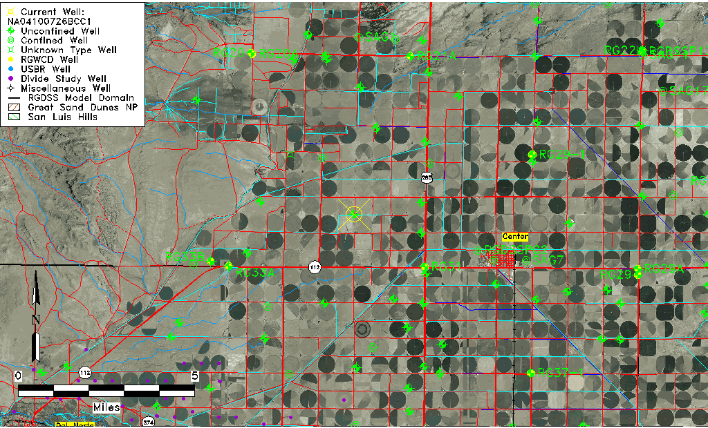
| Common Well ID | NA04100726BCC1 |
| USGS Well ID | 374610106110001 |
| USGS Station Name | NA04100726BCC1 |
| USGS Construction Date | 01/01/1944 |
| USGS Site Type | Well |
| USGS Site Use Information | Unused |
| USGS Groundwater Use Information | Unused |
| Data Source(s) | USGS |
| Location Data |
|---|
| TRS | NA04100726BCC1 |
| USGS TRS 1 | NA04100726BCC1 |
| USGS TRS | SWSWNWS026T0041NR0007EN |
| Longitude/Latitude (NAD83) | -106.18547330 , 37.77002916 |
| Longitude/Latitude Data Source | GWSI decimal LAT/LONG field |
| USGS Longitude/Latitude (NAD83) | -106.1854733 , 37.77002916 |
| Easting, Northing RGDSS-NAD83 (US ft) | 52229.85 , 282220.41 |
| USGS Topography | Valley flat |
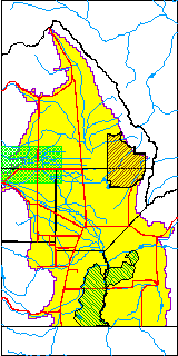
| USGS County | Saguache County |
| Elevation and Depth Data |
|---|
| Ground Elevation (ft NAVD88) | 7685.65000000000 |
| Elevation Data Source | USGS GWSI database |
| USGS Ground Elevation (ft NGVD29) | 7681.00 |
| 1/3-Arc Second NED Ground Elevation (ft NAVD88) | 7685.32 |
| 1-Arc Second NED Ground Elevation (ft NAVD88) | 7684.40 |
| SRTM Ground Elevation (ft NAVD88) | 7690.29 |
| Total Depth (ft) | 53.00 |
| USGS Well Depth (ft) | 53.00 |
| Model Layer | 1 |
| Model Layer Source | Well Depth |
| Depth of Bottom of Layer 1 | 150 |
| Depth of Bottom of Layer 2 | 360 |
| Depth of Bottom of Layer 3 | 495 |
| Depth of Bottom of Layer 4 | 1699 |
| Additional Well Information | Geohydrology, Construction |
| Aquifer Information |
|---|
| Aquifer Type | Unconfined |
| Aquifer Type Source | TD Elevation/Model Layer |
| USGS Primary Aquifer | Cenozoic Erathem |
| USGS Aquifer Type | Unconfined Single Aquifer |
| USGS Hydrologic Unit | Saguache |
| USGS Data Available | Water-level (GW.LEV) |
| Water-level Database Information |
|---|
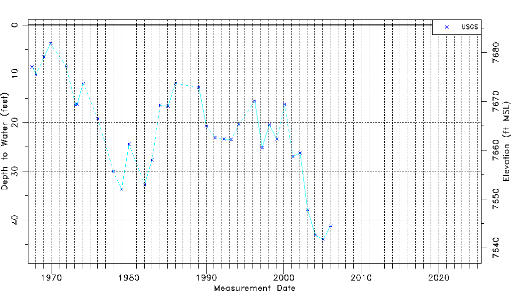
| Water-level Count | 34 |
| Water-level Date Range | 07/14/1967 thru 01/18/2006 |
| Monitored within the last 18 months | No, most recently on 01/18/2006 |
| Depth-to-Water Range (ft) | 3.75 to 43.96 |
| Water Table Elevation Range (ft NAVD88) | 7641.69 to 7681.90 |
| Water-Level-Source:Number-of-Measurements | USGSaguache Creek:34 |