| Well Information Table |
|---|
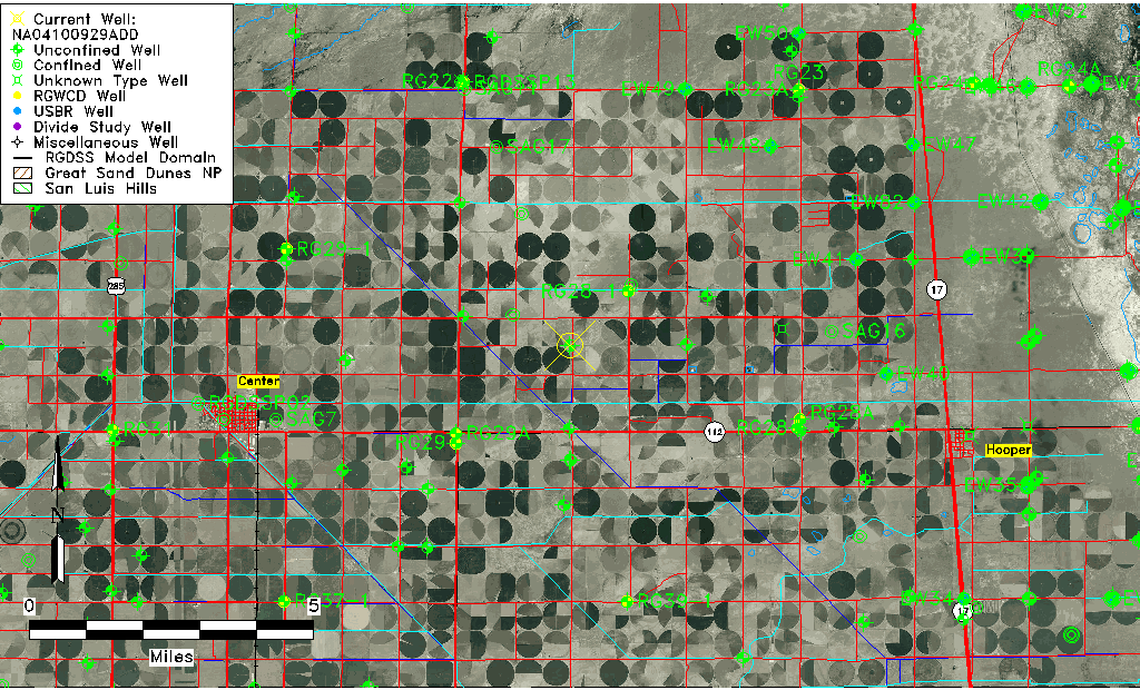
| Common Well ID | NA04100929ADD |
| USGS Well ID | 374614106000701 |
| USGS Station Name | NA04100929ADD |
| USGS Construction Date | 08/11/1993 |
| USGS Site Type | Well |
| USGS Site Use Information | Observation |
| USGS Groundwater Use Information | Unused |
| Data Source(s) | USGS |
| Location Data |
|---|
| TRS | NA04100929ADD |
| USGS TRS 1 | NA04100929ADD |
| USGS TRS | SESENES 29T 41NR 9E |
| Longitude/Latitude (NAD83) | -106.00210560 , 37.77066110 |
| Longitude/Latitude Data Source | GWSI decimal LAT/LONG field |
| USGS Longitude/Latitude (NAD83) | -106.0021056 , 37.77066110 |
| Easting, Northing RGDSS-NAD83 (US ft) | 105219.48 , 282208.23 |
| USGS Topography | Valley flat |
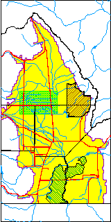
| USGS County | Saguache County |
| USGS Map Name | CENTER NORTH |
| USGS Map Scale | 24000 |
| Elevation and Depth Data |
|---|
| Ground Elevation (ft NAVD88) | 7591.00000000000 |
| Elevation Data Source | USGS GWSI database |
| USGS Ground Elevation (ft NAVD88) | 7591.00 |
| 1/3-Arc Second NED Ground Elevation (ft NAVD88) | 7587.25 |
| 1-Arc Second NED Ground Elevation (ft NAVD88) | 7587.06 |
| SRTM Ground Elevation (ft NAVD88) | 7592.19 |
| Total Depth (ft) | 18.37 |
| USGS Hole Depth (ft) | 20.00 |
| USGS Well Depth (ft) | 18.37 |
| Model Layer | 1 |
| Model Layer Source | Well Depth |
| Depth of Bottom of Layer 1 | 99 |
| Depth of Bottom of Layer 2 | 167 |
| Depth of Bottom of Layer 3 | 1034 |
| Depth of Bottom of Layer 4 | 2458 |
| Additional Well Information | Logs, Geohydrology, Construction, Aquifer |
| Aquifer Information |
|---|
| Aquifer Type | Unconfined |
| Aquifer Type Source | TD Elevation/Model Layer |
| USGS Primary Aquifer | 112ALMS |
| USGS Aquifer Type | Unconfined Single Aquifer |
| USGS Hydrologic Unit | San Luis |
| USGS Data Available | Water-level (GW.LEV) |
| Water-level Database Information |
|---|
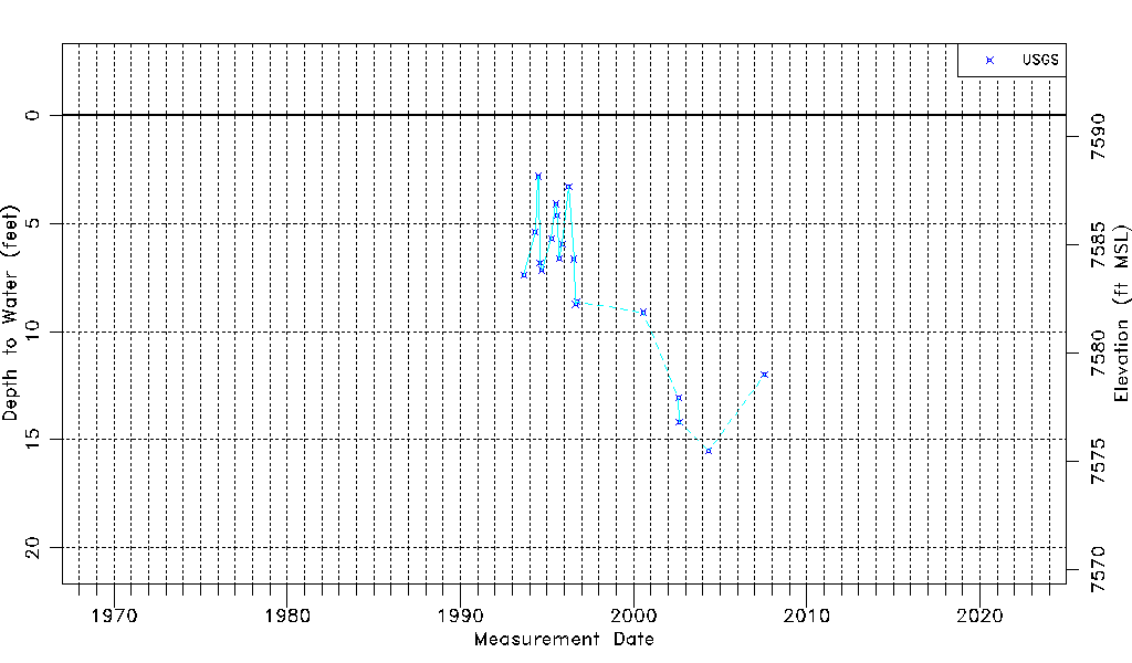
| Water-level Count | 20 |
| Water-level Date Range | 09/01/1993 thru 07/26/2007 |
| Monitored within the last 18 months | No, most recently on 07/26/2007 |
| Depth-to-Water Range (ft) | 2.82 to 15.51 |
| Water Table Elevation Range (ft NAVD88) | 7575.49 to 7588.18 |
| Water-Level-Source:Number-of-Measurements | USGS:20 |