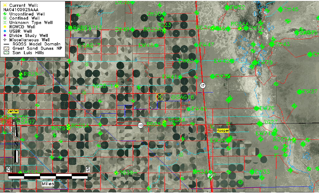
| Well Information Table |
|---|
| Common Well ID | NA04100925AAA |
| USGS Well ID | 374630105560001 |
| USGS Station Name | NA04100925AAA |
| USGS Construction Date | 01/01/1946 |
| USGS Site Type | Well |
| USGS Site Use Information | Observation |
| USGS Groundwater Use Information | Unused |
| Data Source(s) | USGS |
| Location Data |
|---|
| TRS | NA04100925AAA |
| USGS TRS 1 | NA04100925AAA |
| USGS TRS | NENENES025T0041NR0009EN |
| Longitude/Latitude (NAD83) | -105.93391050 , 37.77499959 |
| Longitude/Latitude Data Source | GWSI decimal LAT/LONG field |
| USGS Longitude/Latitude (NAD83) | -105.9339105 , 37.77499959 |
| Easting, Northing RGDSS-NAD83 (US ft) | 124930.17 , 283723.98 |
| USGS Topography | Flat Surface |
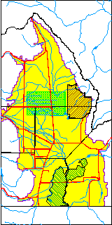
| USGS County | Saguache County |
| Elevation and Depth Data |
|---|
| Ground Elevation (ft NAVD88) | 7562.91000000000 |
| Elevation Data Source | USGS GWSI database |
| USGS Ground Elevation (ft NGVD29) | 7559.00 |
| 1/3-Arc Second NED Ground Elevation (ft NAVD88) | 7563.37 |
| 1-Arc Second NED Ground Elevation (ft NAVD88) | 7563.23 |
| SRTM Ground Elevation (ft NAVD88) | 7565.37 |
| Depth of Bottom of Layer 1 | 99 |
| Depth of Bottom of Layer 2 | 208 |
| Depth of Bottom of Layer 3 | 1171 |
| Depth of Bottom of Layer 4 | 2937 |
| Additional Well Information | Geohydrology, Construction |
| Aquifer Information |
|---|
| Aquifer Type | Unknown |
| Aquifer Type Source | None |
| USGS Primary Aquifer | Cenozoic Erathem |
| USGS Hydrologic Unit | San Luis |
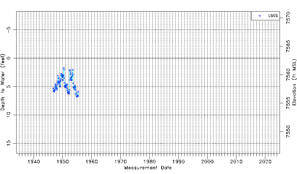
| USGS Data Available | Water-level (GW.LEV) |
| Water-level Database Information |
|---|
| Water-level Count | 109 |
| Water-level Date Range | 10/03/1946 thru 06/03/1955 |
| Monitored within the last 18 months | No, most recently on 06/03/1955 |
| Depth-to-Water Range (ft) | 1.74 to 6.77 |
| Water Table Elevation Range (ft NAVD88) | 7556.14 to 7561.17 |
| Water-Level-Source:Number-of-Measurements | USGSaguache Creek:109 |