| Well Information Table |
|---|
| Common Well ID | NA04100821DDD |
| USGS Well ID | 374630106090001 |
| USGS Station Name | NA04100821DDD |
| USGS Construction Date | 01/01/1948 |
| USGS Site Type | Well |
| USGS Site Use Information | Observation |
| USGS Groundwater Use Information | Unused |
| Data Source(s) | USGS |
| Location Data |
|---|
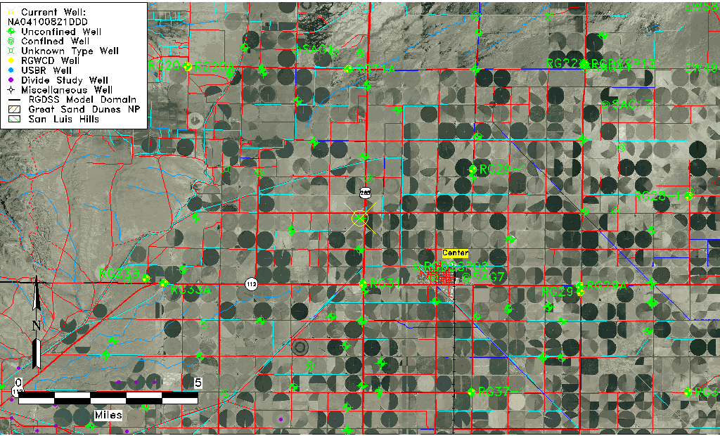
| TRS | NA04100821DDD |
| USGS TRS 1 | NA04100821DDD |
| USGS TRS | NENES25 T41N R07E N |
| Longitude/Latitude (NAD83) | -106.15058330 , 37.77500100 |
| Longitude/Latitude Data Source | GWSI decimal LAT/LONG field |
| USGS Longitude/Latitude (NAD83) | -106.1505833 , 37.77500100 |
| Easting, Northing RGDSS-NAD83 (US ft) | 62321.71 , 283976.28 |
| USGS Topography | Flat Surface |
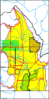
| USGS County | Saguache County |
| USGS Map Name | LA GARITA, CO |
| USGS Map Scale | 24000 |
| Elevation and Depth Data |
|---|
| Ground Elevation (ft NAVD88) | 7660.00000000000 |
| Elevation Data Source | USGS GWSI database |
| USGS Ground Elevation (ft NAVD88) | 7660.00 |
| 1/3-Arc Second NED Ground Elevation (ft NAVD88) | 7659.76 |
| 1-Arc Second NED Ground Elevation (ft NAVD88) | 7659.79 |
| SRTM Ground Elevation (ft NAVD88) | 7664.03 |
| Total Depth (ft) | 10.00 |
| USGS Well Depth (ft) | 10.00 |
| Model Layer | 1 |
| Model Layer Source | Well Depth |
| Depth of Bottom of Layer 1 | 128 |
| Depth of Bottom of Layer 2 | 289 |
| Depth of Bottom of Layer 3 | 658 |
| Depth of Bottom of Layer 4 | 2252 |
| Additional Well Information | Geohydrology, Construction |
| Aquifer Information |
|---|
| Aquifer Type | Unconfined |
| Aquifer Type Source | TD Elevation/Model Layer |
| USGS Primary Aquifer | Cenozoic Erathem |
| USGS Hydrologic Unit | Saguache |
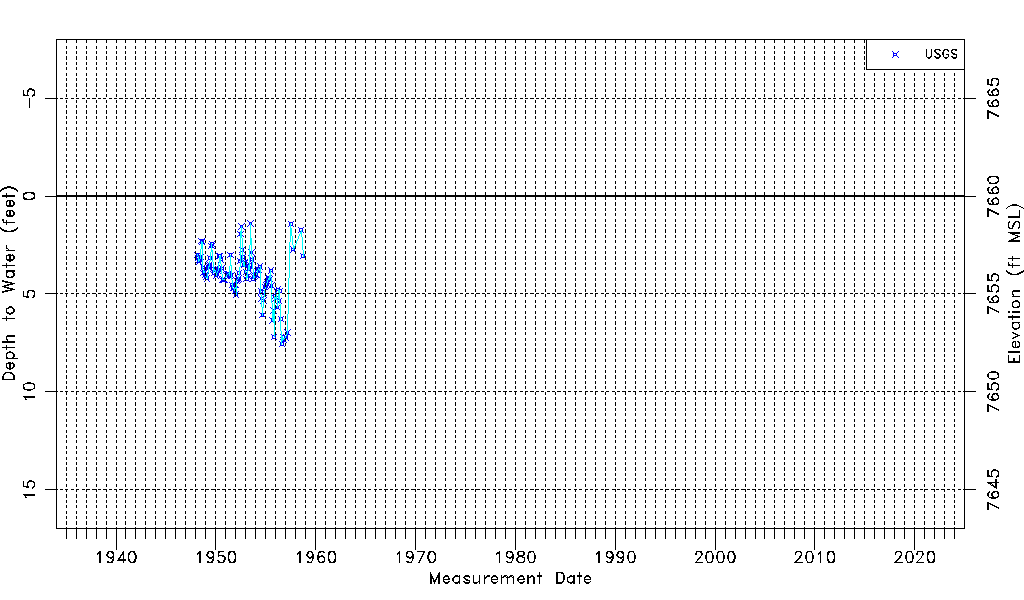
| USGS Data Available | Water-level (GW.LEV) |
| Water-level Database Information |
|---|
| Water-level Count | 111 |
| Water-level Date Range | 03/01/1948 thru 09/27/1958 |
| Monitored within the last 18 months | No, most recently on 09/27/1958 |
| Depth-to-Water Range (ft) | 1.40 to 7.56 |
| Water Table Elevation Range (ft NAVD88) | 7652.44 to 7658.60 |
| Water-Level-Source:Number-of-Measurements | USGS:111 |